These geography printable worksheets give K-12 teachers a ready-to-use collection that moves from compass rose basics through US regional studies and into the physical-versus-political distinctions that appear on most state assessments. Each worksheet targets a discrete, named skill — labeling continents, reading a coordinate grid, calculating distance from a bar scale — so teachers can pull individual worksheets into a lesson without reorganizing a unit around them.
What's Inside the Set
The geography printable worksheets in this set are organized into four content strands:
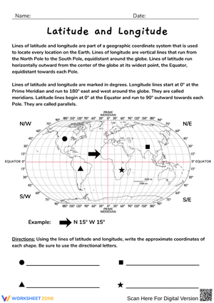
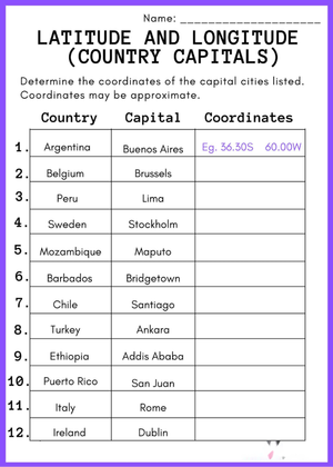
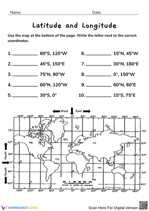
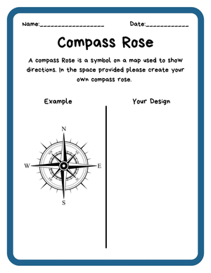
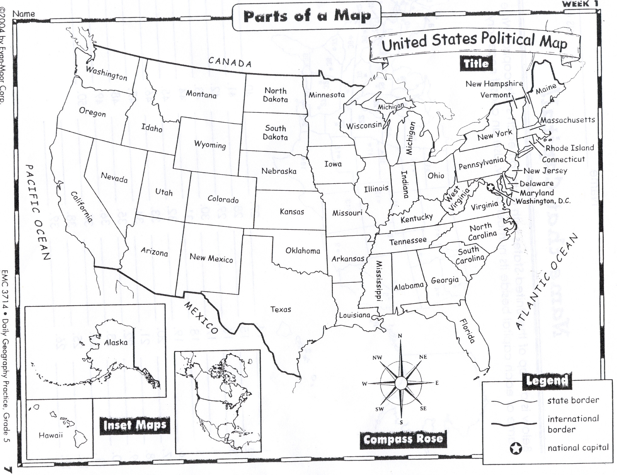
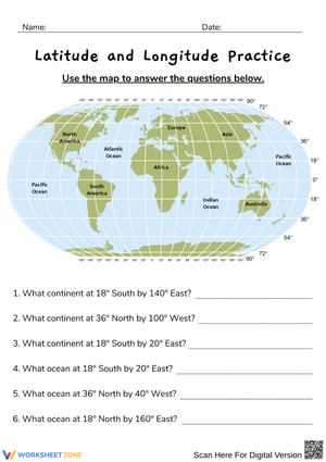
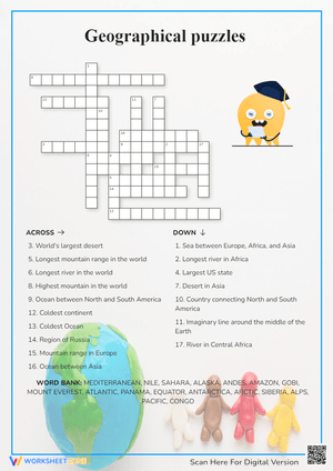
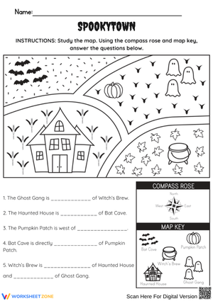
- Map skills — compass rose identification covering all eight cardinal and intermediate directions, multi-symbol legend reading, latitude and longitude coordinate work, and bar-scale distance calculations
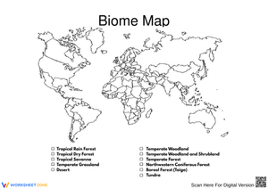
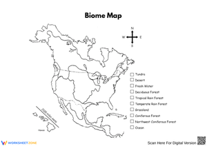
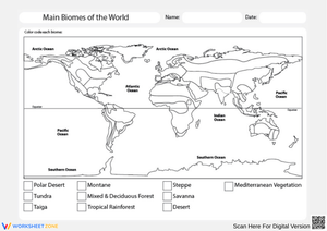
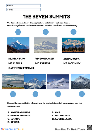
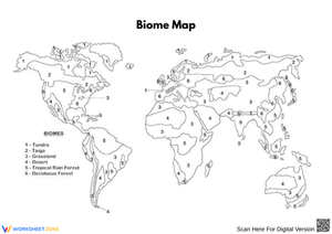
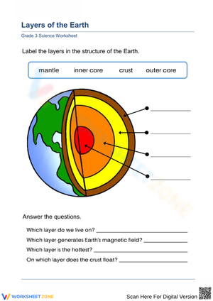
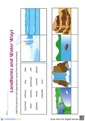
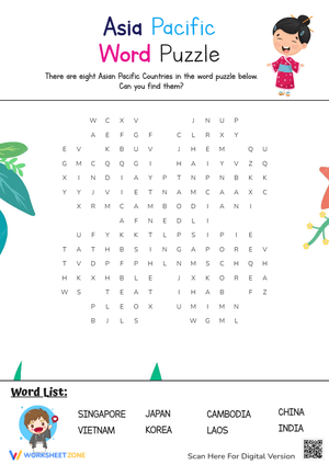
- Continents and oceans — blank outline maps for labeling exercises ranging from the seven continents and five oceans for grades 2–4 to major mountain ranges and river systems for grades 5 and up
- United States regions — one worksheet per region (Northeast, Southeast, Midwest, Southwest, West), each asking students to label states, capitals, and two or three defining physical features
- Physical-versus-political comparison — paired maps of the same region with annotation tasks and a short written response explaining one way physical geography shaped the border drawn over it
The four strands are designed to be used independently. Teachers running a US history unit can pull only the regional worksheets; teachers building an introductory map-skills unit at the start of the year can work entirely within the first strand before touching the others.
Building These Worksheets Into Weekly Lesson Planning
The warm-up slot is the most natural entry point. A compass rose or coordinate worksheet takes six to eight minutes — long enough to settle a class after morning meeting and activate prior geographic knowledge before direct instruction begins, short enough to protect instruction time. Continent and ocean labeling worksheets work well as exit tickets when you want a quick read on spatial retention before moving deeper into a unit. A student who blanks on the placement of Australia relative to Antarctica on a blank outline map is telling you they need another pass at that content, not another new lesson.
For US regional units, geography printable worksheets work best when organized as a running portfolio: students complete one region worksheet per week, file it in a dedicated notebook section, and return to earlier worksheets when reviewing cumulative content before assessments. By the end of the unit, each student has built a self-made reference set covering all fifty states — which most students use more actively for test prep than any commercially printed study guide.
Geographic Misconceptions Worth Addressing Before You Move On
The latitude-longitude distinction produces more confusion than most teachers expect, and it runs deeper than simply mixing up which lines are horizontal. Students who correctly identify latitude lines as horizontal still assign east-west coordinates to them because, as one sixth grader put it, "horizontal feels like going sideways." Pairing "lat = flat" explicitly during instruction and then reinforcing the connection through the coordinate worksheets resolves this more reliably than re-explanation alone. Watch also for students who write coordinates in reversed order — longitude before latitude — a pattern that surfaces most often after students have had map app exposure and internalized the x-before-y digital convention without realizing geographic coordinates follow the opposite sequence.
On continent worksheets, students who can recite all seven continents from memory will still draw Europe and Asia as a single connected landmass on a blank outline map. This happens because Eurasia is physically undivided, and without repeated labeling practice the cultural-geographic distinction stays abstract. The blank outline exercises force that distinction explicitly with each repetition, which is what actually closes the gap over time.
Standard Alignment
The map-skills and continental geography worksheets address NCSS Standard 3 (People, Places, and Environments) and National Geography Standards 1 and 2 within Element 1 (The World in Spatial Terms). In terms of instructional sequence, most teachers introduce the map-skills worksheets at the start of the school year to establish spatial thinking as a disciplinary habit, then return to the continent and US region worksheets as content-specific units open. In states following the C3 Framework, the physical-versus-political comparison worksheets support D2.Geo.2.3-5 and D2.Geo.2.6-8, both of which ask students to explain relationships between human and physical geography — a skill that strengthens through the repeated visual practice these worksheets build across the year.
Adjusting the Worksheets for a Range of Learners
Students who struggle with spatial recall do better when they work alongside a fully labeled reference map before attempting the blank version. Using a labeled example for comparison is not the same as giving away the answer — it gives students a working model while the spatial schema is still forming. A useful transition rule: once a student completes the labeled version correctly three sessions in a row without consulting the original, move them to the blank worksheet. That moment is also the most useful piece of formative information these worksheets generate for a mixed-ability class.
Students who need extension work get it from the same blank outline maps. After labeling US regions, they shade states by a variable — population density, average annual rainfall, a historical crop distribution — using a provided key. This turns a recall exercise into geographic analysis without requiring a different worksheet. The physical-versus-political comparison worksheets are especially well-suited for mixed-ability classrooms because the annotation task has a genuinely low floor (basic feature labeling) and a high ceiling (written analytical responses about why a border follows or ignores the physical landscape beneath it).
Frequently Asked Questions
Do these worksheets cover both elementary and middle school content?
Yes. The compass rose, continent, and ocean worksheets are calibrated for grades 2–5, where NCSS standards first introduce spatial thinking as a formal disciplinary concept. The US regional worksheets and the physical-versus-political comparison exercises are most appropriate for grades 4–7, where geographic analysis begins connecting to history and civics. Elementary teachers typically draw from the first two strands; middle school teachers pull more heavily from the regional and comparative work.
Can I use these as formative assessments rather than just practice?
Blank outline maps are among the most efficient formative tools in social studies — the task is unambiguous and results are readable at a glance. These geography printable worksheets are built for exactly that dual purpose: the same worksheet that serves as guided practice on Tuesday functions as a two-minute formative check on Thursday when given unannounced. A completed continent-labeling worksheet tells you immediately which students have internalized spatial placement and which are placing landmasses by guess.
What file format do the worksheets come in?
Each worksheet is available as a print-ready PDF. The outline maps print cleanly on standard 8.5 × 11 paper and are optimized for black-and-white printing, so color ink is not required — though color printing makes the physical-versus-political comparison exercises significantly easier to read when both maps appear side by side on the same worksheet.