


Views
Plays
Geography Essentials Worksheet | Grade 5 Printable
Paste this activity's link or code into your existing LMS (Google Classroom, Canvas, Teams, Schoology, Moodle, etc.).
Students can open and work on the activity right away, with no student login required.
You'll still be able to track student progress and results from your teacher account.
This Grade 5 geography worksheet provides a comprehensive review of essential map skills and spatial concepts. Students demonstrate their understanding of coordinate systems, directional tools, and map features through a structured 11-question assessment. By identifying absolute locations and interpreting map legends, learners build the foundational literacy required for advanced social studies curriculum and real-world navigation.
At a Glance
- Grade: 5 · Subject: Social Studies
- Standard:
SS.4.G.1.1— Use various map components to locate and describe places on Earth- Skill Focus: Latitude, longitude, and map elements
- Format: 2 pages · 11 problems · Answer key included · PDF
- Best For: Independent practice or formative assessment
- Time: 15–20 minutes
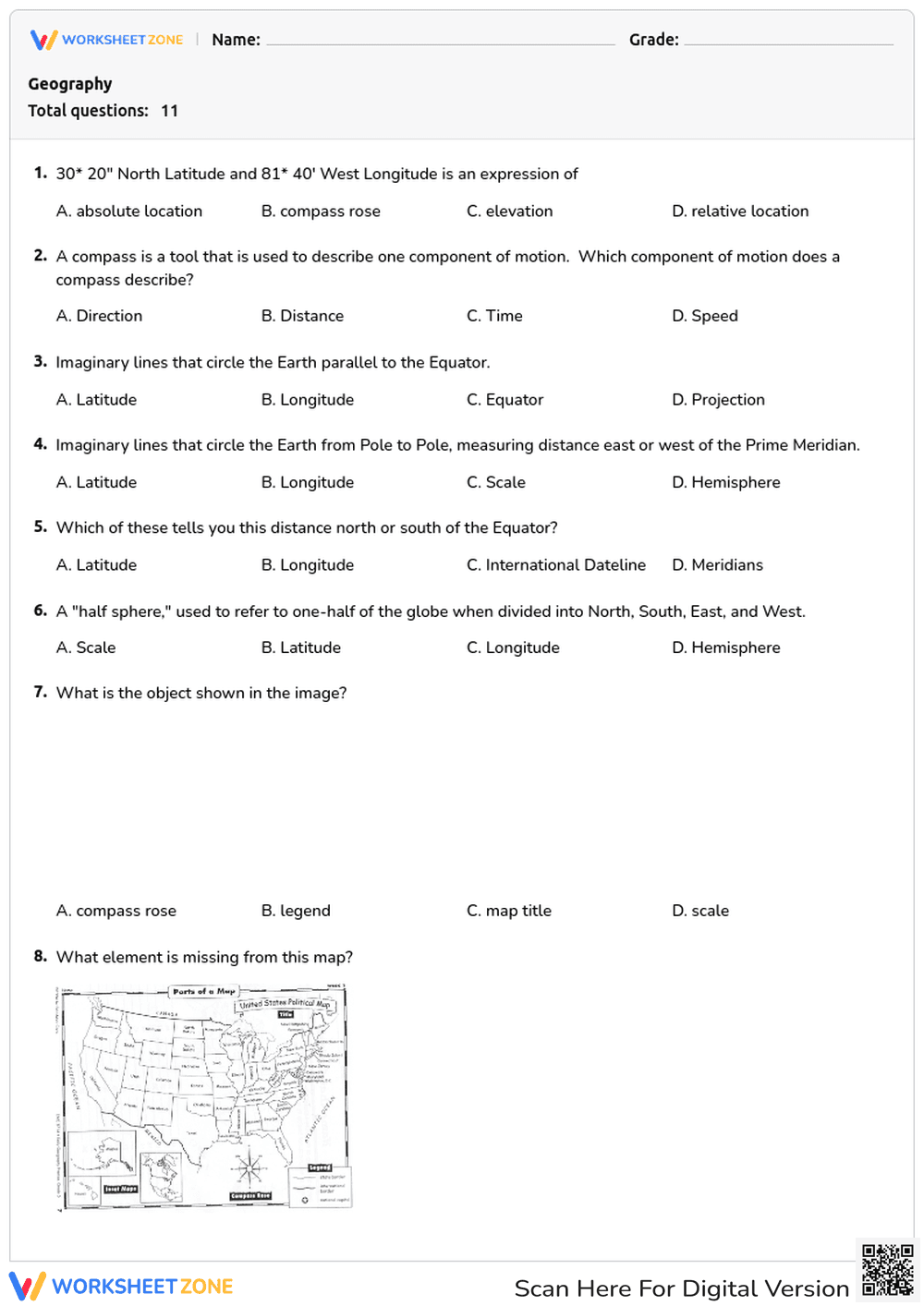
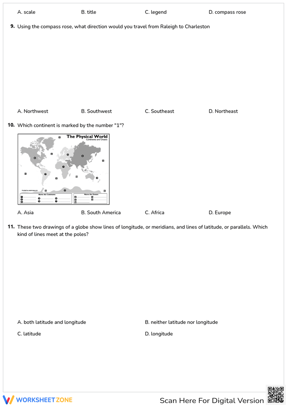
Inside this resource, you will find a two-page PDF featuring 11 high-quality multiple-choice questions. The layout includes clear visual aids, such as a United States political map and a physical world map, to support spatial reasoning. The questions cover a broad range of topics including the Prime Meridian, the Equator, hemispheres, and the specific functions of a compass rose and map scale.
This resource is designed for a zero-prep workflow to save teacher time. First, print the two-page document (1 minute). Second, distribute the sheets to students for a quiet independent work session (1 minute). Finally, use the included answer key to review responses as a whole group or for rapid grading (5 minutes). This streamlined process makes it an ideal choice for emergency sub plans or Friday review sessions.
The content is aligned to SS.4.G.1.1, which requires students to use latitude and longitude to determine location and identify key map elements. It also supports CCSS.ELA-LITERACY.RI.5.7 by asking students to draw on information from multiple print or digital sources. Both standard codes can be copied directly into lesson plans, IEP goals, or district curriculum mapping tools.
To maximize the impact of this worksheet, use it as a mid-unit check for understanding after introducing the global grid system. Teachers can observe students as they work on question 8 to see if they can identify missing map elements like titles or scales. Expect most students to complete the 11 tasks within a 15 to 20-minute window during a social studies block.
This worksheet is specifically tailored for upper elementary students in grades 4 through 6 who are developing geographic literacy. It serves as an excellent bridge for English Language Learners who benefit from the visual map prompts. Pair this activity with a physical globe or a digital mapping tool to provide a multi-sensory learning experience for your classroom.
According to Fisher & Frey (2014), the use of visual scaffolds like maps in social studies instruction significantly improves the retention of spatial vocabulary and conceptual frameworks. This worksheet applies those principles by requiring students to translate abstract definitions of latitude and longitude into concrete identification tasks on a 2D plane. By engaging with 11 distinct problems, students move beyond rote memorization toward functional map literacy. Research from the RAND AIRS 2024 report suggests that frequent, low-stakes assessments of geographic skills help close the achievement gap in middle school social studies by ensuring foundational concepts are mastered early. This resource provides the necessary repetition and visual reinforcement to meet those instructional goals effectively while maintaining high student engagement through varied question types.