These earth and spaces worksheets printable give K-8 teachers a direct path through one of the most conceptually demanding science domains — one that asks 3rd graders to picture the sun and Earth separated by three school hallways, and asks 7th graders to explain why the same subducting plate produces both an ocean trench and a volcanic island chain. The set spans the full breadth of Earth and Space Sciences: solar system structure, moon phases, the rock cycle, plate tectonics, weather systems, and Earth's internal layers, in activities calibrated to the specific grade bands where each concept appears in the standards.
What's Inside the Set
The worksheets address three broad clusters within Earth and Space Sciences:
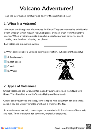
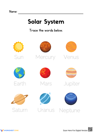
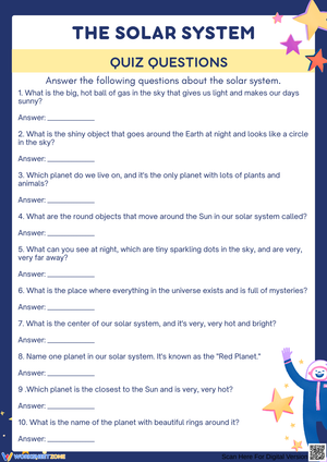
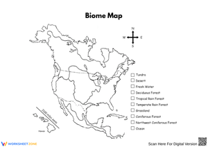
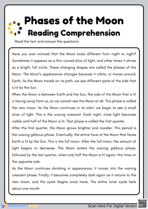
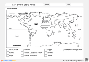
- Solar system and space: planet comparison and ordering tasks, moon phase shading charts that require students to mark the illuminated portion based on lunar position, and basic constellation identification
- Earth's systems: water cycle modeling, weather data collection logs students complete over multiple class days, and atmosphere layer diagramming
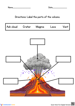
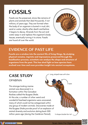
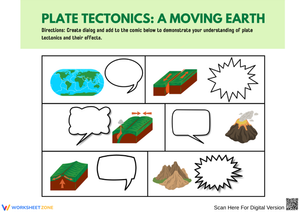
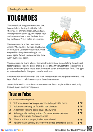
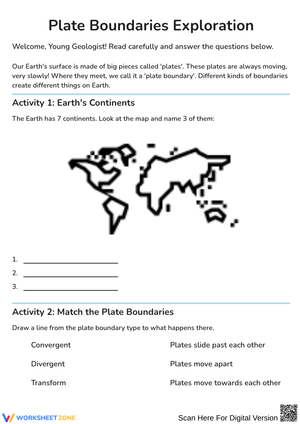
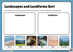
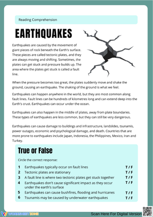
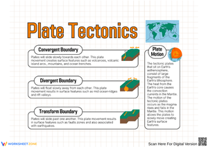
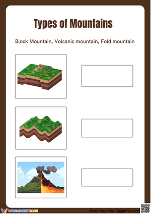
- Geology: rock cycle classification, tectonic plate boundary identification, and relative dating using fossil record sequences
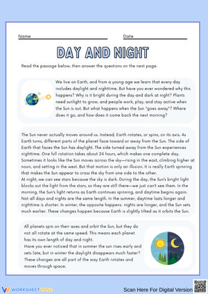
These earth and spaces worksheets printable address a persistent instructional gap in the solar system cluster: students can recite the planets in order but struggle to explain why seasons change. The diagramming activities prompt students to annotate Earth's axial tilt and orbital position on the same figure rather than treating those two ideas as separate facts to memorize independently. Across all three clusters, activities move between diagramming, classification, data reading, and short constructed-response tasks — so students practice multiple science process skills within a single topic.
Misconceptions That Show Up in Student Work
The rotation-versus-revolution confusion is near-universal. Students who correctly draw Earth's orbit around the sun will still write "the Earth rotates around the sun every 365 days" on a short-answer item — they've memorized the number without anchoring it to the correct motion. These worksheets place both motions on the same labeled diagram and require students to name each separately before attempting any written explanation, which disrupts the conflation before it becomes a durable misconception.
Geological time is the other major sticking point. Seventh graders accept that dinosaurs lived "a long time ago" but treat 65 million years and 250 million years as functionally equivalent — both read as "really long." A scaled timeline worksheet that compresses 4.6 billion years of Earth history so that all of recorded human civilization occupies under 1 mm on the page generates productive cognitive dissonance that abstract explanation alone does not produce. Students who work through it report genuine surprise, which is a reliable sign the concept has actually landed rather than been noted and forgotten.
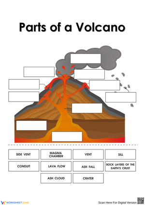
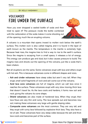
A third consistent error appears in the geology cluster: students treat the rock cycle as a fixed one-way sequence — magma to igneous to sedimentary to metamorphic — and resist the idea that any rock type can transform into any other depending on heat, pressure, and erosion conditions. Activities that require students to draw multiple conversion arrows between rock types, rather than trace a single loop, interrupt that linear thinking early in the unit, before it calcifies into a wrong model.
Standard Alignment
These worksheets target the Next Generation Science Standards' Earth and Space Sciences (ESS) disciplinary core ideas across all three sub-domains. ESS1 (Earth's Place in the Universe) is addressed through solar system comparison tasks and moon phase diagramming, connecting to performance expectations ESS1.A and ESS1.B at grade bands 1, 3–5, and MS. ESS2 (Earth's Systems) is supported by water cycle modeling, weather data analysis, and rock cycle classification tied to ESS2.A through ESS2.C across the 2–5 band and MS-ESS2. ESS3 (Earth and Human Activity) enters through climate trend interpretation and human-impact reflection tasks aligned to MS-ESS3.C and MS-ESS3.D. Within the three-dimensional NGSS framework, the activities specifically develop the science and engineering practices of Developing and Using Models, Analyzing and Interpreting Data, and Constructing Explanations — the three practices most consistently assessed in grade 5 and grade 8 state performance tasks.
Fitting These Worksheets Into Your Week
In elementary classrooms, the blank diagramming activities work best as pre-assessments before a unit begins. Hand students an unlabeled cross-section of Earth's layers or a blank moon phase sequence and ask them to fill in what they already know. After the lesson cycle, they return to the same worksheet and annotate corrections in a second color. That before-and-after document becomes concrete evidence of conceptual change — useful for student-led conferences, parent communication, and your own formative records without requiring a separate assessment task.
For middle school, earth and spaces worksheets printable serve a different function than they do in elementary. A lab on simulated earthquake triangulation or rock permeability generates data, but students routinely complete the procedure without connecting their results to the underlying concept. A paired worksheet that asks students to write a specific claim, cite evidence from their lab measurements, and explain the reasoning using a disciplinary idea closes that gap — and produces a gradeable artifact that reflects actual understanding rather than procedural completion.
The 10-minute warm-up block on Monday mornings — after attendance, before direct instruction — is a natural home for the shorter classification and identification activities. A rock type sorting task or moon phase identification chart reactivates prior knowledge from the previous week, gives students something focused while late arrivals settle in, and requires no setup beyond printing.
Adapting the Worksheets Across Ability Levels
For students still building science vocabulary, partially completed diagrams with a word bank lower the language barrier without removing the conceptual demand. A student who cannot retrieve "mantle" from memory can still demonstrate understanding of relative position and layer thickness when the label is provided — which is the skill ESS1 actually targets at the elementary level. Sentence starters on the constructed-response items serve the same purpose for writing: they remove the blank-page problem without doing the thinking for the student.
Advanced students shift from identification toward analysis. Instead of labeling tectonic plate boundaries on a given map, they sort a dataset of historical earthquake epicenters and volcano locations by geographic coordinates and infer boundary placement from the clustering — the same reasoning a geologist uses, compressed to fit a class period. Students who find identification tasks disengaging often re-engage quickly when the task requires original inference rather than recall.
One honest limitation worth knowing before you print: the climate and weather data worksheets assume students can read a scaled line graph with confidence. Students who haven't had sustained graphing practice in math will need direct instruction on axis interpretation before the science content becomes accessible. Treating graph literacy as assumed rather than as a prerequisite to explicitly address is the most common reason these particular worksheets underdeliver in classrooms where math and science instruction aren't coordinated.
Frequently Asked Questions
Do these worksheets span all of K–8, or are they built for specific grade bands?
The set is calibrated to specific grade bands rather than a single difficulty level. Solar system and moon phase activities are built for grades 1–5, matching where NGSS first introduces ESS1. Rock cycle and tectonic plate worksheets target grades 5–8, aligned with the MS-ESS2 placement. Weather and climate activities span the full K–8 range with different task types — data recording charts for early elementary and data interpretation tasks for middle school. Each worksheet identifies its target grade band, so selection is straightforward when you're planning a unit.
Do the answer keys cover the explanation and reasoning questions, not just the labeled diagrams?
Answer keys include worked responses for constructed-explanation items, not just the fill-in labels. For short written responses — "explain why the seasons change" or "describe what happens to oceanic crust at a convergent boundary" — the key provides a model answer with the core scientific reasoning identified. Those model answers also work as mentor texts during whole-class review, letting students compare their phrasing to a complete scientific explanation rather than just checking whether they got the label right.
Can these be used alongside a district-adopted program, or are they designed to stand alone?
These earth and spaces worksheets printable function as standalone practice but integrate naturally with any textbook-based curriculum. The topic sequence follows standard ESS instructional order, so they slot into existing units without restructuring the program. Teachers using FOSS, Amplify Science, or STEMscopes typically use this set for supplemental reinforcement, independent work during small-group rotations, or targeted review before a unit assessment.