Geography skills worth practicing in Grade 4
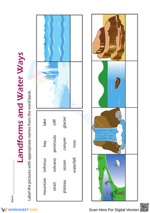
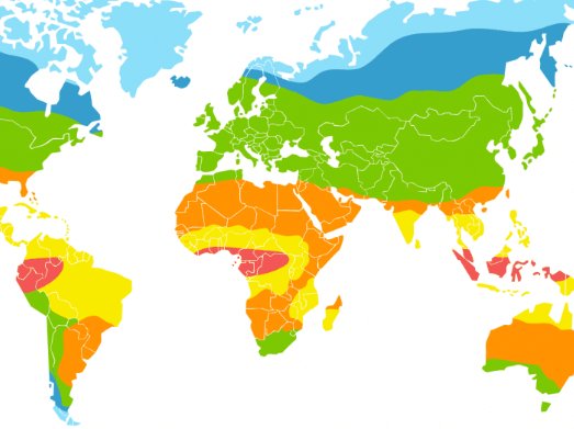
Grade 4 geography lessons blend core map skills with short thinking tasks. Students should practice reading titles, locating places on a map, using a compass rose, checking symbols in a legend, and making sense of scale in age-appropriate ways. They also need chances to build vocabulary around landforms, regions, natural resources, and human-environment connections so the map is tied to meaning instead of treated like a separate activity.
Teachers often get better results when the worksheet sequence moves from identification to application. A student might first label a river, mountain, plain, or region, then answer a short question about why people settle near one feature and avoid another. That combination keeps geography grounded in social studies thinking. It also supports quick formative checks because a teacher can see whether a student only memorized a term or can actually use the term while reading a map or interpreting a simple scenario.
What strong printable PDFs should include
Not every worksheet packet supports Grade 4 instruction equally well. The most helpful sets mix visual reading with short written responses so students are doing more than matching terms to definitions. They should feel clear on the page, easy to print, and flexible enough for whole-group review or independent practice.
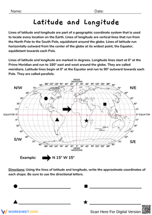
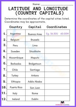
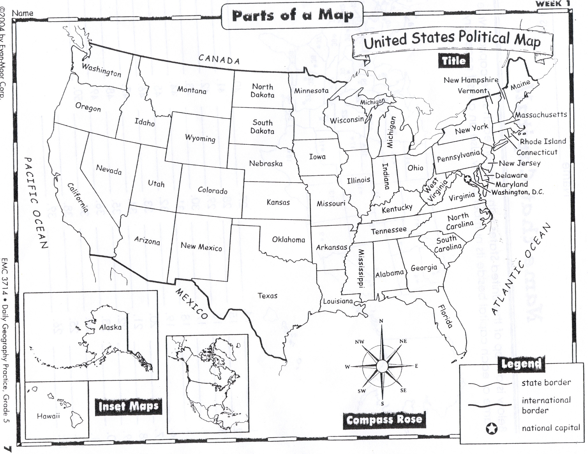
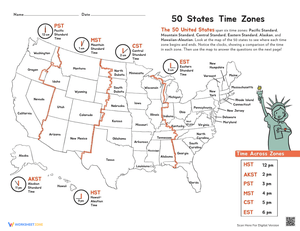
- Map reading tasks that ask students to use a title, compass rose, legend, or simple scale.
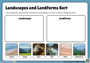
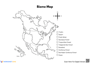
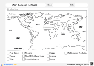
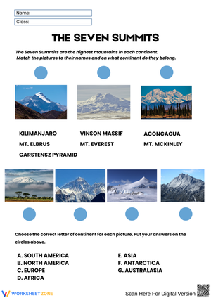
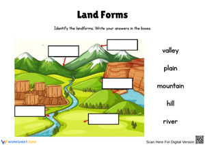
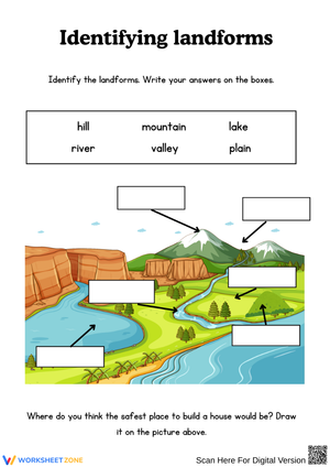
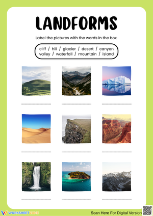
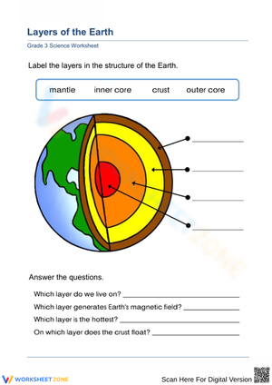
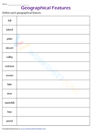
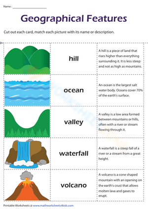
- Labeling practice for landforms, bodies of water, regions, and resource locations.
- Vocabulary support that keeps terms connected to a map or real place-based example.
- Applied questions that ask students to explain movement, settlement, or resource use.
- Short completion time so teachers can use one page as a bell ringer, exit task, or intervention piece.
National Geographic Education's Map resource reinforces that maps organize location information in ways students can interpret. For Grade 4 worksheet design, that translates into 3 repeated moves: read the legend, follow direction, and explain what symbols show about place. That structure keeps the practice concrete and readable for upper elementary learners.
Classroom Implementation
Printable geography pages work best when teachers assign each one a clear job. One page can open a lesson as a warm-up on cardinal directions. Another can serve as partner practice during centers. A third can work as a fast review before a unit quiz. Because the pages are in PDF form, they are also useful for emergency sub plans, reteaching folders, and homework packets that students can complete without logging into another platform.
A dependable Grade 4 geography worksheet routine often works best with 4 parts: map reading, vocabulary, short written application, and error analysis. That fourth step matters because it shows whether students can fix a misconception about scale, region, or symbol meaning instead of simply circling a correct answer by chance.
Teachers can also rotate the same content across small groups. One group might label landforms, another might measure distance in a simplified way, and another might answer short questions about how people use land and resources. That kind of reuse helps teachers get more from a single worksheet set while still adjusting support. Students who need intervention can work with a reduced number of items, while stronger readers can explain their thinking in complete sentences.
A standards-aware way to reinforce social studies thinking
In social studies, geography worksheets should reinforce inquiry rather than replace it. The point is not only that students can point to a map feature, but that they can use evidence from a map to answer a question about place, movement, or human activity. The C3 Framework for Social Studies State Standards is a helpful reference point here because teachers need students to gather information, interpret it, and use it in short explanations. Even a one-page worksheet can support that kind of thinking when the prompts are well chosen.
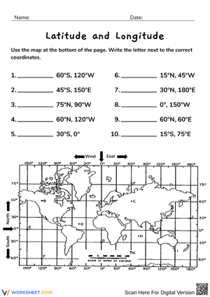
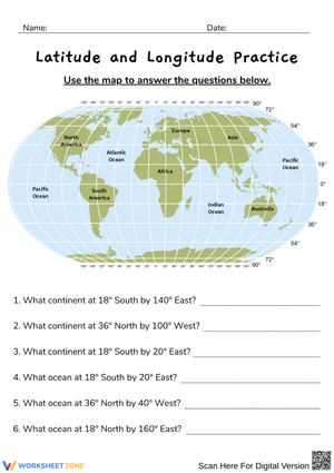
According to National Geographic Education's Measuring Distances on a Map and Geography Standard 1, map work should help students use spatial tools with purpose, not as isolated vocabulary review. A strong Grade 4 packet should therefore include at least 1 direction task, 1 legend task, and 1 location or distance question so students practice multiple ways of reading place-based information.
That balance is especially important in upper elementary classrooms where time is tight. A well-made worksheet does not need to be long to be useful. It needs to ask the right questions, give students a readable visual, and leave space for teachers to see how students are thinking. When those parts are in place, the worksheet becomes a practical assessment tool instead of a filler activity.
Why Worksheetzone works for busy geography blocks
Teachers need materials that are easy to slot into an existing plan. Worksheetzone supports that routine by making printable geography practice easier to access when the goal is speed, clarity, and classroom use. For Grade 4 social studies, that means pages that can reinforce maps, landforms, regions, and human-environment ideas without requiring a full lesson rewrite. The format is especially helpful when a teacher wants consistent practice across the week but does not want to build every page from scratch.
Another advantage is flexibility. The same worksheet can be used as independent practice for one class, paired discussion for another, and a quick check for a third. That matters in real schools because pacing is rarely identical across sections or groups. When a PDF is clear and grade-appropriate, it becomes easier to keep instruction moving while still collecting useful evidence of student understanding.
Worksheetzone is also a practical option for review cycles. Teachers can pull one page for Monday practice, another for reteaching on Wednesday, and a final page for Friday review. That kind of repeated exposure helps students hold onto map vocabulary and location concepts over time, especially when each page asks them to apply the same ideas in a slightly different context.
Frequently Asked Questions
1. What geography skills should 4th graders practice with worksheets?
Grade 4 students benefit from practice with map titles, legends, compass roses, cardinal directions, landforms, regions, natural resources, and short human-environment connection questions. The strongest worksheets combine vocabulary and map interpretation so students can apply what they know.
2. Are these 4th grade geography worksheets available as printable PDFs?
Yes. Teachers searching this keyword usually want ready-to-print PDF pages that work for classwork, homework, centers, or substitute plans. That printable format keeps prep low and makes it easier to use the same material across different classroom routines.
3. How can teachers use geography worksheets for centers or test review?
Teachers can assign one worksheet for map reading, one for vocabulary review, and one for short written responses. That setup works well for centers, reteaching groups, or quiz prep because students practice several geography skills without needing a long transition.
4. Do the worksheets cover map skills, landforms, and regions?
They should. A solid Grade 4 geography set usually includes map skills alongside landforms, regions, and applied location questions so students are not only memorizing terms but using them in a social studies context.