


Views
Downloads
Printable Landforms & Bodies of Water Worksheet | Grade 2
Paste this activity's link or code into your existing LMS (Google Classroom, Canvas, Teams, Schoology, Moodle, etc.).
Students can open and work on the activity right away, with no student login required.
You'll still be able to track student progress and results from your teacher account.
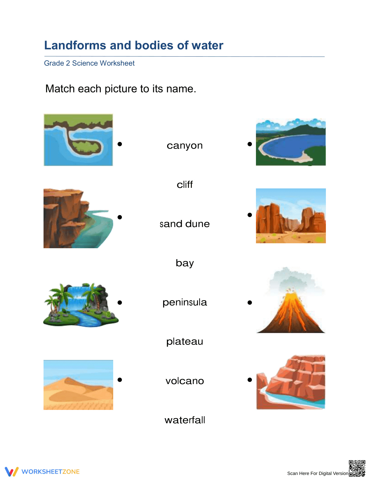
This Grade 2 science worksheet helps students identify and name common landforms and bodies of water through visual recognition. By matching vivid illustrations to terms like peninsula, plateau, and canyon, students build the foundational vocabulary necessary for understanding Earth's geographical diversity and the shapes of various physical features.
At a Glance
- Grade: Grade 2 · Subject: Science
- Standard:
2-ESS2-2— Represent the shapes and kinds of land and bodies of water- Skill Focus: Geographic feature identification
- Format: 2 pages · 8 problems · Answer key included · PDF
- Best For: Independent practice and quick formative assessment
- Time: 10–15 minutes
What's Inside
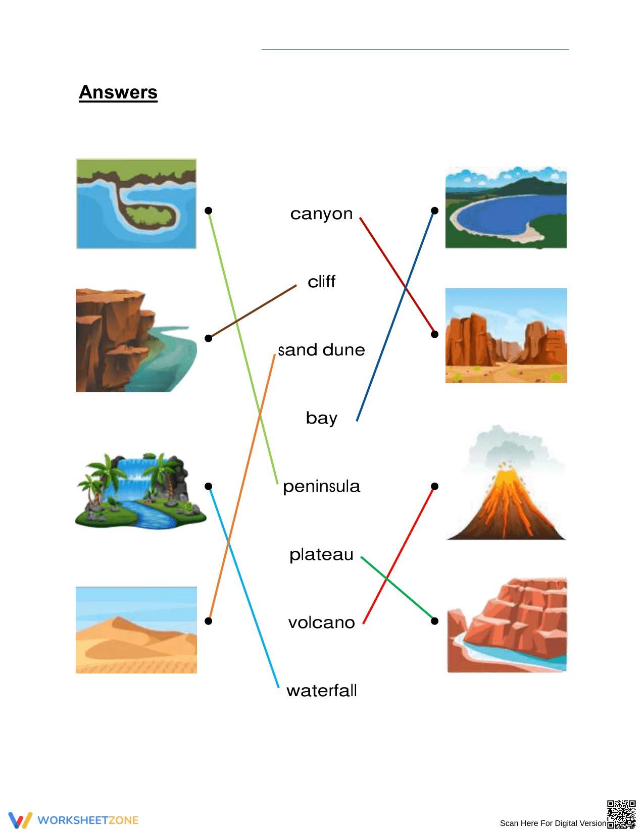
This resource contains a clean, one-page matching activity and a corresponding full-page answer key. The worksheet features eight distinct full-color illustrations of landforms and water bodies, including volcanoes, sand dunes, and waterfalls. Images are paired with dots for easy matching to the central column of terms. The layout is spacious and age-appropriate for second-grade learners.
Zero-Prep Workflow
Print the matching sheet for each student. Distribution takes less than thirty seconds, and because the task is self-explanatory, students can begin working immediately with zero additional teacher setup. Reviewing the answers using the included key takes approximately one minute, making this an ideal option for morning work, sub plans, or transition periods. Total prep time is under 2 minutes.
Standards Alignment
This resource is aligned to NGSS 2-ESS2-2, which requires students to "develop a model to represent the shapes and kinds of land and bodies of water in an area." By using images to represent these physical features, students engage with visual models that bridge the gap between abstract terms and real-world geography. Both standard codes can be copied directly into lesson plans, IEP goals, or district curriculum mapping tools.
How to Use It
Assign this worksheet during the "independent practice" phase of a science lesson on Earth systems. It works exceptionally well as an exit ticket to gauge whether students can distinguish between similar features like a peninsula and a cliff. Completion typically takes between 10 and 15 minutes, allowing for a quick check for understanding before the end of the science block.
Who It's For
This activity is designed for second-grade students but is also suitable for first-grade extension or third-grade review. It provides support for English Language Learners (ELLs) by providing direct visual-to-text association. It pairs naturally with a classroom anchor chart displaying the same landform definitions or a short reading passage about Earth's surface features.
According to NGSS 2-ESS2-2, geographic literacy in early elementary grades depends on the ability to recognize and name various land and water configurations. This worksheet addresses this by providing structured visual matching that reinforces the specific skill of geographic feature identification. Research from Fisher & Frey (2014) emphasizes that visual scaffolds are critical for students as they transition from observing their local environment to understanding global geographic diversity. In a NAEP study, students who engaged in regular visual-spatial identification tasks showed higher proficiency in earth science concepts later in middle school. By providing 8 high-quality illustrations and immediate feedback via an answer key, this resource ensures that students develop the precise vocabulary needed for more complex spatial modeling. This self-contained activity provides an efficient way to meet federal science standards while requiring minimal instructional overhead.