


1 / 2
0
Views
0
Plays
0.0
0
Save
0 Likes
Seasons and Earth Quiz
0 Views
0 Plays
Paste this activity's link or code into your existing LMS (Google Classroom, Canvas, Teams, Schoology, Moodle, etc.).
Students can open and work on the activity right away, with no student login required.
You'll still be able to track student progress and results from your teacher account.
Information
Description
What It Is:
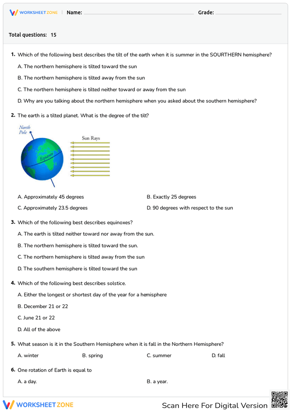
This is a diagram illustrating Earth's tilt and the direction of sunlight. It shows a globe with the North Pole, Equator, and an axis. Arrows representing 'Sun Rays' are depicted shining on the globe. This likely explains how sunlight falls on Earth and how the tilt affects seasons.
Grade Level Suitability:
Suitable for grades 3-6. The diagram is simple and clearly labeled, making it appropriate for introducing basic concepts about Earth's rotation, tilt, and the sun's rays to elementary and early middle school students.
Why Use It:
This diagram helps students visualize the relationship between Earth's tilt and sunlight. It can improve understanding of why different parts of the world receive varying amounts of sunlight, leading to the seasons. It reinforces spatial reasoning and science concepts.
How to Use It:
Use this diagram as a visual aid during a lesson on Earth's rotation, axis, and the seasons. Students can label the diagram, trace the path of sunlight, and discuss how the tilt affects different regions. Use it as a springboard for further discussion about climate and geography.
Target Users:
Elementary and middle school students learning about Earth science, geography, and the solar system. Educators can use it as a teaching tool, and students can use it for review or study.