


























Views
Plays
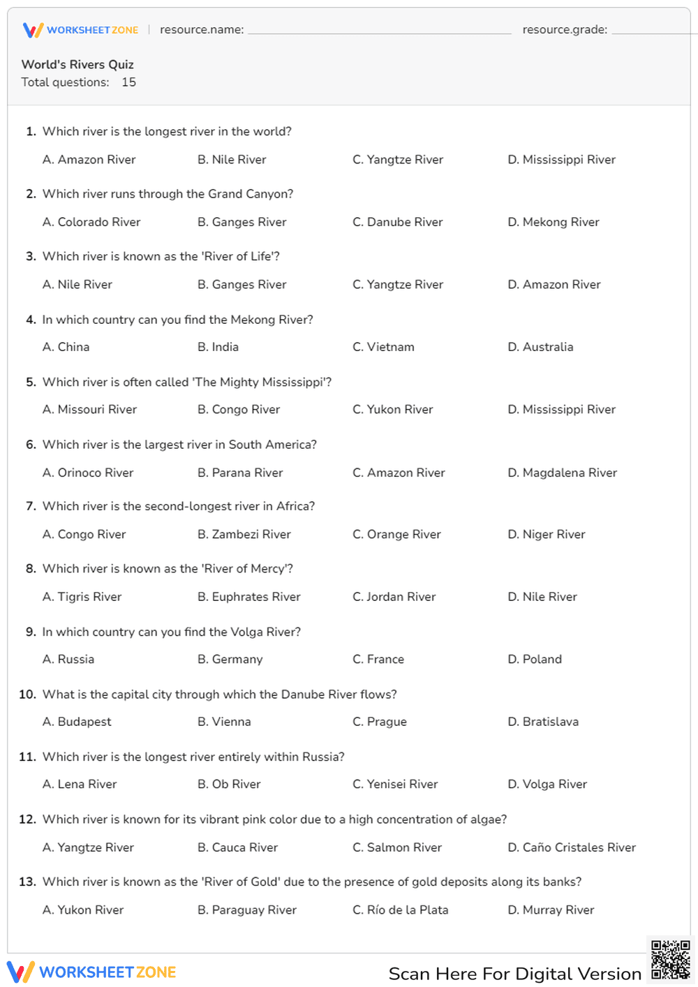
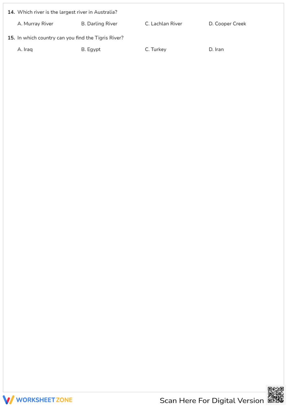

World's Rivers Quiz | Essential Grade 3-5 Geography
Paste this activity's link or code into your existing LMS (Google Classroom, Canvas, Teams, Schoology, Moodle, etc.).
Students can open and work on the activity right away, with no student login required.
You'll still be able to track student progress and results from your teacher account.
This World's Rivers Quiz provides a comprehensive assessment of global geography for upper elementary students. By identifying major waterways and their unique geographical contexts, learners demonstrate mastery of physical features across seven continents. This resource ensures students can recall specific facts about the Nile, Amazon, and Mekong rivers with high accuracy.
At a Glance
- Grade: 4 · Subject: Geography
- Standard:
CCSS.ELA-LITERACY.RI.4.1— Refer to details and examples when explaining facts about physical geography- Skill Focus: Global River Identification
- Format: 2 pages · 15 problems · Answer key included · PDF
- Best For: Summative assessment or geography unit review
- Time: 15–20 minutes
What's Inside: This two-page PDF features 15 carefully crafted multiple-choice questions. Each question focuses on a specific river, such as the Volga, Danube, or Murray, and asks students to identify its location, length, or nickname. The layout is clean and distraction-free, providing ample space for students to circle their answers. A full answer key is provided for rapid grading.
Zero-Prep Workflow: This resource is designed for immediate classroom implementation. First, print the two-page document (30 seconds). Next, distribute the quiz to students as a quiet-work activity or formal assessment (1 minute). Finally, use the included answer key to review results or facilitate peer-grading (5 minutes). Total teacher preparation time is under two minutes, making it an ideal choice for sub plans.
Standards Alignment: The primary standard addressed is `CCSS.ELA-LITERACY.RI.4.1`, which requires students to refer to details and examples in a text when explaining what the text says explicitly. By correctly identifying river characteristics, students demonstrate the ability to process and recall informational facts. This standard code can be copied directly into lesson plans, IEP goals, or district curriculum mapping tools.
How to Use It: Use this quiz as a summative assessment at the conclusion of a unit on world landforms. Alternatively, assign it as a pre-assessment to gauge prior knowledge before beginning a geography rotation. During the activity, observe which continents students struggle with most to inform future map-reading lessons. Expected completion time ranges from 15 to 20 minutes.
Who It's For: This worksheet is ideal for Grade 3, 4, and 5 students studying social studies or earth science. It serves as an excellent resource for general education classrooms, homeschool environments, and geography bees. Pair this quiz with a physical world map or a digital atlas to provide visual support for students who require spatial scaffolding.
Research from Fisher & Frey (2014) emphasizes that structured retrieval practice, such as multiple-choice quizzes, significantly improves long-term retention of factual knowledge in social studies. This World's Rivers Quiz aligns with these findings by requiring students to recall specific geographical data points across 15 distinct tasks. By focusing on CCSS.ELA-LITERACY.RI.4.1, the worksheet bridges the gap between literacy and content-area knowledge, ensuring students can accurately identify physical features like the Nile and Amazon. According to the RAND AIRS 2024 report, high-quality printable assessments reduce teacher cognitive load while maintaining rigorous standards for student output. This resource provides a reliable metric for measuring student progress in global geography, making it a staple for any upper elementary curriculum focused on physical systems and human-environment interaction.


