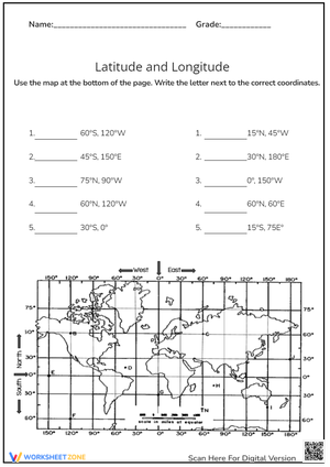
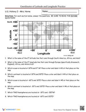
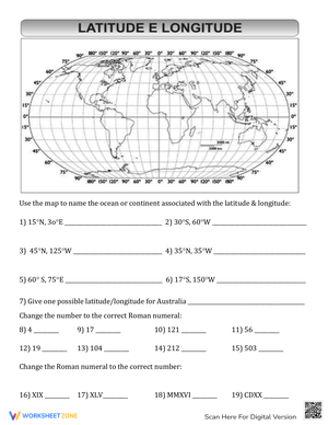
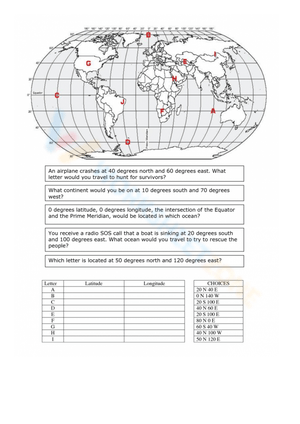
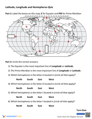
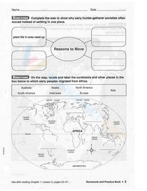
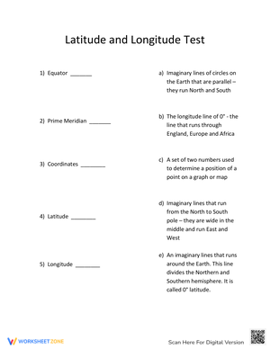
These 6th grade latitude and longitude printable worksheets give teachers a map-reading resource that covers the full arc of introductory coordinate instruction — identifying line types, reading degree notation, sorting by hemisphere, and plotting real locations on a world map. The set spans enough task variety that teachers can pull from it at any point in a geography unit, from first-day introduction through pre-assessment review.
What Students Get Wrong — and What to Watch For
Latitude and longitude errors follow predictable patterns, which makes targeted practice unusually effective at preventing them from becoming ingrained habits. The most persistent mistake is coordinate order. A student who can correctly define both terms will still write "45°W, 30°N" when the answer should be "30°N, 45°W" — the vocabulary is there, but the sequence hasn't been internalized as a fixed convention. That distinction matters because the reversal error tends to persist for weeks if it isn't caught and corrected early.
A second cluster of mistakes involves direction versus measurement. Students observe that latitude lines are horizontal and conclude that latitude must measure east-west distance. The logic is internally consistent enough that a single correction rarely sticks — students need to encounter the apparent contradiction across multiple tasks before it settles. A third predictable error is hemisphere misidentification: students who can correctly label the Equator and Prime Meridian on a diagram will still place a coordinate in the wrong hemisphere on a printed world map, because the visual cues shift when the task format changes. Worksheets that rotate through all three of these problem types give teachers a clearer diagnostic picture than those that drill one skill repeatedly.
The Specific Skills Each Worksheet Targets
The set stays focused on coordinate literacy rather than broad geography review. Skills covered across the worksheets include:
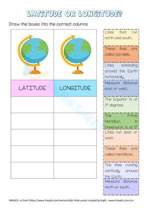
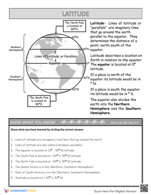
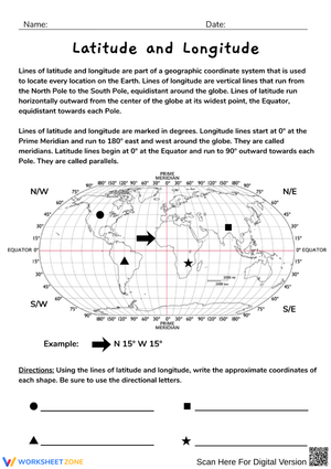
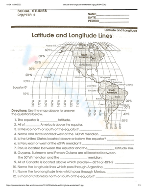
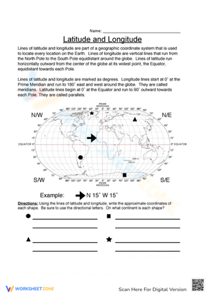
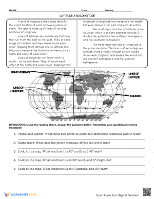
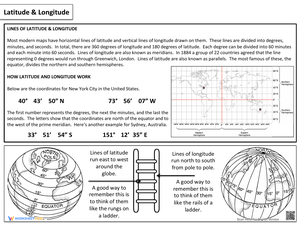
- Distinguishing latitude from longitude by line direction and what each measures
- Identifying the Equator and Prime Meridian as reference lines for the coordinate system
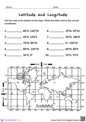
- Reading coordinates written in degree notation with hemisphere markers (N, S, E, W)
- Sorting given locations by hemisphere using the Equator and Prime Meridian as dividing lines
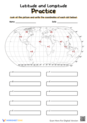
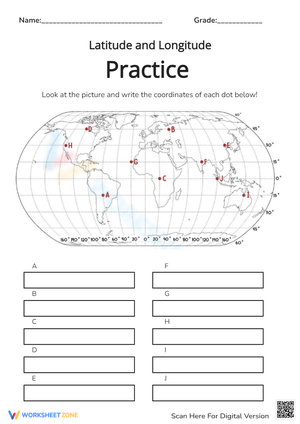
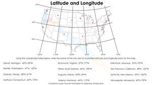
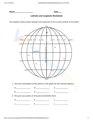
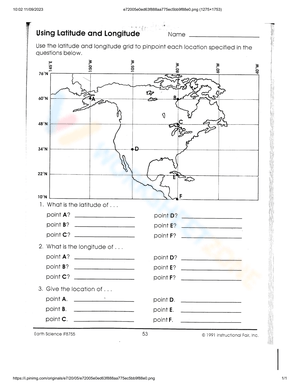
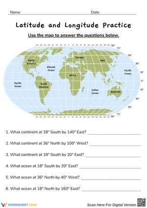
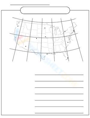
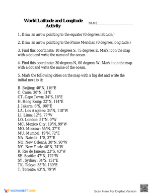
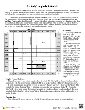
- Plotting coordinate pairs on a world map grid
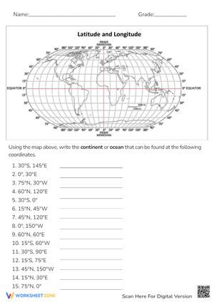
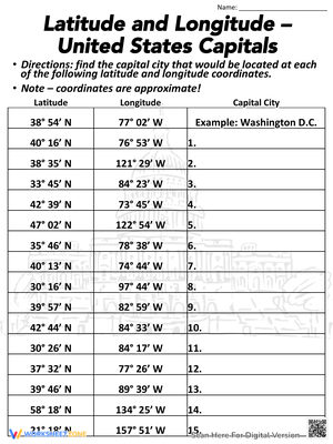
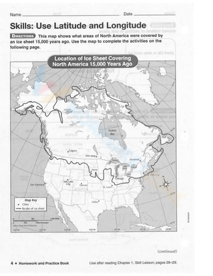
- Locating real places — capitals, ocean regions, landmarks — from given coordinates
These 6th grade latitude and longitude printable worksheets stay grounded in actual map use rather than isolated matching tasks, so students practice the same reasoning they will apply during textbook activities and geography assessments — not a skill that exists only on a worksheet.
Building These Worksheets Into Your Unit Plan
The most reliable placement is right after direct instruction on line types, not before. Students who attempt to plot coordinates before understanding that latitude lines run east-west but measure north-south distance tend to build a flawed mental model that takes longer to undo than to prevent. A short worksheet — five to eight items — works well in the first ten minutes of class while the previous lesson is still accessible. Longer mixed-skill worksheets belong mid-unit, once students have encountered all three major skills and can move between them without a teacher prompt.
One routine worth building in from the start: have students say a coordinate aloud before writing it. "Thirty degrees north, forty-five degrees east" forces the latitude-first sequence at the exact moment reversals happen most — during transcription. Students who skip the verbal step are consistently the ones who write the answer backwards. These 6th grade latitude and longitude printable worksheets support that verbal-written pairing because the task structure stays consistent enough that the routine transfers from one worksheet to the next without any relearning.
Formats that fit naturally across a unit:
- Daily opening routine: one coordinate question each day during the week a unit launches
- Mini-lesson follow-up: teacher models one item, students complete the rest independently
- Station rotation: worksheet alongside a classroom globe and an atlas, rotating every eight minutes
- Partner review: one student reads the coordinate aloud, the other locates it on the map, then they compare answers
- Pre-assessment check: four to six mixed questions to identify who needs reteaching before a quiz
Standard Alignment
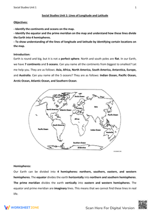
The content aligns with NCSS Standard II (People, Places, and Environments), which frames geographic knowledge as a tool for understanding how physical space shapes human activity. Most state geography standards place coordinate systems at grade 6 because of a developmental shift at this level: students move from working primarily with local and regional maps to navigating world maps and global geographic patterns. Coordinate reading is the foundational skill that makes world map work possible, which is why it appears at the start of the 6th grade sequence rather than later in the year. Many state standards explicitly name the Equator, Prime Meridian, latitude, and longitude at this grade level, making coordinate instruction a predictable first-unit anchor skill across the country.
Differentiating the Set Across Student Ability Levels
For students who need more support, begin with worksheets that include a labeled reference map alongside a small reminder box — something as direct as latitude measures north or south from the Equator and longitude measures east or west from the Prime Meridian. Keeping the number of coordinate points low also helps: five carefully worked problems build more durable understanding than fifteen rushed ones, and the slower pace gives students time to use the reference box before it becomes unnecessary.
Students working at grade level benefit from mixed-skill worksheets that require switching between reading, plotting, and hemisphere identification within the same task. That variety reveals whether understanding transfers across question formats or whether a student has learned to pattern-match one type without real comprehension. For students ready for extension, open-ended items push further — ask them to select two coordinates, plot both, and write a sentence comparing their positions relative to the Equator and Prime Meridian. That shift in demand moves the task from recall into geographic reasoning without requiring separate enrichment materials. These 6th grade latitude and longitude printable worksheets are straightforward to differentiate because the core tasks — reading, plotting, identifying — scale naturally across ability levels without needing entirely separate resources.
Frequently Asked Questions
What prior knowledge do students need before working independently on these worksheets?
Students should have had at least one direct-instruction lesson introducing latitude, longitude, the Equator, and the Prime Meridian, and they should understand that the two line systems intersect to form a coordinate pair. The worksheets then handle practice and accuracy-building. Students who begin without that foundation tend to treat each worksheet as a guessing task rather than a skill-building one — which shows up in the work as wild inconsistency from problem to problem rather than the systematic errors that are actually easier to address.
How do I address students who keep reversing latitude and longitude in their answers?
Two targeted routines help most. First, have students mark the first number in a coordinate pair before writing anything — circle it, label it "lat." — so they must consciously identify which value belongs first. Second, use a verbal step: students say the full coordinate in correct order aloud before writing it down. The reversal error almost always happens during transcription, and saying "thirty degrees north, forty-five degrees east" interrupts that automatic backwards sequence at exactly the right moment.
Can these worksheets function as formative assessments?
Yes. A mixed-skill worksheet with five to eight items gives enough evidence to determine whether a student has coordinate order correct, can identify hemispheres reliably, and can plot a point accurately on a world map. That's a usable snapshot for reteaching decisions. They work best as formative checks — a quick signal about who needs more practice — rather than as summative grades on their own.
What's the most effective sequencing for these worksheets across a unit?
Start with identification worksheets — line types, the reference lines, and basic hemisphere labels. Move to coordinate reading once students reliably distinguish latitude from longitude. Introduce plotting after reading is solid. End with mixed-skill worksheets for consolidation and pre-assessment review. That order builds each new skill on top of a confirmed foundation rather than introducing everything at once and hoping students sort it out.