


1 / 7
0
Views
0
Downloads
0.0
0
Save
0 Likes
Latitude And Longitude Map Skills Activity Pack
0 Views
0 Downloads
Paste this activity's link or code into your existing LMS (Google Classroom, Canvas, Teams, Schoology, Moodle, etc.).
Students can open and work on the activity right away, with no student login required.
You'll still be able to track student progress and results from your teacher account.
Information
Description
What It Is:
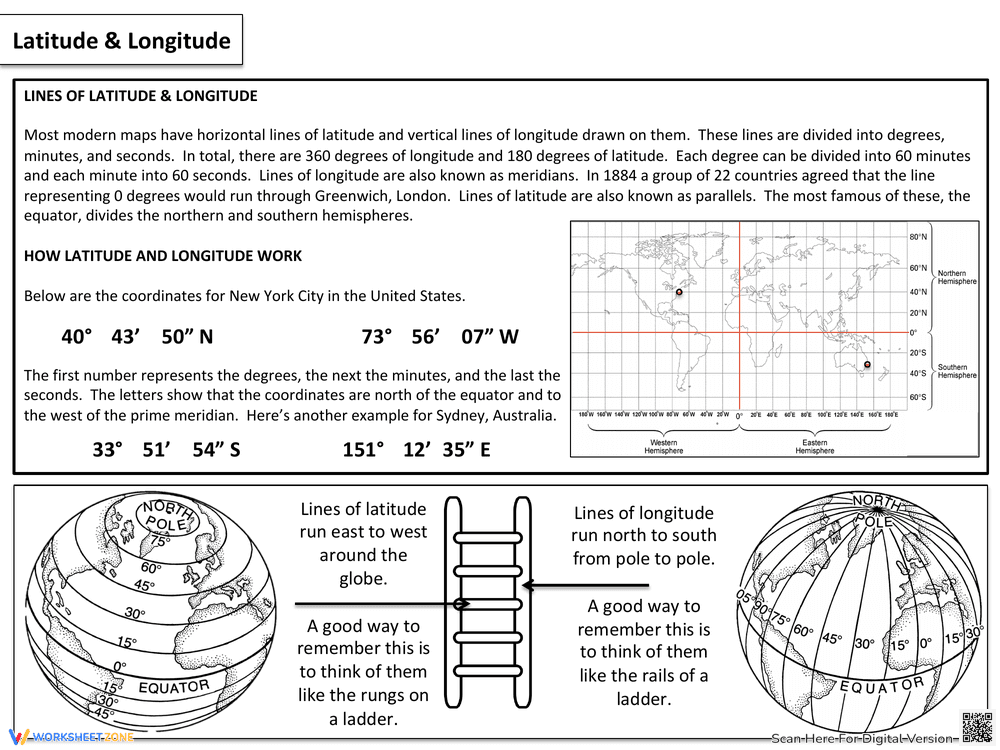
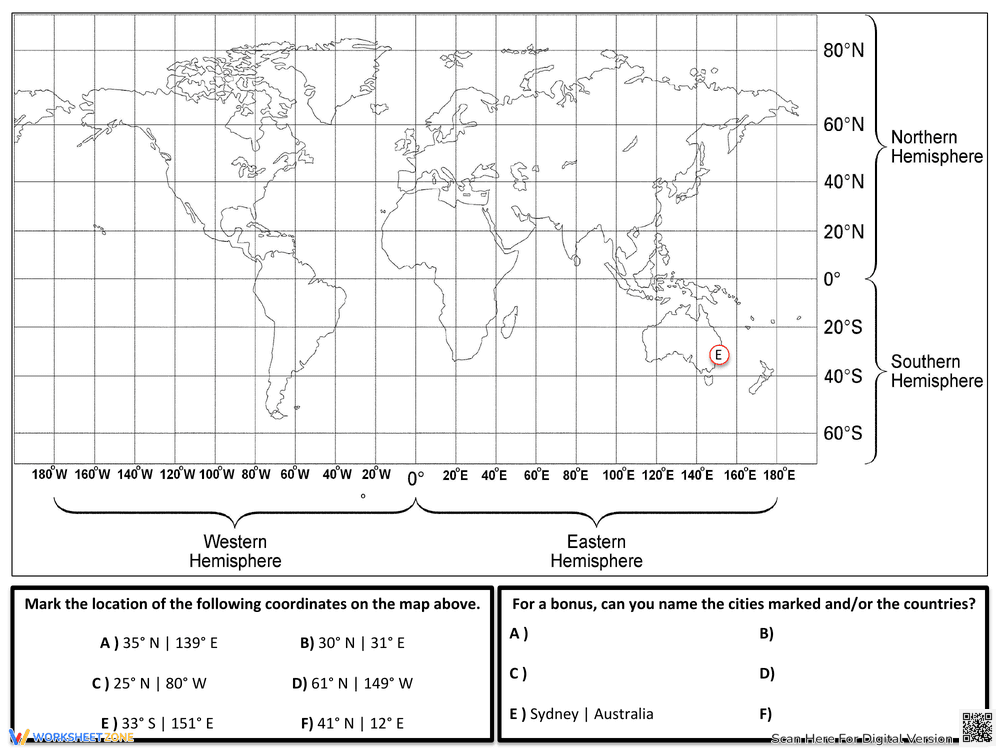
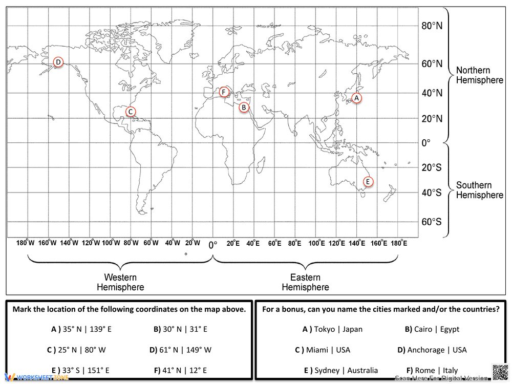
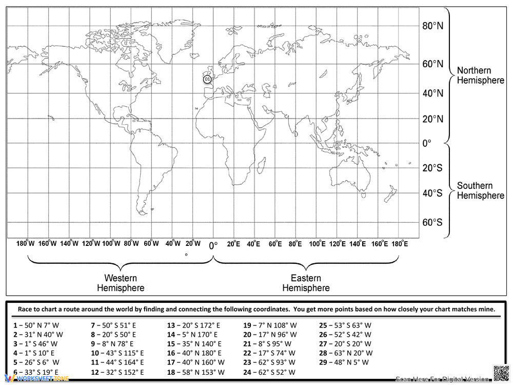
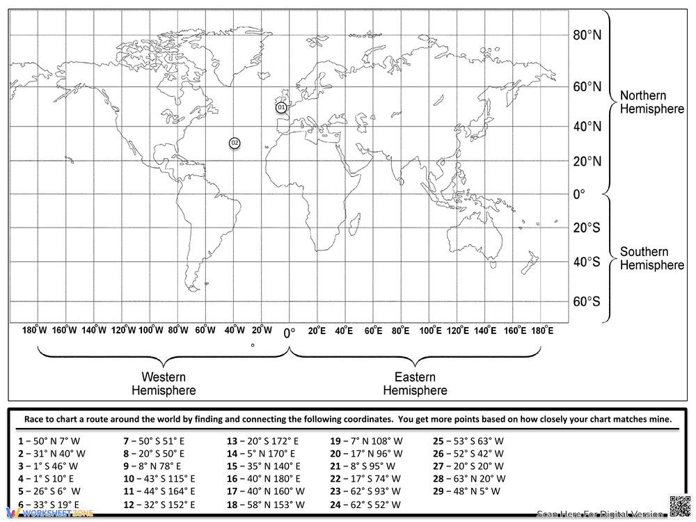
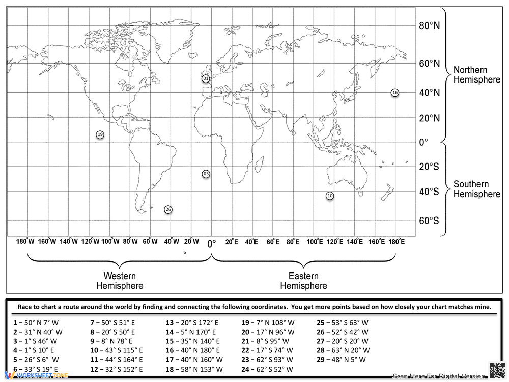
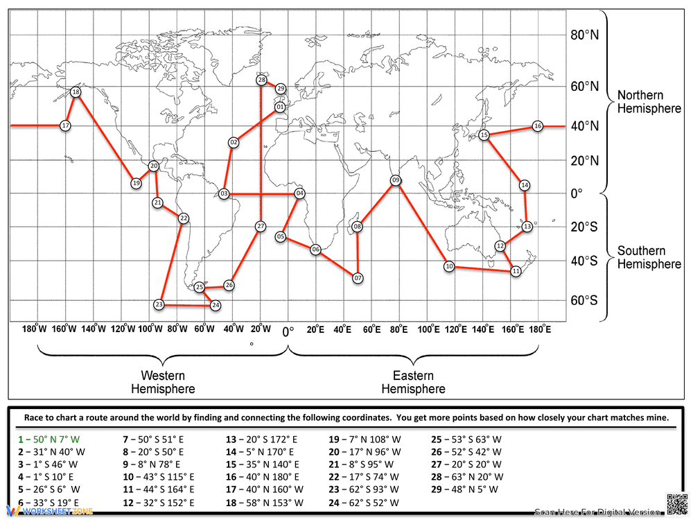
This educational package is a comprehensive 7-page set designed to introduce and master the concepts of latitude and longitude. It includes an instructional guide featuring a clever ladder mnemonic, practice worksheets for identifying global cities like Tokyo and Cairo, and an engaging "Race to chart a route" activity where students plot 29 specific coordinates to create a path across the world map.
Why Use It:
This resource transforms abstract geographical coordinates into a hands-on learning experience. By using visual aids and interactive plotting exercises, students develop spatial awareness, improve their map-reading accuracy, and gain a deeper understanding of how the Earth's grid system works.
How to Use It:
• Start with the instructional page to learn definitions for parallels and meridians using the helpful ladder analogy.
• Use the first worksheet to identify specific global cities by finding their coordinates on the provided world map grid.
• Complete the "Race to chart a route" challenge by plotting all 29 points in sequence and connecting them to visualize a journey around the globe.
Grade Suitability:
Best for Grade 5 and Grade 6.
• Younger kids focus area: Understanding the Equator, Prime Meridian, and basic hemisphere divisions.
• Older students focus area: Precisely plotting degrees and minutes to navigate complex world map grids.
Target Users:
This worksheet set is ideal for geography teachers, social studies educators, and homeschooling parents looking for structured mapping practice.