


Views
Downloads
Printable Latitude & Longitude Worksheet | Grade 5
Paste this activity's link or code into your existing LMS (Google Classroom, Canvas, Teams, Schoology, Moodle, etc.).
Students can open and work on the activity right away, with no student login required.
You'll still be able to track student progress and results from your teacher account.
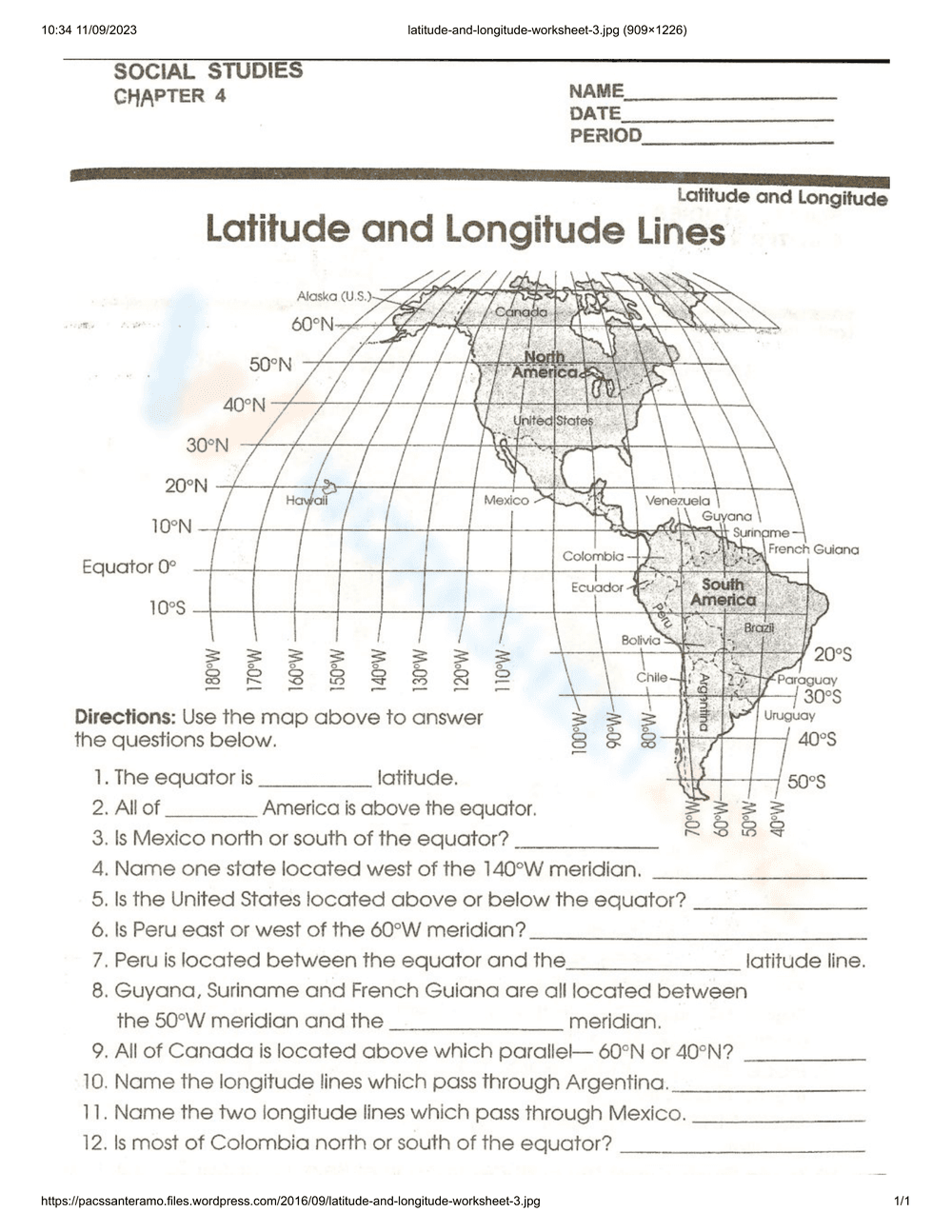
This printable latitude and longitude worksheet helps students build essential map-reading skills by locating specific regions across North and South America. By interpreting a geographic grid system, learners practice identifying coordinates, hemispheres, and absolute locations to answer targeted questions about the Western Hemisphere.
At a Glance
- Grade: 5 · Subject: Social Studies
- Standard:
CCSS.ELA-LITERACY.RI.5.7— Locate answers using visual information- Skill Focus: Latitude and Longitude
- Format: 1 page · 12 problems · Answer key included · PDF
- Best For: Independent practice
- Time: 15–20 minutes
This resource features a single-page map of the Americas overlaid with a latitude and longitude grid. It includes 12 short-answer questions requiring students to analyze the map, identify specific meridians, and determine the relative locations of countries like Mexico and Canada. A complete answer key ensures accurate grading.
Designed for immediate classroom implementation:
- Print (1 minute): Simply download the PDF and print a class set. The map prints clearly in black and white.
- Distribute (1 minute): Hand out the worksheets as a bell-ringer, independent assignment, or emergency sub plan. No prior teacher setup is required.
- Review (3 minutes): Use the included answer key to quickly check student responses or project it on the board for self-correction.
Total teacher prep time is under two minutes, making it an ideal sub plan.
This activity aligns with CCSS.ELA-LITERACY.RI.5.7: "Draw on information from multiple print or digital sources, demonstrating the ability to locate an answer to a question quickly or to solve a problem efficiently." It also supports general social studies frameworks for understanding geographic representations. Both standard codes can be copied directly into lesson plans, IEP goals, or district curriculum mapping tools.
Use this worksheet during direct instruction as a guided activity. After introducing the concepts of the equator and prime meridian, have students complete the first three questions together before transitioning to independent work. Alternatively, it serves as an excellent formative assessment at the end of a geography unit. While students work, observe whether they correctly trace the lines of latitude (horizontal) versus longitude (vertical) with their fingers, which is a key indicator of spatial comprehension. Expected completion time ranges from 15 to 20 minutes.
This worksheet is primarily designed for fifth-grade social studies students, though it is highly effective for fourth and sixth graders reviewing map skills. For students needing differentiation, teachers can highlight the equator and specific meridians in different colors to reduce visual tracking challenges. It pairs perfectly with an introductory lesson on global grid systems or a reading passage about the geography of the Americas.
Mastering geographic grid systems is a foundational component of spatial literacy for elementary learners. This resource directly targets CCSS.ELA-LITERACY.RI.5.7 by requiring students to locate answers using visual information on a map. According to EdReports 2024, students who regularly engage with integrated visual data, such as maps and coordinate grids, demonstrate significantly higher proficiency in cross-curricular problem-solving tasks. The ability to accurately read latitude and longitude lines not only supports social studies comprehension but also reinforces foundational mathematical concepts related to coordinate planes and geometry. By providing structured, repetitive practice with a clear visual model, this worksheet ensures learners internalize the mechanics of geographic coordinates. Consistent exposure to these spatial tasks builds the cognitive frameworks necessary for advanced geographical analysis and real-world navigation skills, preparing students for more complex data interpretation in middle school and beyond.