


0
Views
0
Downloads
0.0
0
Save
0 Likes
USA Latitude and Longitude Practice
0 Views
0 Downloads
Paste this activity's link or code into your existing LMS (Google Classroom, Canvas, Teams, Schoology, Moodle, etc.).
Students can open and work on the activity right away, with no student login required.
You'll still be able to track student progress and results from your teacher account.
Information
Description
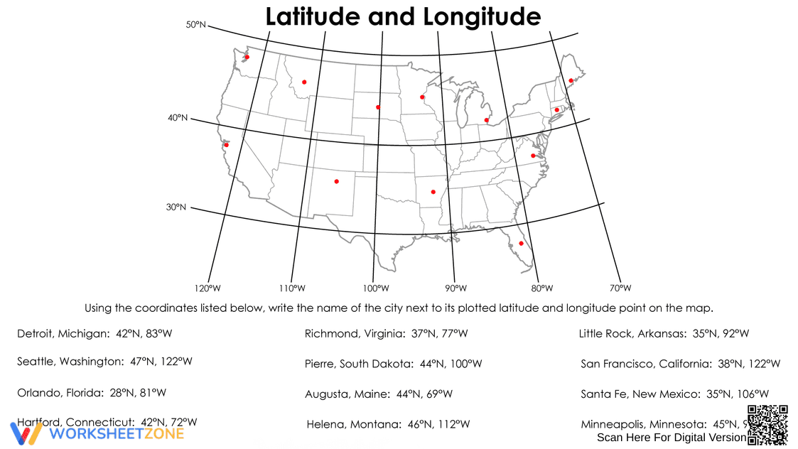
What It Is:
This is a geography worksheet focusing on latitude and longitude. It features a map of the United States with grid lines representing latitude and longitude coordinates. The worksheet asks students to identify cities on the map by matching their listed coordinates (e.g., Detroit, Michigan: 42°N, 83°W) to their corresponding locations on the grid.
Grade Level Suitability:
This worksheet is suitable for grades 5-8. The concept of latitude and longitude is typically introduced in upper elementary or middle school. The complexity of reading coordinates and identifying locations on a map aligns with these grade levels.
Why Use It:
This worksheet helps students develop their understanding of latitude and longitude and their ability to locate places on a map using coordinates. It reinforces map reading skills, spatial reasoning, and the ability to apply geographic concepts to real-world locations.
How to Use It:
Students should use the provided list of cities and their coordinates. Find the intersection of the latitude and longitude lines on the map that correspond to each city's coordinates. Mark the location and write the name of the city next to it.
Target Users:
This worksheet is designed for students learning about geography, map reading, and coordinate systems. It is particularly useful for students in grades 5-8 who are studying the United States or learning about latitude and longitude for the first time.