These 3rd grade landforms worksheets pdf give teachers a focused set of printable materials for the point in Earth science instruction where students first work to distinguish the major features of Earth's surface — a unit where the vocabulary alone (plateau, peninsula, elevation) demands deliberate, repeated practice before students can use it with any real confidence. Each worksheet targets a specific task: labeling diagrams from a word bank, matching terms to definitions, reading simple relief maps, or comparing related landforms in a Venn diagram. The set builds the concrete visual knowledge that later instruction in erosion, water systems, and physical geography depends on.
Skills Each Worksheet Targets
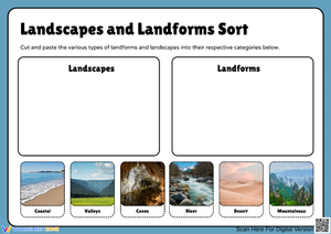
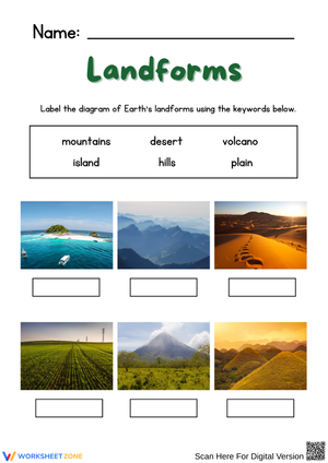
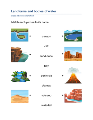
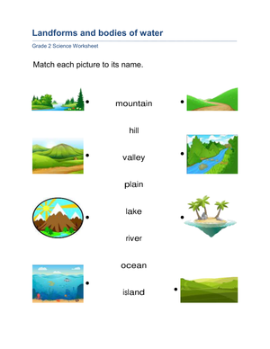
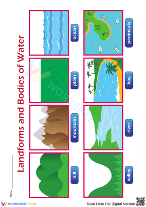
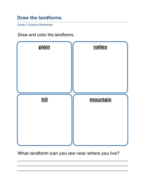
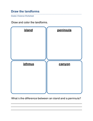
The set moves through the core landform vocabulary third-graders are expected to know: mountains, hills, valleys, plains, plateaus, islands, and peninsulas. Each term appears as both a labeled diagram and a written definition, which matters because many students can recite "a plateau is an elevated landform with a flat top" without being able to identify one when it turns up in a cross-section drawing next to a mountain. The 3rd grade landforms worksheets pdf present every landform across multiple formats — diagram, definition, application — so students have more than one chance to build the connection before the unit ends.
Specific tasks across the set include:
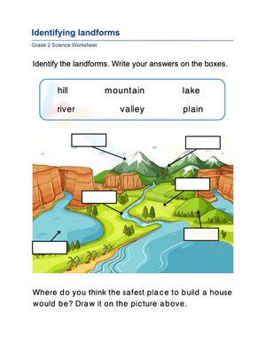
- Labeling unlabeled diagrams from a word bank
- Matching each landform name to its written definition
- Reading a simple relief map and identifying named features by type
- Completing a Venn diagram comparing two closely related landforms
- Writing a real-world example next to each diagram — the Rocky Mountains, the Great Plains, the Florida peninsula
That last task is the one that separates recognition from understanding. When a student has to supply an actual place name rather than circle a printed option, you see quickly whether the concept is solid or whether they have been pattern-matching within the worksheet.
Mistakes Students Make That These Worksheets Help You Catch
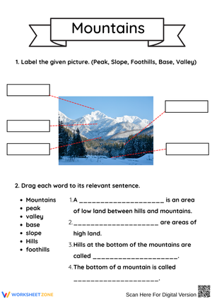
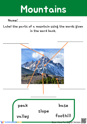
The plateau-mountain confusion is the error we see most consistently at this grade level. Both are elevated above the surrounding terrain, and students who correctly identify a mountain from a steep, peaked diagram will label a plateau "a flat mountain" or simply write "mountain" a second time. The distinguishing feature — a wide, flat summit rather than a narrowing peak — has to be made explicit through side-by-side diagram comparison. Restating the definition a second time does not fix it.
The valley-plain pairing causes a subtler problem. Students recognize that both involve relatively flat or low terrain and use the terms interchangeably, especially in short writing tasks. The correction is to shift identification from the landform itself to its surroundings: a valley sits between elevated landforms; a plain extends without them. Worksheets that show the adjacent terrain rather than isolating a single feature in a box make this distinction visible in a way that a printed definition box does not.
Peninsula and island also produce more confusion than their definitions suggest. Students hear "surrounded by water" and apply it to both. Drawing out the water coverage — three sides versus full encirclement — is more effective than repeating the text.
How to Work These Worksheets Into Your Science Week
The labeling worksheets hold up well as warm-ups during the opening days of the unit, when students are building initial mental images of each landform. Five to eight minutes of diagram labeling before the main lesson gives students a visual reference they can return to during whole-class discussion. After two or three days of new-vocabulary work, the matching and definition worksheets shift function: students are now retrieving terms rather than encountering them for the first time, which is where the retention actually happens.
The 3rd grade landforms worksheets pdf format works naturally with interactive science notebooks. Print the diagrams at roughly 75% scale and students can glue each one into a two-column notebook spread — diagram on the left, written notes on the right — instead of keeping loose papers that disappear by Wednesday. By the end of the unit, the notebook functions as a student-built reference they draw on when the class moves into related content like erosion or water systems.
The Venn diagram and map-skills worksheets fit best later in the unit, once students have the base vocabulary and are ready to make comparisons in a new context. Using one of the matching worksheets as a five-minute exit ticket the afternoon before a unit assessment gives you a fast, readable picture of which students are still mixing up plateaus and mountains before the test lands on their desks.
Standard Alignment
The closest NGSS anchor is 2-ESS2-2: "Develop a model to represent the shapes and kinds of land and water in an area." That performance expectation is formally placed at second grade in the NGSS framework, but many states sequence this content at third grade, and the worksheets align directly to its core demand — using a simplified model (a labeled diagram or relief map) to identify and categorize landforms. The labeling and map-reading tasks in the set address the NGSS science and engineering practice of developing and using models. Teachers following a state-level framework rather than the national sequence should check their state's equivalent Earth science strand; this content appears somewhere in the K–3 band in nearly every state's standards.
Adjusting These Worksheets for Different Learners
For students still building reading fluency, the diagram-labeling worksheets with a printed word bank are the right starting point. The word bank removes the spelling barrier so students focus entirely on visual identification — which is the actual skill at stake. Taking the word bank away for students who are ready for that step converts the same worksheet into a recall task without any other modifications needed.
Students who already have the vocabulary down benefit most from the map-reading tasks and the real-world example requirement. Asking them to find two instances of a specific landform in a classroom atlas and write those place names directly on the worksheet pushes the work from identification to application. For students who need more processing time, the Venn diagram works better as a paired task: talking through the comparison with a partner before writing tends to produce more accurate responses than asking those students to work through a conceptual comparison in silence.
Frequently Asked Questions
Which landforms are covered across the set?
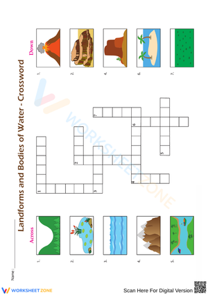
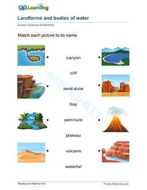
The worksheets cover the seven landforms most consistently taught at the third-grade level: mountains, hills, valleys, plains, plateaus, islands, and peninsulas. Each appears in diagram form with labeling and definition tasks. Coastal features like bays, capes, and deltas are not included — those are typically addressed separately in a geography unit focused on bodies of water.
Can these worksheets function as assessments?
Yes. The matching and labeling formats work well as formative checks — a five-minute exit ticket at the end of a lesson, or a pre-unit snapshot to gauge what prior knowledge students bring. A full labeling worksheet without a word bank makes a reasonable post-unit quiz. These are not standardized assessments, but they give teachers clear, gradable evidence of whether a student can independently identify and define each landform.
Are these resources appropriate for homeschool use?
The 3rd grade landforms worksheets pdf format is self-contained enough that it does not require a specific textbook or curriculum sequence. A parent or tutor can use each worksheet alongside a read-aloud, a short video, or a photo reference and get the same instructional benefit. The real-world example task — where students write in a known place name for each landform — works especially well in homeschool settings where local geography or a regional field trip can be worked directly into the lesson.
How long does each worksheet take to complete?
Most students finish a labeling or matching worksheet in eight to twelve minutes when the vocabulary has already been introduced. The Venn diagram and map-reading worksheets typically run closer to fifteen minutes because they ask for analysis rather than recall. Cold-completion times at the very start of the unit will be longer, especially for the definition-matching tasks.