


Views
Downloads
Pennsylvania Map Worksheet | Grade 2 Essential Geography
Paste this activity's link or code into your existing LMS (Google Classroom, Canvas, Teams, Schoology, Moodle, etc.).
Students can open and work on the activity right away, with no student login required.
You'll still be able to track student progress and results from your teacher account.
This Grade 2 Pennsylvania geography worksheet helps students master map literacy by identifying key state features. Students use a detailed, labeled map to locate the state capital, major cities, and surrounding bodies of water. By translating visual data into written answers, learners build a foundational understanding of regional geography and spatial relationships.
At a Glance
- Grade: 2 · Subject: Social Studies & Geography
- Standard:
CCSS.ELA-LITERACY.RI.2.7— Use information from a map to demonstrate understanding of a specific region- Skill Focus: State geography and map reading
- Format: 1 page · 4 problems · Answer key included · PDF
- Best For: Introduction to US states and regions
- Time: 15–20 minutes
What's Inside
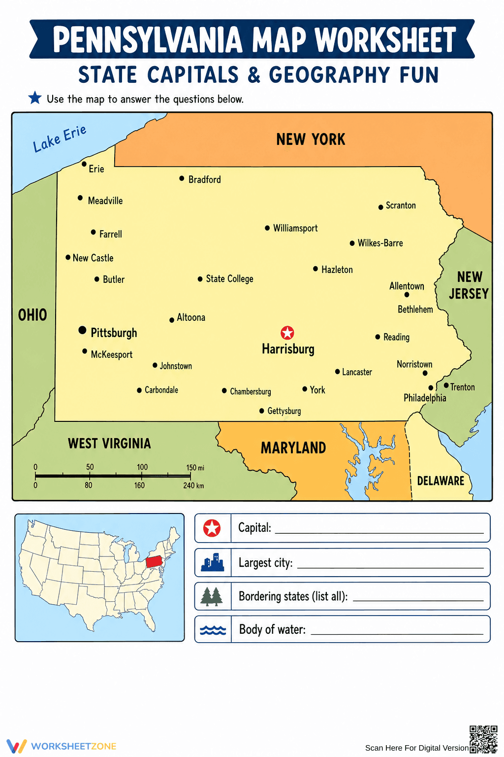
This resource features a high-contrast map of Pennsylvania with clear labels for cities like Pittsburgh, Philadelphia, and Harrisburg. It includes an inset map showing Pennsylvania's location within the United States and a distance scale. Students complete 4 specific tasks: identifying the capital, the largest city, bordering states, and the primary body of water. A full answer key is provided for quick grading.
Zero-Prep Workflow
- Print: Generate copies in under 30 seconds with this high-resolution PDF.
- Distribute: Hand out the worksheet as a standalone activity or part of a geography folder.
- Review: Use the included answer key for a 5-minute whole-class check or individual grading.
Total teacher prep time is under 2 minutes, making this an ideal choice for sub plans or morning work.
Standards Alignment
This worksheet aligns with `CCSS.ELA-LITERACY.RI.2.7`, requiring students to explain how specific images, such as a map, contribute to and clarify a text. It also supports state-level social studies standards regarding regional identification. Both standard codes can be copied directly into lesson plans, IEP goals, or district curriculum mapping tools.
How to Use It
Use this worksheet during your introductory unit on the Northeast region or as a formative assessment after a lesson on map keys and symbols. It works well as a quiet independent activity or a partner task where students quiz each other on city locations. Expect students to spend 15 to 20 minutes completing the identification tasks.
Who It's For
This resource is designed for Grade 2 students but is appropriate for Grade 3 review. It is particularly helpful for English Language Learners (ELLs) due to the heavy visual support. Pair this worksheet with a physical classroom globe or a digital map of the United States for a comprehensive geography lesson.
According to Fisher & Frey (2014), the use of non-linguistic representations, such as labeled maps and visual organizers, significantly enhances a student's ability to synthesize informational text. This Pennsylvania Map Worksheet leverages these principles by requiring Grade 2 students to translate visual spatial data into written responses. By identifying the state capital, Harrisburg, and the largest city, Philadelphia, learners engage in high-level retrieval tasks that solidify geographic literacy. Research from the NAEP suggests that early exposure to map-reading skills is a strong predictor of later success in social studies and earth science disciplines. This resource provides a structured environment for students to practice these skills without the cognitive load of complex text, allowing for focused mastery of the RI.2.7 standard. Bordering state identification encourages relational thinking, situating Pennsylvania within the broader United States geography.