



















Views
Downloads


Ready Civil War Map Word Search | Grades 4–5 Social Studies

Paste this activity's link or code into your existing LMS (Google Classroom, Canvas, Teams, Schoology, Moodle, etc.).
Students can open and work on the activity right away, with no student login required.
You'll still be able to track student progress and results from your teacher account.
This Civil War geography word search helps Grades 4–5 students reinforce key historical locations and regional divisions from the American Civil War. Learners identify vital waterways, capital cities, and border states while connecting geographical names to significant wartime events, building foundational social studies vocabulary and spatial awareness across ten foundational historical terms.
At a Glance
- Grade: Grades 4–5 · Subject: Social Studies
- Standard: Not standards-assessed — vocabulary enrichment and historical term identification
- Skill Focus: Union and Confederate geography and regional locations
- Format: 1 student page · 10 words · 3-page answer key included · PDF
- Best For: Independent Civil War unit vocabulary practice and review
- Time: 15–20 minutes
What's Inside
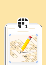
This 1-page printable activity features an engaging word search layout accompanied by an alphabetical word bank and 10 detailed historical clues. Students search for ten critical geographic locations, such as Richmond, Vicksburg, and the Potomac River, while referencing contextual clues that link each place to its strategic role in the conflict. A comprehensive 3-page answer key provides clear letter-by-letter solutions for efficient grading.
Puzzle Mechanics
The activity is built on a 12 by 12 grid designed specifically for intermediate elementary learners. All 10 vocabulary terms run exclusively in two accessible directions: East (left to right) and South (top to bottom). No backwards or diagonal placements are used, preventing visual frustration while maintaining focused word discovery. An alphabetical word bank lists all ten target locations alongside descriptive clues that summarize key wartime landmarks, waterways, and capital cities.
Standards Alignment
This resource serves as targeted vocabulary enrichment rather than a formal standards-assessed assessment. It is not aligned to a specific Common Core or state standard code, making it an adaptable supplemental tool for any state social studies curriculum covering the American Civil War, regional geography, or 19th-century American history.
How to Use It
Introduce this word search before direct instruction as a preview activity to spark curiosity about key locations like Fort Sumter in Charleston or the surrender site at Appomattox. Alternatively, assign it after direct instruction as an independent consolidation task where students match geographical names to their historical roles. While learners complete the puzzle, circulate to observe whether students use the contextual clues to confirm terms or rely solely on letter matching. Expected completion time is 15 to 20 minutes.
Who It's For
This activity is designed for Grades 4–5 social studies classrooms studying the American Civil War. For learners requiring extra support, highlight the initial letter of each word directly on the grid or review the clue descriptions as a whole group prior to independent work. For an extended learning experience, pair this word search with a physical Civil War theater map or a direct instruction lesson on Union border states.
Vocabulary acquisition in elementary social studies relies heavily on repeated, multi-contextual exposure to domain-specific terminology. According to Fisher & Frey (2014), intentional word exposure coupled with contextual definitions strengthens student retention of informational text concepts and deepens domain knowledge across content areas. This Grades 4–5 Civil War word search targets union and confederate geography through active term discovery and historical clue integration. Although designed as an unaligned vocabulary enrichment resource without a formal standard code, the activity reinforces essential spatial and historical literacy by connecting ten pivotal locations—including strategic border states, vital waterways, and wartime capital centers—to their broader historical significance during the American Civil War. By integrating localized geographic names within structured puzzle mechanics, the resource provides accessible cognitive reinforcement that prepares intermediate elementary learners for more complex historical analysis and map-based curriculum units.


