


























Views
Plays

Geography Vocabulary Quiz | Grade 3-5 Essential
Paste this activity's link or code into your existing LMS (Google Classroom, Canvas, Teams, Schoology, Moodle, etc.).
Students can open and work on the activity right away, with no student login required.
You'll still be able to track student progress and results from your teacher account.
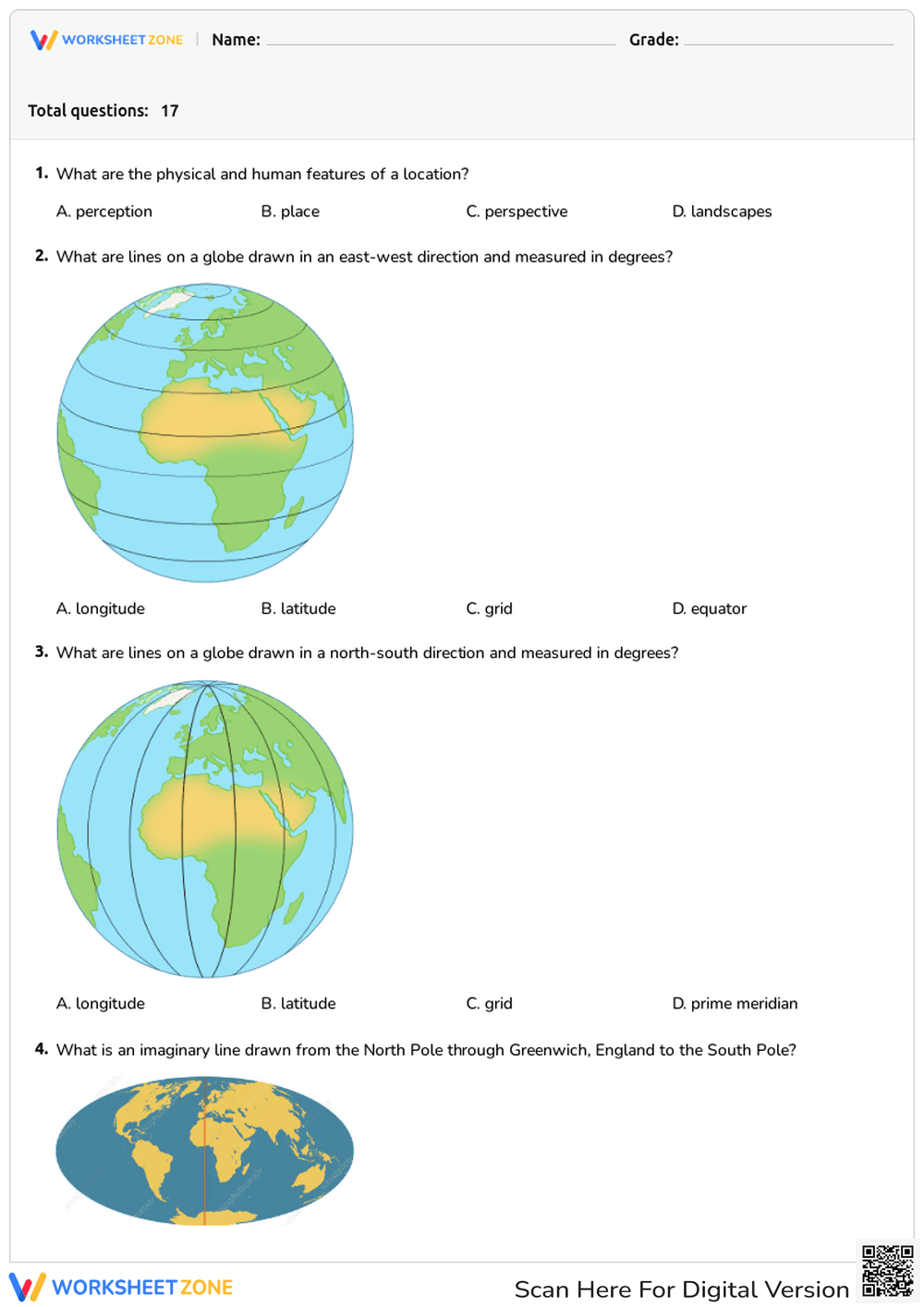
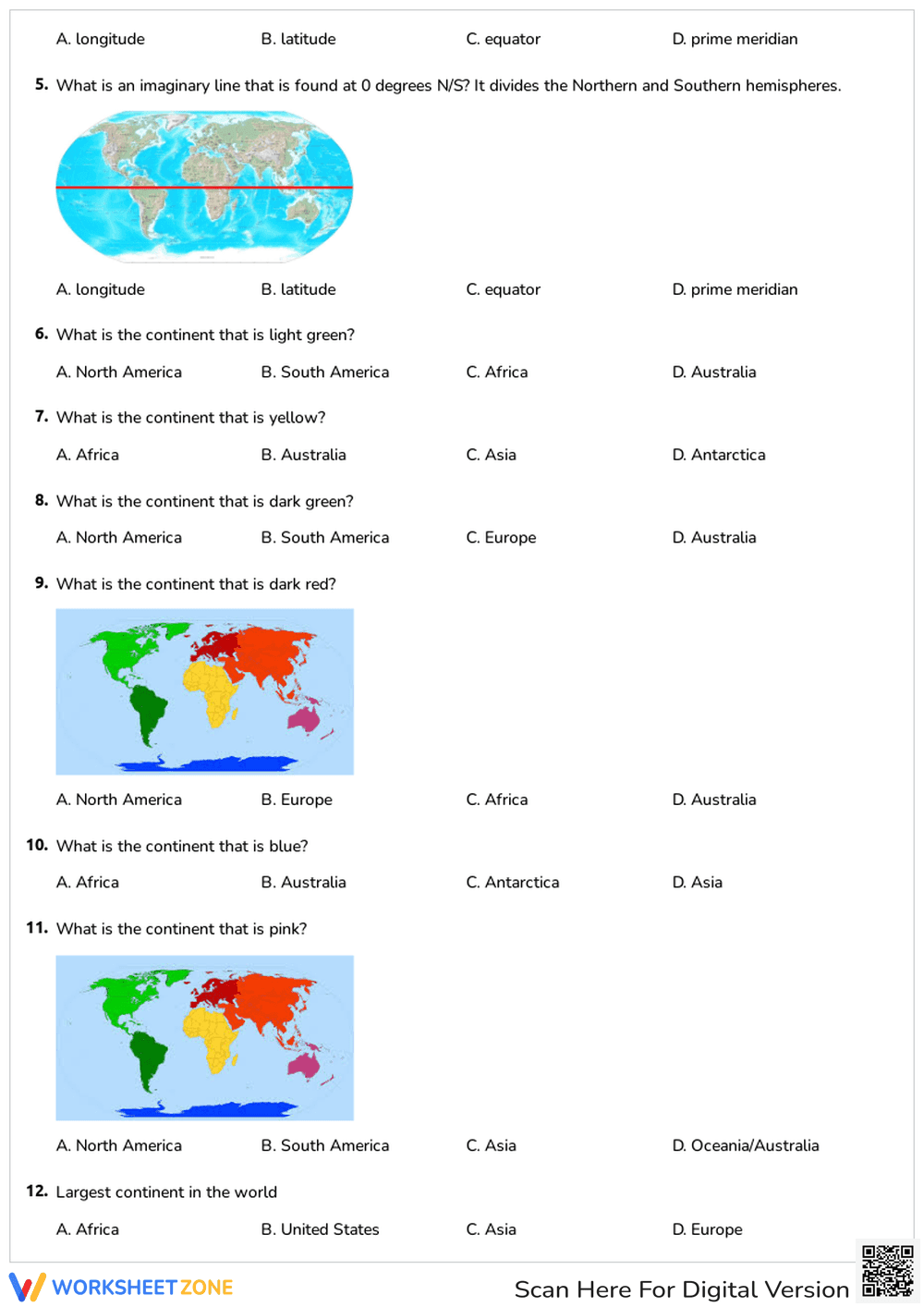
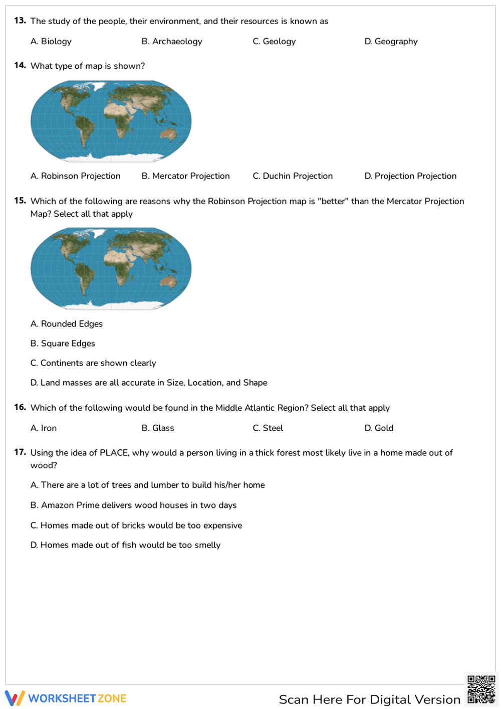
This comprehensive geography vocabulary worksheet helps students master essential map skills and global terminology. By identifying key features like the Prime Meridian and specific continents, learners build a strong spatial foundation. It provides a clear assessment of student understanding regarding how we represent the Earth's surface through various map projections and coordinate systems.
At a Glance
- Grade: 3–5 · Subject: Geography
- Standard:
D2.Geo.1.3-5— Construct maps and other graphic representations of both familiar and unfamiliar places- Skill Focus: Map Skills & Geographic Terms
- Format: 3 pages · 17 problems · Answer key included · PDF
- Best For: Summative assessment or unit review
- Time: 20–30 minutes
The packet contains a three-page assessment featuring 17 multiple-choice questions. It utilizes high-quality visual aids, including color-coded world maps and globe diagrams illustrating latitude and longitude lines. Students will differentiate between the Robinson and Mercator projections and identify continents based on geographic location. A full answer key is provided for rapid grading and immediate student feedback.
Zero-Prep Workflow
- Print: Download and print the three-page PDF for your entire class in under 30 seconds.
- Distribute: Hand out the materials for a quiet independent assessment or a timed vocabulary quiz.
- Review: Use the included answer key to facilitate peer-grading or to quickly enter scores into your gradebook.
This streamlined layout is ideal for emergency sub plans or as a quick check for understanding at the end of a geography unit.
Standards Alignment
The primary alignment is `D2.Geo.1.3-5`, which focuses on using maps and other graphic representations to explain geographic relationships. It also supports `CCSS.ELA-LITERACY.RI.4.7` by requiring students to interpret information presented visually and explain how the information contributes to an understanding of the text. Both standard codes can be copied directly into lesson plans, IEP goals, or district curriculum mapping tools.
How to Use It
Use this as a summative assessment after a unit on global geography or as a diagnostic tool to gauge prior knowledge. During the activity, observe if students struggle more with abstract lines like latitude and longitude versus physical landmasses. This worksheet typically takes 20 to 30 minutes to complete depending on the student's reading level and familiarity with the map projections shown.
Who It's For
This is designed for upper elementary students in grades 3 through 5. It is particularly effective for visual learners who benefit from seeing concepts like the Equator mapped onto a physical globe. Pair this with a physical classroom globe or an interactive atlas for a complete introductory geography lesson that bridges the gap between abstract terms and physical locations.
According to the NAEP Geography Framework, spatial thinking and the ability to interpret map projections are critical components of middle-childhood social studies development. This worksheet aligns with research from Fisher & Frey (2014) regarding the importance of visual literacy in content-area learning. By requiring students to decode color-coded maps and coordinate grids, the resource addresses the D2.Geo.1.3-5 standard through direct application. Studies from EdReports 2024 emphasize that high-quality instructional materials must integrate visual evidence with technical vocabulary to ensure long-term retention of geographic concepts. This 17-question assessment provides the necessary scaffolding to move students from basic identification to analyzing the strengths and weaknesses of different map projections, such as the Robinson versus Mercator models. It serves as a reliable instrument for measuring student mastery of foundational Earth-science and social studies terminology in a classroom setting.


