

























Views
Downloads



Complete Local Geologic Setting Worksheet | Grade 8 Science

Paste this activity's link or code into your existing LMS (Google Classroom, Canvas, Teams, Schoology, Moodle, etc.).
Students can open and work on the activity right away, with no student login required.
You'll still be able to track student progress and results from your teacher account.
This Grade 8 science worksheet equips students to analyze tectonic plate interactions and explain local geologic settings using real-world physical constraints. Through structured data evaluation and comparative case studies, learners determine how lithospheric density, thickness, and boundary velocity drive subduction, mountain building, earthquake focal depths, and volcanic arc formation across diverse Earth systems.
At a Glance
- Grade: 8 · Subject: Science
- Standard: Explain how plate tectonics and crustal properties shape local geologic settings
- Skill Focus: Explain a Local Geologic Setting
- Format: 5 pages · 10 problems · Answer key included · PDF
- Best For: Post-instruction tectonic data analysis
- Time: 45–60 minutes
What's Inside
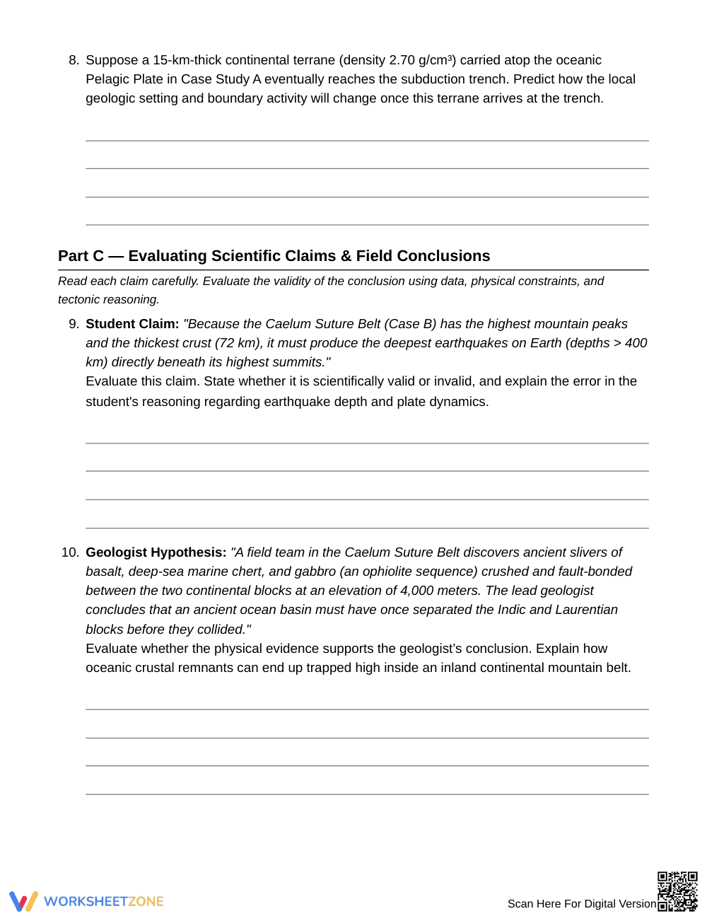
The 5-page worksheet includes a comprehensive crustal reference table detailing density, thickness, and rock composition across lithospheric layers. Students analyze two contrasting synthetic case studies featuring quantitative seismic, volcanic, and velocity data across 10 structured free-response and evaluative items, supported by an exhaustive 3-page explanatory answer key.
Skill Progression
- Guided Practice (Part A, Problems 1–2): Students examine crustal properties in a structured density reference table to identify foundational buoyancy constraints governing subduction versus continental collision.
- Supported Practice (Part B, Problems 3–8): Learners apply tectonic mechanisms to calculate convergence rates, trace Wadati-Benioff seismic zones, model crustal thickening, and predict terrane accretion outcomes.
- Independent Practice (Part C, Problems 9–10): Students evaluate authentic scientific claims, refuting common misconceptions regarding earthquake depths and explaining ophiolite emplacement in suture belts.
This sequence reinforces student independence through a structured gradual-release model, moving from data-table interpretation to complex geologic evaluation.
Standards Alignment
This resource aligns with middle school Earth and space science standards requiring students to analyze and interpret geoscience data to explain how tectonic plate motions produce localized geologic structures and regional features. Both standard codes can be copied directly into lesson plans, IEP goals, or district curriculum mapping tools.
How to Use It
Implement this worksheet after direct instruction on lithospheric dynamics and plate boundary types. Use Part B as a collaborative partner investigation where students calculate plate velocities and interpret Wadati-Benioff earthquake profiles. For formative assessment, inspect student responses to Question 7 to check whether learners recognize why melting is absent during continental collision. Completion typically takes 45 to 60 minutes.
Who It's For
This activity targets Grade 8 earth science classrooms mastering plate tectonics and crustal dynamics. Built-in reference metrics support emerging learners, while advanced evaluation prompts provide rigor for honors students. Pair this worksheet directly with cross-sectional lithospheric boundary diagrams or physical mantle convection demonstrations to anchor spatial reasoning.
Explaining a local geologic setting requires students to synthesize quantitative geophysical metrics, lithospheric rock properties, and spatial boundary behaviors into coherent scientific explanations. Grounded in the gradual release of responsibility framework synthesized by Fisher & Frey (2014), this 10-task worksheet structures cognitive demand by progressing from foundational density tables to complex case study evaluation. Middle school students systematically analyze convergence velocities, crustal buoyancy limits, and Wadati-Benioff earthquake focal zones across 5 rigorous pages. By challenging learners to validate scientific claims regarding mountain root thickening and continental suture belts, the resource directly targets persistent spatial misconceptions in plate tectonics. Research demonstrates that pairing explicit structural scaffolds with authentic data analysis significantly deepens conceptual retention and evidence-based writing in middle school science classrooms, ensuring students successfully master how dynamic Earth systems generate distinct, real-world geologic outcomes across diverse convergent environments.


