



























Views
Downloads



Complete Landform Prediction Worksheet | Grade 8 Science

Paste this activity's link or code into your existing LMS (Google Classroom, Canvas, Teams, Schoology, Moodle, etc.).
Students can open and work on the activity right away, with no student login required.
You'll still be able to track student progress and results from your teacher account.
This Grade 8 science worksheet helps students predict geological landforms using relative plate motion and crust density. Through 12 structured tasks, learners analyze boundary interactions, calculate tectonic movement rates, and interpret synthetic data to develop clear scientific reasoning about Earth's dynamic surface.
At a Glance
- Grade: 8 · Subject: Science
- Standard: Plate Motion — Predict surface landforms using relative plate motion and crustal density
- Skill Focus: Predict Landforms from Relative Motion
- Format: 5 pages · 12 problems · Answer key included · PDF
- Best For: Earth science mechanics practice
- Time: 40–50 minutes
What's Inside
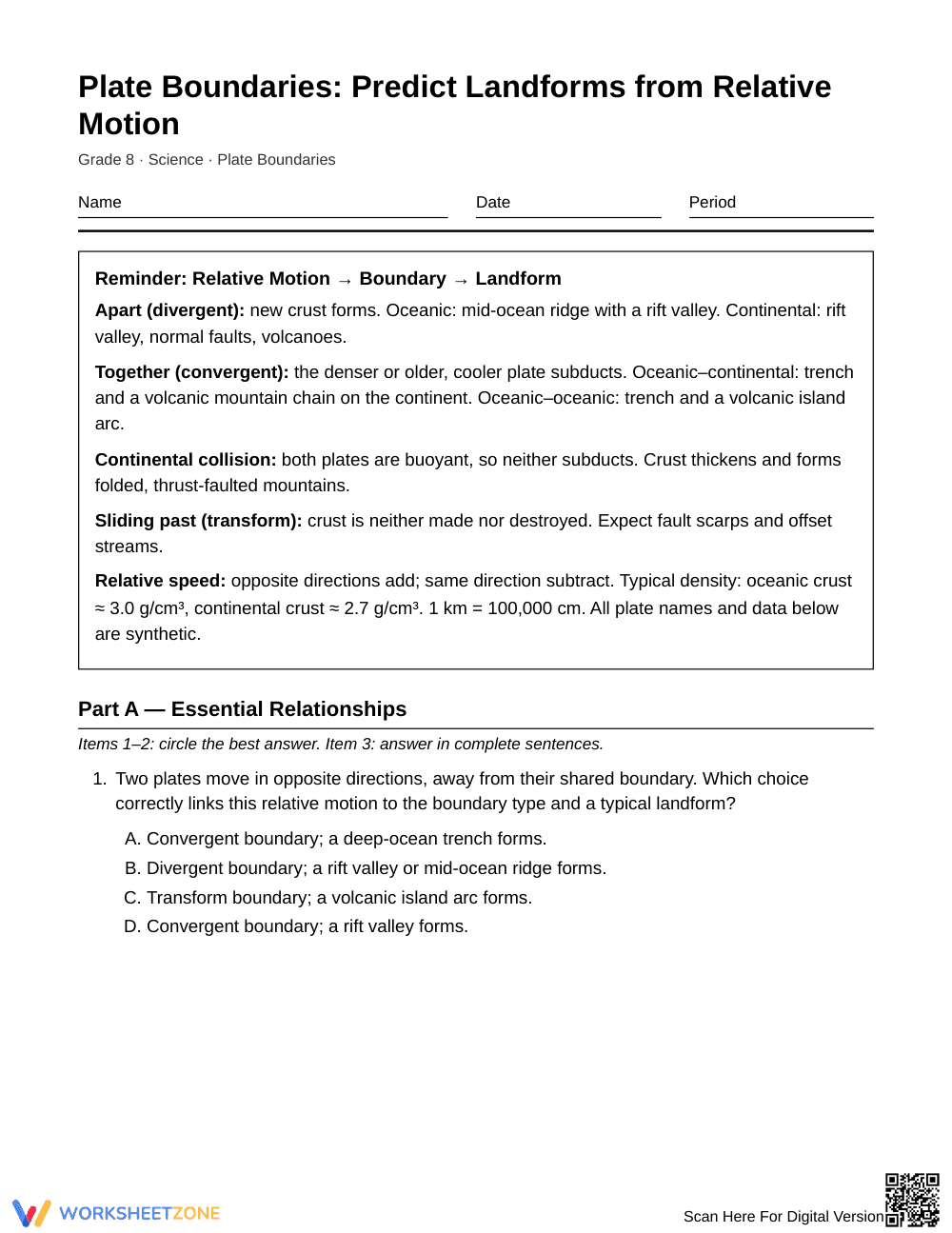
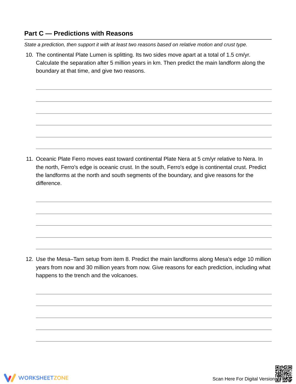
This 5-page resource includes a 2-page student worksheet and a 3-page complete answer key. A reference box outlines motion types, density rules, and unit conversions. Tasks include multiple-choice checks, short explanations, rate calculations, and synthetic data analysis comparing crust thickness and earthquake depths.
Skill Progression
- Guided practice (Tasks 1–3): Students identify boundary motions and connect crust density to subduction.
- Supported practice (Tasks 4–9): Learners solve rate calculations, measure stream offsets, and classify boundaries using synthetic crust data.
- Independent practice (Tasks 10–12): Students construct multi-million-year landform predictions supported by speed and density evidence.
This sequence follows the gradual release model (I Do, We Do, You Do) to foster student autonomy.
Standards Alignment
This worksheet aligns with middle school Earth science standards where students construct evidence-based explanations for how geoscience processes change Earth's surface. Tasks examine how divergent, convergent, and transform boundaries produce distinct features. Both standard codes can be copied directly into lesson plans, IEP goals, or district curriculum mapping tools.
How to Use It
Use this worksheet after introducing plate boundaries to reinforce quantitative analysis. During classwork, check Task 5 and Task 8 to ensure students correctly convert centimeters per year to kilometers. The activity also functions effectively as a formative checkpoint on subduction mechanics. Expect completion within 40 to 50 minutes.
Who It's For
Designed for Grade 8 Earth science students, this resource includes reference notes for emerging learners and multi-step rate calculations for enrichment. Pair this worksheet with an interactive plate tectonics map or physical fault models.
Predicting landforms from relative plate motion requires middle school learners to coordinate spatial reasoning, rate mathematics, and crustal density relationships. According to Fisher & Frey (2014), purposeful gradual release structures that transition students systematically from foundational concept identification to complex mechanism synthesis produce measurable gains in scientific literacy and analytical autonomy. This Grade 8 science worksheet operationalizes that instructional progression across 12 targeted tasks, guiding students through foundational boundary classifications before prompting them to evaluate multi-million-year continental convergence scenarios. By integrating synthetic empirical data tables alongside unit-conversion rate problems, the five-page resource reinforces how divergent, convergent, and transform boundaries actively sculpt Earth's topography. The comprehensive three-page answer key provides complete mathematical derivations and model scientific explanations, enabling educators to quickly identify student misconceptions regarding subduction physics and crustal buoyancies during formative Earth science instruction.


