


Views
Plays
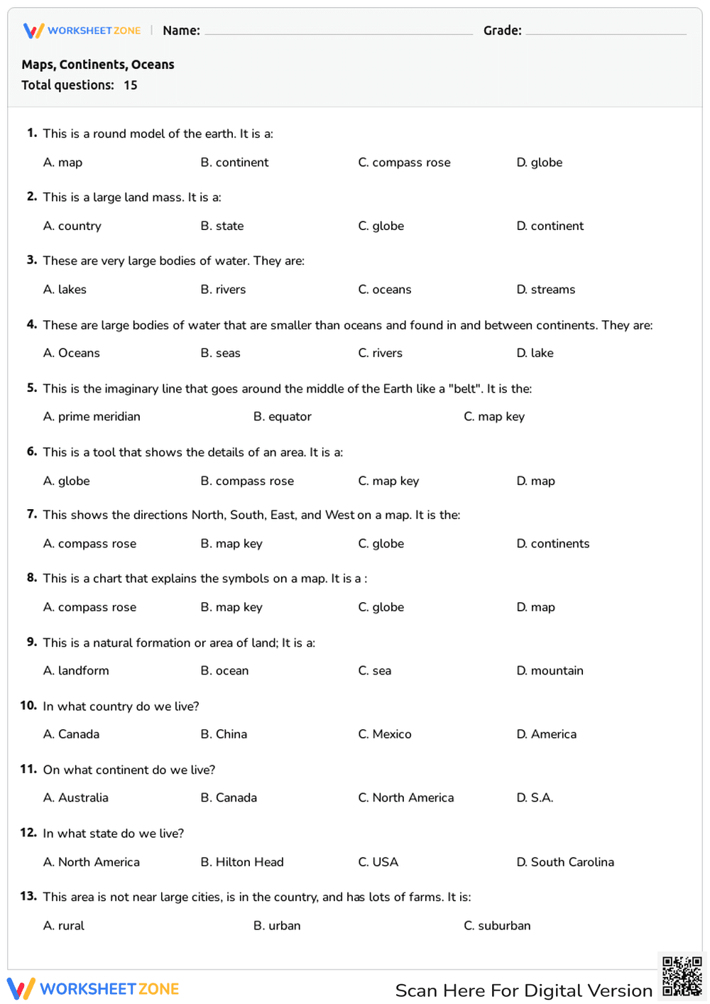

Printable Basic Geography Assessment | Grade 3
Paste this activity's link or code into your existing LMS (Google Classroom, Canvas, Teams, Schoology, Moodle, etc.).
Students can open and work on the activity right away, with no student login required.
You'll still be able to track student progress and results from your teacher account.
This basic geography assessment helps students review essential map skills and geographic terminology. By completing this multiple-choice quiz, learners will demonstrate their understanding of continents, oceans, map tools, and community types. Use this straightforward resource to quickly evaluate student knowledge and identify areas needing further review.
At a Glance
- Grade: 3 · Subject: Geography
- Standard:
SS.3.G.1.2— Identify basic map elements and geographic terms- Skill Focus: Map skills and geography vocabulary
- Format: 2 pages · 15 problems · Answer key included · PDF
- Best For: Formative assessment or review
- Time: 15–20 minutes
Inside this resource, educators will find a comprehensive two-page assessment featuring 15 multiple-choice questions. The task types cover a wide range of foundational geography concepts, including identifying globes, continents, oceans, the equator, and the prime meridian. Additionally, the quiz tests students on map reading tools like the compass rose and map key, as well as community classifications such as rural, urban, and suburban areas. A complete answer key is included to ensure grading is fast and accurate.
Zero-Prep Workflow
- Print (1 minute): Simply download the PDF and print a class set. The clean, black-and-white layout ensures minimal ink usage.
- Distribute (1 minute): Hand out the two-page assessment to students. The clear instructions and multiple-choice format mean students can begin immediately without extensive teacher setup.
- Review (3 minutes): Use the provided answer key to quickly grade the 15 questions, or review the answers together as a whole-class activity. Total teacher prep time is under two minutes, making this an ideal resource for emergency sub plans or last-minute review sessions.
Aligned to primary standard SS.3.G.1.2, this worksheet requires students to review basic map elements, coordinate grids, and essential geographic terminology. It also supports broader social studies frameworks by asking students to differentiate between physical features and human settlements. Both standard codes can be copied directly into lesson plans, IEP goals, or district curriculum mapping tools.
This assessment is highly versatile and can be deployed in multiple instructional moments. Use it as a pre-assessment before beginning a new geography unit to gauge baseline knowledge, or assign it as a summative quiz after direct instruction on map skills. As a formative assessment tip, observe which specific questions students miss most frequently—such as confusing the equator with the prime meridian—to guide your reteaching efforts. Expected completion time is 15 to 20 minutes.
This worksheet is primarily designed for third-grade students, though it serves as an excellent review tool for fourth and fifth graders needing a refresher on basic geography. For differentiation, teachers can read the questions aloud to students who require reading accommodations or eliminate one incorrect multiple-choice option to reduce cognitive load. It pairs perfectly with an introductory lesson on reading maps or a classroom anchor chart detailing rural, urban, and suburban communities.
Integrating structured vocabulary assessments into social studies instruction significantly reinforces student retention of foundational concepts. By aligning to SS.3.G.1.2 to identify basic map elements and geographic terms, this resource ensures learners build the spatial awareness necessary for advanced historical and geographic analysis. According to Fisher & Frey (2014), providing students with clear, targeted opportunities to retrieve and apply academic vocabulary strengthens their long-term comprehension and ability to engage with complex informational texts. This 15-question format offers a low-stakes environment for students to practice this critical retrieval, ultimately supporting broader literacy and social studies objectives.