




















Views
Downloads


Printable Lat/Long Map Worksheet | Grades 4-8 Social Studies

Paste this activity's link or code into your existing LMS (Google Classroom, Canvas, Teams, Schoology, Moodle, etc.).
Students can open and work on the activity right away, with no student login required.
You'll still be able to track student progress and results from your teacher account.
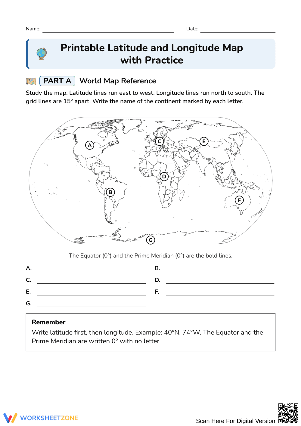
This printable latitude and longitude worksheet teaches students to read a world map grid, write coordinates in the correct order, and plot points with confidence. A reusable 15° map anchors seven continent labels, five coordinate readings, and five plotting tasks, so learners move from naming places to locating them precisely.
At a Glance
- Grade: 4–8 · Subject: Social Studies
- Standard: Not specified — students read, write, and plot latitude and longitude coordinates.
- Skill Focus: Reading and plotting coordinates on a 15° grid
- Format: 2 pages · 17 problems · Answer key included · PDF
- Best For: Map skills practice and review
- Time: 20–30 minutes
What's Inside
The 2-page worksheet includes a labeled world map with a 15° grid and bold Equator and Prime Meridian, plus a blank reference map with five lettered points. A 2-page answer key is included. Part A asks for seven continent names, Part B for five coordinate pairs, and Part C for five plotted points with location sentences. A Remember box states the latitude-first rule, and each part has a worked example.
Skill Progression
- Guided practice: 7 continent labels in Part A, with the map and Remember box in view.
- Supported practice: 5 coordinate readings in Part B, with a worked example to copy.
- Independent practice: 5 plotting tasks in Part C, each ending with a continent or ocean sentence.
This sequence follows gradual release: I Do, We Do, You Do.
Standards Alignment
No specific standard code was assigned to this worksheet. It supports map-and-globe geography skills: using a coordinate grid to describe and find absolute location. Teachers can match it to their own state or district geography standards in lesson plans or curriculum maps.
How to Use It
- During instruction: Work Part A together, then let students try Part B with a partner.
- After instruction: Assign Part C as independent review or homework.
Formative tip: watch for reversed order (longitude before latitude) and missing N, S, E, or W letters. Expect 20–30 minutes.
Who It's For
Students in Grades 4–8 learning or reviewing map skills. Younger or struggling learners can stop after Parts A and B, while stronger students can finish Part C. It pairs well with a classroom wall map or a short lesson on the Equator and Prime Meridian.
This Grades 4–8 Social Studies worksheet teaches students to read, write, and plot latitude and longitude coordinates on a world map with a 15° grid. Students name seven continents, write five coordinate pairs with latitude first, and plot five points, completing 17 tasks across 2 pages with a 2-page answer key. The structure follows the gradual release model described by Fisher & Frey (2014), in which learners move from guided to independent work. A reusable reference map and a Remember box support accuracy throughout. The resource suits map skills instruction, review, and formative checks, and takes about 20 to 30 minutes. No specific standard code is assigned, so teachers can align it to local geography standards.


