


Views
Downloads
Essential Landforms Worksheet | Grade 2 Science
Paste this activity's link or code into your existing LMS (Google Classroom, Canvas, Teams, Schoology, Moodle, etc.).
Students can open and work on the activity right away, with no student login required.
You'll still be able to track student progress and results from your teacher account.
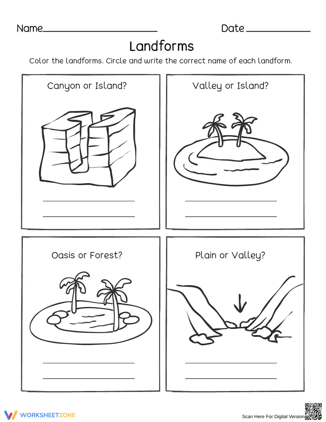
Identify and name common geographical features with this straightforward identification worksheet. Students observe detailed illustrations to distinguish between landforms like canyons, islands, oases, and valleys. This resource builds foundational vocabulary while helping early learners recognize the diverse shapes of land and bodies of water on Earth's surface.
At a Glance
- Grade: 2 · Subject: Science
- Standard:
2-ESS2-2— Develop models to represent the shapes and kinds of land and water- Skill Focus: Landform Identification
- Format: 1 page · 4 problems · Answer key included · PDF
- Best For: Independent practice or introductory science lesson
- Time: 10–15 minutes
This single-page PDF features four distinct identification panels. Each panel contains a high-quality line-art illustration of a specific landform, a binary choice prompt (e.g., "Canyon or Island?"), and primary-ruled lines for handwriting practice. The layout is clean and spacious, allowing students to color the images after completing the writing portion. A complete answer key is included for rapid grading.
This resource is designed for immediate classroom implementation. First, print the single-page master (30 seconds). Second, distribute to students with basic coloring supplies (1 minute). Third, review the completed identification tasks using the included answer key (1 minute). The total teacher preparation time is under two minutes, making this an ideal selection for emergency sub plans or quick bell-ringer activities.
The primary standard addressed is `2-ESS2-2`, which requires students to develop a model to represent the shapes and kinds of land and bodies of water in an area. By identifying and naming canyons, valleys, and islands, students build the conceptual schema necessary for more complex topographical mapping. This standard code can be copied directly into lesson plans, IEP goals, or district curriculum mapping tools.
Use this worksheet as a summative check after a direct instruction lesson on Earth's features. Alternatively, assign it as a pre-assessment to gauge students' existing vocabulary regarding geographic shapes. During the activity, observe if students can accurately distinguish between the "V" shape of a valley versus the steep walls of a canyon. Expect completion in approximately 12 minutes.
This activity is perfectly suited for second-grade students, though it can be scaffolded for first grade or used for remedial support in third grade. It provides excellent support for English Language Learners (ELLs) by pairing visual representations directly with key vocabulary words. It pairs naturally with a classroom anchor chart or a digital slideshow of real-world landform photography.
Aligned to the `2-ESS2-2` standard, this landform identification resource focuses on the essential skill of recognizing and naming diverse terrestrial features. According to EdReports 2024, high-quality science materials for early elementary students must bridge the gap between abstract concepts and visual recognition. This worksheet achieves that by using clear, uncluttered illustrations that emphasize the defining characteristics of islands, oases, and valleys. By integrating handwriting practice with scientific observation, the activity reinforces cross-curricular literacy goals. The inclusion of coloring elements further engages students, promoting longer retention of geographical terminology. This evidence-based approach ensures that students develop the foundational knowledge required for later studies in plate tectonics and erosion. This summary highlights the practical application of geographic modeling in a classroom setting, providing a reliable tool for formative assessment and vocabulary development in the early science curriculum.