


















Views
Downloads


Equator & Hemispheres Printable Grade 6 Worksheet

Paste this activity's link or code into your existing LMS (Google Classroom, Canvas, Teams, Schoology, Moodle, etc.).
Students can open and work on the activity right away, with no student login required.
You'll still be able to track student progress and results from your teacher account.
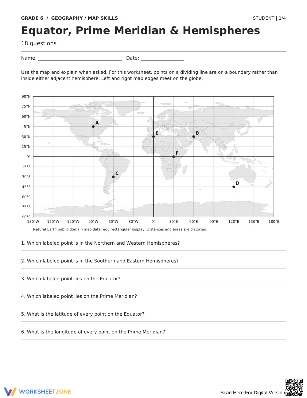
This Grade 6 geography worksheet builds students' ability to locate and apply the equator, prime meridian, and four hemispheres on labeled world maps through 24 structured problems. Students move from identifying reference lines to classifying continents and countries by hemisphere, reinforcing spatial reasoning and map literacy skills essential for middle school geography.
At a Glance
- Grade: 6 · Subject: Geography / Map Skills
- Standard:
CCSS.ELA-LITERACY.RI.6.7— Integrate information from maps and other visual sources; also aligns to Grade 6 Geography standards for identifying hemispheres and reference lines- Skill Focus: Equator, prime meridian, and hemisphere identification
- Format: 4 pages · 24 problems · Answer key included · PDF
- Best For: Introductory map skills practice and review
- Time: 25–35 minutes
The worksheet spans four student pages and includes a variety of task types: labeling world maps, identifying which hemisphere a continent or country falls in, answering short-answer questions about the equator and prime meridian, and completing fill-in-the-blank statements about global reference lines. A full answer key covers all 24 items, making teacher review fast and straightforward.
- Guided practice: The first section (approximately 8 problems) provides a labeled reference map so students can orient themselves before working independently. Sentence frames and visual cues reduce cognitive load at the start.
- Supported practice: The middle section (approximately 8 problems) removes the reference labels and asks students to identify and classify hemispheres using a blank outline map, with key lines still printed for support.
- Independent practice: The final section (approximately 8 problems) requires students to apply hemisphere knowledge without visual scaffolds, answering questions about specific countries and continents from reasoning. This gradual-release structure mirrors the I Do, We Do, You Do model.
Standards Alignment
This worksheet aligns to CCSS.ELA-LITERACY.RI.6.7, which asks students to integrate information presented in different media or formats, including maps. It also supports National Geography Standards Standard 1: How to use maps and other geographic representations to acquire and report information. Both references can be copied directly into lesson plans or curriculum mapping tools.
How to Use It
Use this worksheet during direct instruction as a guided note-taking companion when introducing global reference lines, or assign it after instruction as a formative check. As students complete hemisphere classification tasks, circulate and note which students confuse Eastern and Western Hemispheres — a common misconception signaling a need for reteaching with a physical globe. Expected completion time is 25–35 minutes for most sixth graders.
Who It's For
This resource is designed for Grade 6 students beginning a world geography or social studies unit on map skills. It works well for on-grade learners and those needing additional repetition with spatial concepts. Pair it with a classroom anchor chart showing the four hemispheres to maximize impact.
Proficiency in locating global reference lines is foundational for middle school geography. This worksheet targets the equator and prime meridian through 24 scaffolded tasks across four pages. Structured, repeated practice with labeled and unlabeled maps supports the transfer of spatial knowledge from recognition to application. Teachers can use student performance on the independent section as a formative data point to guide small-group reteaching before moving to latitude and longitude instruction.


