




















Complete Waterways Word Search | Grades 6–7 Social Studies

Paste this activity's link or code into your existing LMS (Google Classroom, Canvas, Teams, Schoology, Moodle, etc.).
Students can open and work on the activity right away, with no student login required.
You'll still be able to track student progress and results from your teacher account.
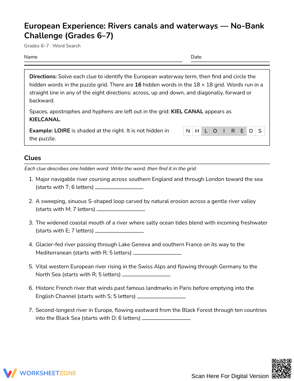
This European waterways word search reinforces geography vocabulary by challenging students in Grades 6–7 to read clues and identify European rivers, canals, and navigation terms. Students strengthen spatial awareness and regional knowledge as they locate 16 hidden terms across the letter grid.
At a Glance
- Grade: Grades 6–7 · Subject: Social Studies (World Geography)
- Standard: Not standards-assessed — vocabulary enrichment
- Skill Focus: European rivers, engineered canals, and waterway terminology
- Format: 3 pages · 16 words to find · Full answer key included · PDF
- Best For: Regional geography review, bell ringers, and vocabulary reinforcement
- Time: 20–35 minutes of focused student practice
What's Inside
This 3-page printable activity features 16 content-rich clues defining European waterways without a traditional word bank. Students read each geographic description to identify major rivers, historic canals, and navigational terms like aqueducts, meanders, and locks. A complete 4-page answer key provides clear letter coordinates and highlighted solution paths for rapid assessment.
Puzzle Structure and Mechanics
The puzzle is built on an 18 x 18 grid with no word bank, requiring students to deduce each term from context clues. Hidden words run in all eight compass directions: north, northeast, east, southeast, south, southwest, west, and northwest. Students must actively retrieve vocabulary before searching horizontally, vertically, and diagonally across the grid.
Standards Alignment
This resource serves as vocabulary enrichment and is not aligned to a specific standard. While it reinforces middle school geography concepts, it operates as an enrichment activity rather than a standards-assessed test instrument.
How to Use It
Use this puzzle as an introductory hook before direct instruction on European trade corridors or as an independent review station following regional studies. During this 20-to-35-minute activity, observe whether students identify terms like the Seine and Danube from clues alone or rely on letter-scanning, providing immediate formative insight into regional recall.
Who It's For
Designed for Grades 6–7 social studies classes, this puzzle supports learners exploring European physical geography and trade routes. Provide an atlas or physical map for students needing extra scaffolding, or challenge early finishers to locate each river on a blank map. Pair this activity with an introductory physical geography passage.
Vocabulary acquisition in secondary social studies requires intentional cognitive engagement rather than passive rote memorization. According to Fisher & Frey (2014), instructional activities that prompt students to solve contextual definitions before locating target words foster deeper domain-specific retention. This Grades 6–7 vocabulary enrichment puzzle strengthens knowledge of European rivers, canals, and waterway terminology by requiring learners to interpret 16 detailed geographic clues. Because the puzzle omits a traditional word bank, students must actively retrieve terms like Volga, aqueduct, and estuary from their working memory before scanning the 18 x 18 grid across eight directional paths. This dual-demand structure pairs disciplinary literacy with visual-spatial problem solving, ensuring learners engage meaningfully with physical geography concepts. By anchoring vocabulary practice in descriptive clues, educators reinforce essential regional terminology effectively without relying on repetitive drill sheets or superficial recall tasks in middle school classrooms.


