


Views
Downloads
Essential Grade 2 Landforms Worksheet | Printable Science
Paste this activity's link or code into your existing LMS (Google Classroom, Canvas, Teams, Schoology, Moodle, etc.).
Students can open and work on the activity right away, with no student login required.
You'll still be able to track student progress and results from your teacher account.
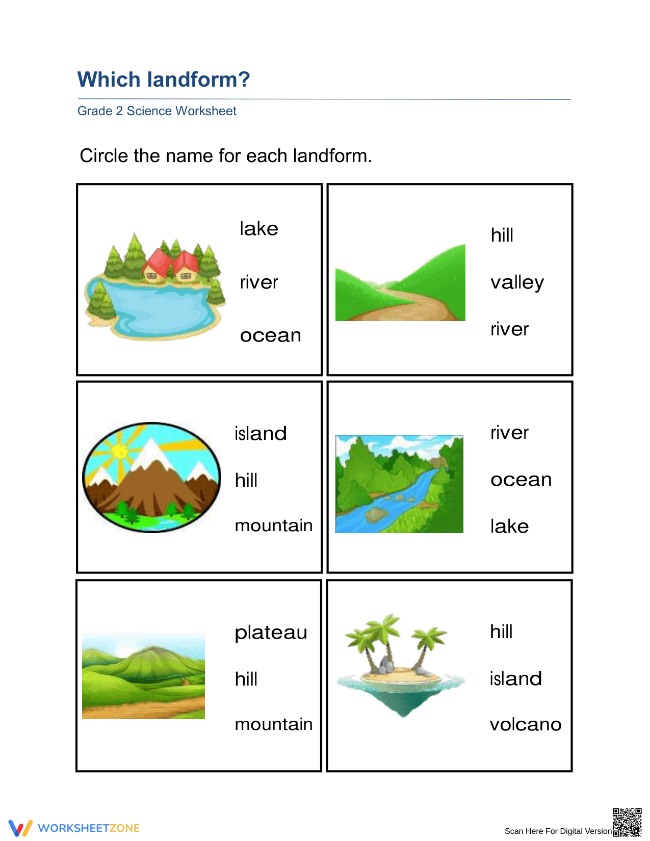
This Essential Grade 2 Science worksheet helps students master the identification of diverse landforms and bodies of water through visual recognition and vocabulary matching. Students observe high-quality illustrations of natural features and select the correct terminology from a multiple-choice list, ensuring they can distinguish between mountains, plateaus, islands, and various aquatic environments effectively.
At a Glance
- Grade: Grade 2 · Subject: Science
- Standard:
2-ESS2-2— Represent the shapes and kinds of land and bodies of water- Skill Focus: Landform and Water Body Identification
- Format: Single-page document · 6 problems · Answer key included · PDF
- Best For: Earth systems introduction or quick formative assessment
- Time: 10–15 minutes
What's Inside
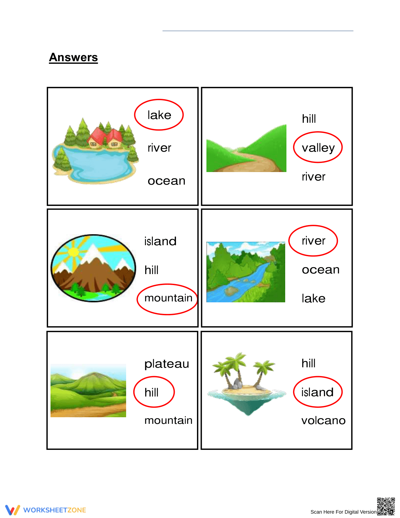
This clean, single-page PDF features six distinct identification tasks. Each task presents a clear, full-color illustration of a specific geographic feature paired with three vocabulary options. The worksheet covers essential landforms including islands, mountains, hills, and valleys, alongside bodies of water like lakes and rivers. A comprehensive answer key is included to facilitate rapid grading and student self-correction.
Zero-Prep Workflow
This resource is designed for immediate classroom implementation with a three-step zero-prep workflow. First, print the single-page document (30 seconds). Second, distribute the copies to students as a morning warm-up or lesson supplement (1 minute). Third, review the answers as a whole group using the provided key (5 minutes). The total teacher preparation time is under two minutes, making it an ideal emergency sub plan.
Standards Alignment
The worksheet is strictly aligned to the primary standard 2-ESS2-2, which requires students to represent the shapes and kinds of land and bodies of water in an area. By identifying features like plateaus and canyons, students build the foundational knowledge necessary for complex Earth science modeling. Both standard codes can be copied directly into lesson plans, IEP goals, or district curriculum mapping tools.
How to Use It
Use this worksheet during the "Explain" phase of a 5E lesson to verify vocabulary acquisition after direct instruction. Alternatively, assign it as a quick formative assessment exit ticket to gauge which students might need additional support with specific geographic terms. Observe if students can distinguish between similar features, such as hills and mountains. The expected completion time for most second graders is approximately twelve minutes.
Who It's For
This resource is tailored for Grade 2 students but serves as an excellent review for Grade 3 or a challenge for Grade 1. It is particularly effective for English Language Learners (ELL) who benefit from the strong visual cues paired with high-frequency scientific vocabulary. Pair this worksheet with a physical map or an anchor chart showing local landforms for a more contextualized learning experience.
Identifying Earth's features is a cornerstone of early geographic literacy, as outlined in the 2-ESS2-2 standard. Research from EdReports 2024 highlights that high-quality visual aids in science instruction significantly improve long-term retention of domain-specific vocabulary among elementary learners. This worksheet utilizes clear, representative illustrations to bridge the gap between abstract geological concepts and concrete visual identification. By focusing on six core features—mountains, hills, islands, valleys, lakes, and rivers—the activity provides the repetitive practice required for students to achieve mastery in Earth system modeling. Such structured practice aligns with the Fisher & Frey (2014) framework for gradual release of responsibility, moving students from guided observation to independent identification. Teachers can confidently integrate this resource into their curriculum, knowing it supports both literacy and science goals while providing the data necessary for evidence-based instructional adjustments in the modern classroom setting.