


0
Views
0
Downloads
0.0
0
Save
0 Likes
Learn Using Google Map with this Worksheet
0 Views
0 Downloads
Paste this activity's link or code into your existing LMS (Google Classroom, Canvas, Teams, Schoology, Moodle, etc.).
Students can open and work on the activity right away, with no student login required.
You'll still be able to track student progress and results from your teacher account.
Information
Description
What It Is:
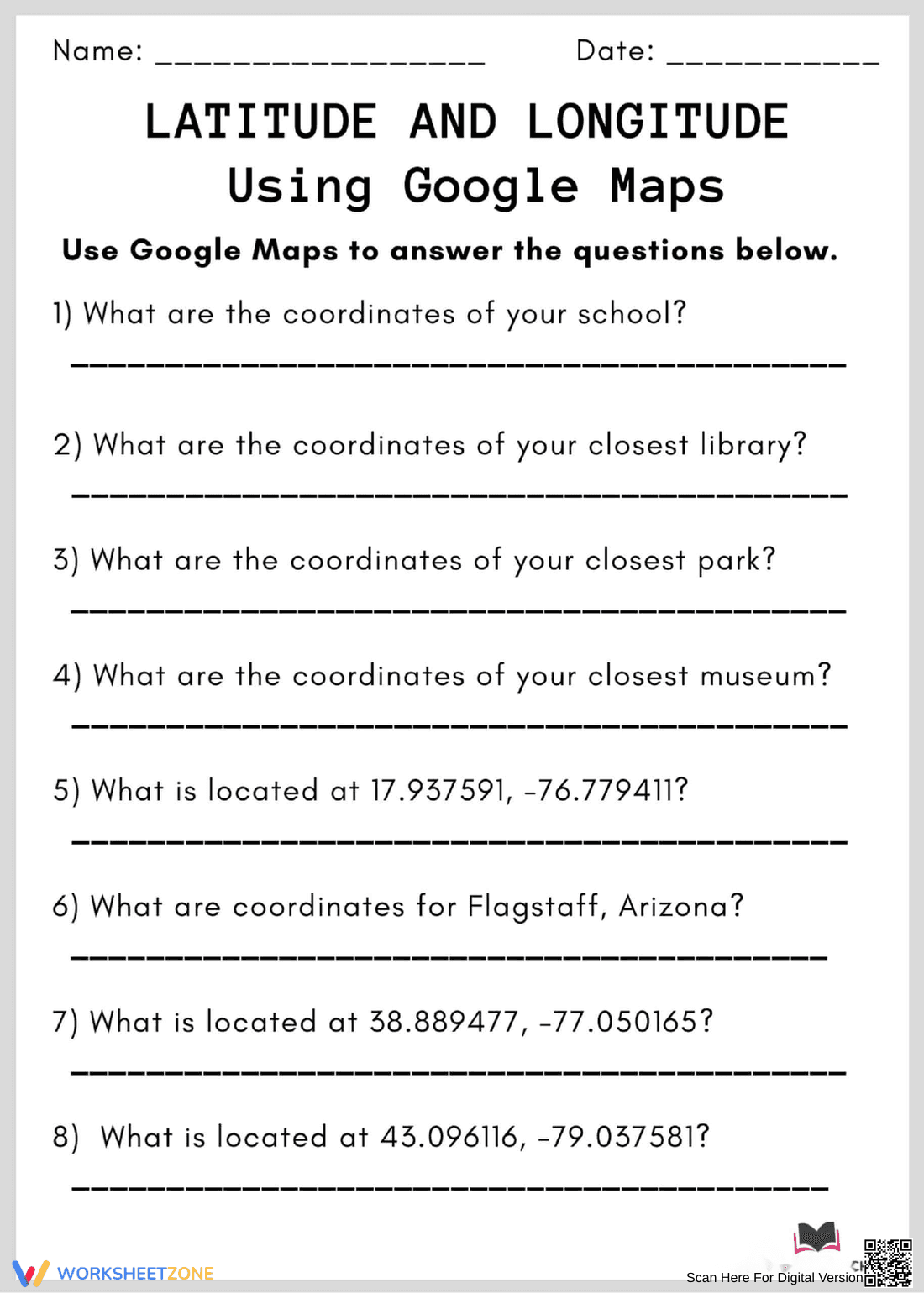
This is an educational worksheet titled 'Latitude and Longitude Using Google Maps'. The worksheet presents a series of questions that require students to use Google Maps to find latitude and longitude coordinates for specific locations, such as their school, local library, park, and museum. It also asks students to identify locations based on given coordinates, including Flagstaff, Arizona.
Grade Level Suitability:
This worksheet is suitable for grades 6-8. It requires basic map reading skills and an understanding of latitude and longitude, along with the ability to use online tools like Google Maps. The questions are structured to build familiarity with geographic coordinates.
Why Use It:
This worksheet reinforces the understanding of latitude and longitude through a practical application using Google Maps. It encourages students to explore their local environment and develop spatial reasoning skills. It also integrates technology into geography learning, making it more engaging.
How to Use It:
Students will need access to Google Maps on a computer or mobile device. They should use the search function to locate the places listed in the questions (school, library, park, museum, Flagstaff). Then, they can right-click on the map to find the latitude and longitude coordinates. For questions providing coordinates, they should enter them into the Google Maps search bar to identify the location.
Target Users:
This worksheet is ideal for middle school students learning about geography, map skills, and coordinate systems. It's also suitable for teachers looking for engaging activities that integrate technology into their geography lessons. Homeschooling parents can also use this worksheet to teach and reinforce map reading skills.