


0
Views
0
Downloads
0.0
0
Save
0 Likes
Identify US City with this Worksheet
0 Views
0 Downloads
Paste this activity's link or code into your existing LMS (Google Classroom, Canvas, Teams, Schoology, Moodle, etc.).
Students can open and work on the activity right away, with no student login required.
You'll still be able to track student progress and results from your teacher account.
Information
Description
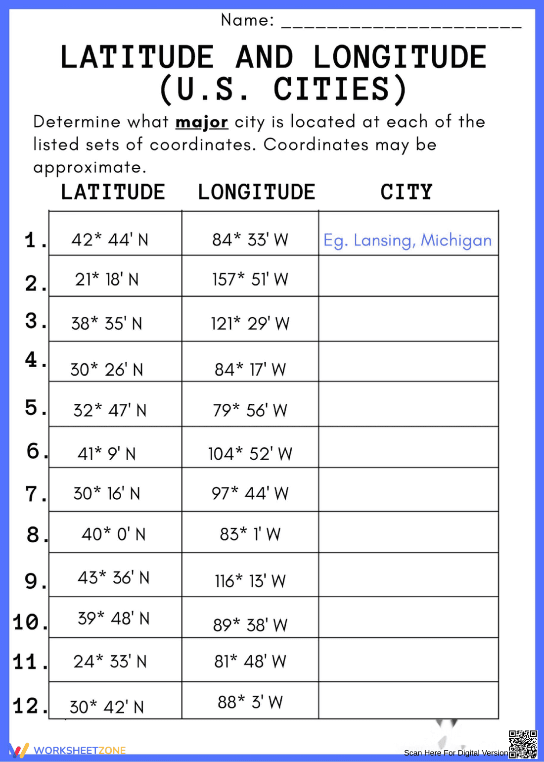
What It Is:
This is a geography worksheet titled 'Latitude and Longitude (U.S. Cities)'. The worksheet presents a table with columns for Latitude, Longitude, and City. The student is tasked with determining the major U.S. city that corresponds to each given set of coordinates. An example is provided: 42° 44' N, 84° 33' W corresponds to Lansing, Michigan. There are 12 sets of coordinates to identify.
Grade Level Suitability:
This worksheet is suitable for grades 5-8. It requires understanding of latitude and longitude coordinates and basic U.S. geography. It also requires research skills to find the cities corresponding to the coordinates.
Why Use It:
This worksheet reinforces the understanding of latitude and longitude and their relation to real-world locations. It enhances map reading skills, geographical knowledge of U.S. cities, and research skills.
How to Use It:
Students should use a map or online resource to find the major U.S. city that corresponds to each set of latitude and longitude coordinates provided in the table. They should write the name of the city in the 'City' column. Coordinates are approximate.
Target Users:
This worksheet is designed for students learning about geography, map reading, and latitude/longitude, particularly in the context of the United States. It's suitable for classroom activities, homework assignments, or independent study.