


Views
Plays

Grade 4 Regions of Texas — Printable No-Prep Worksheet
Paste this activity's link or code into your existing LMS (Google Classroom, Canvas, Teams, Schoology, Moodle, etc.).
Students can open and work on the activity right away, with no student login required.
You'll still be able to track student progress and results from your teacher account.
This Grade 4 geography worksheet helps students master the physical regions of Texas through targeted map-reading practice. By analyzing spatial data and identifying key cities, rivers, and landforms, learners build essential social studies skills while reinforcing their understanding of how physical environments shape historical settlement patterns.
At a Glance
- Grade: 4 · Subject: Geography
- Standard:
TEKS 4.6A— Identify and locate the physical regions of Texas and their characteristics.- Skill Focus: Map Analysis & Texas Geography
- Format: 4 pages · 20 problems · Answer key included · PDF
- Best For: Independent practice or assessment
- Time: 25–35 minutes
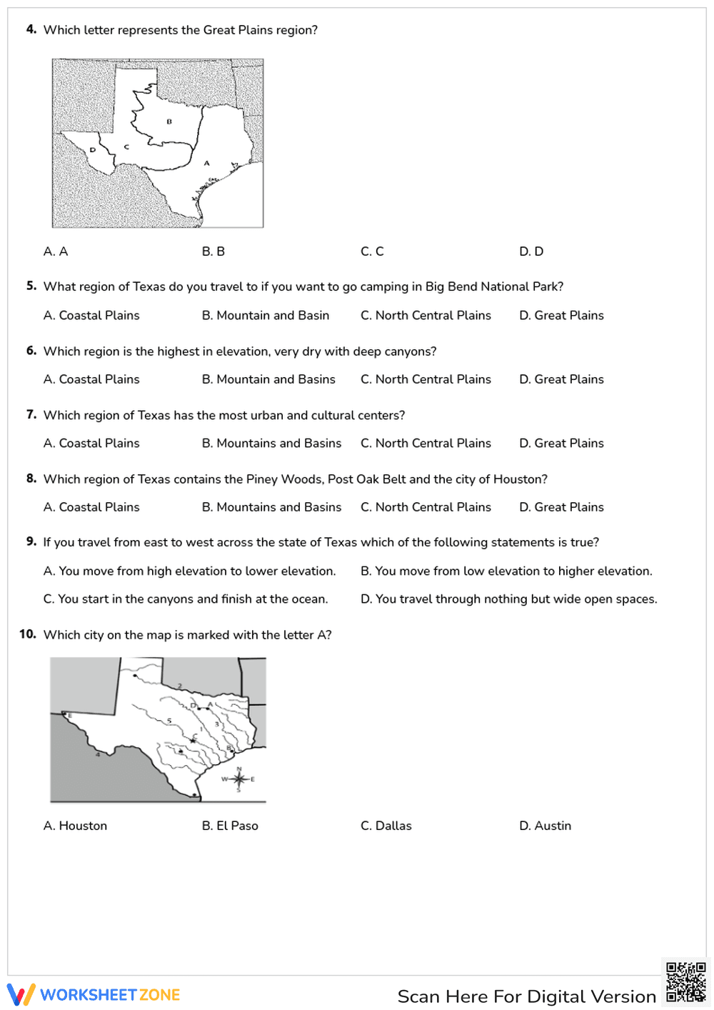
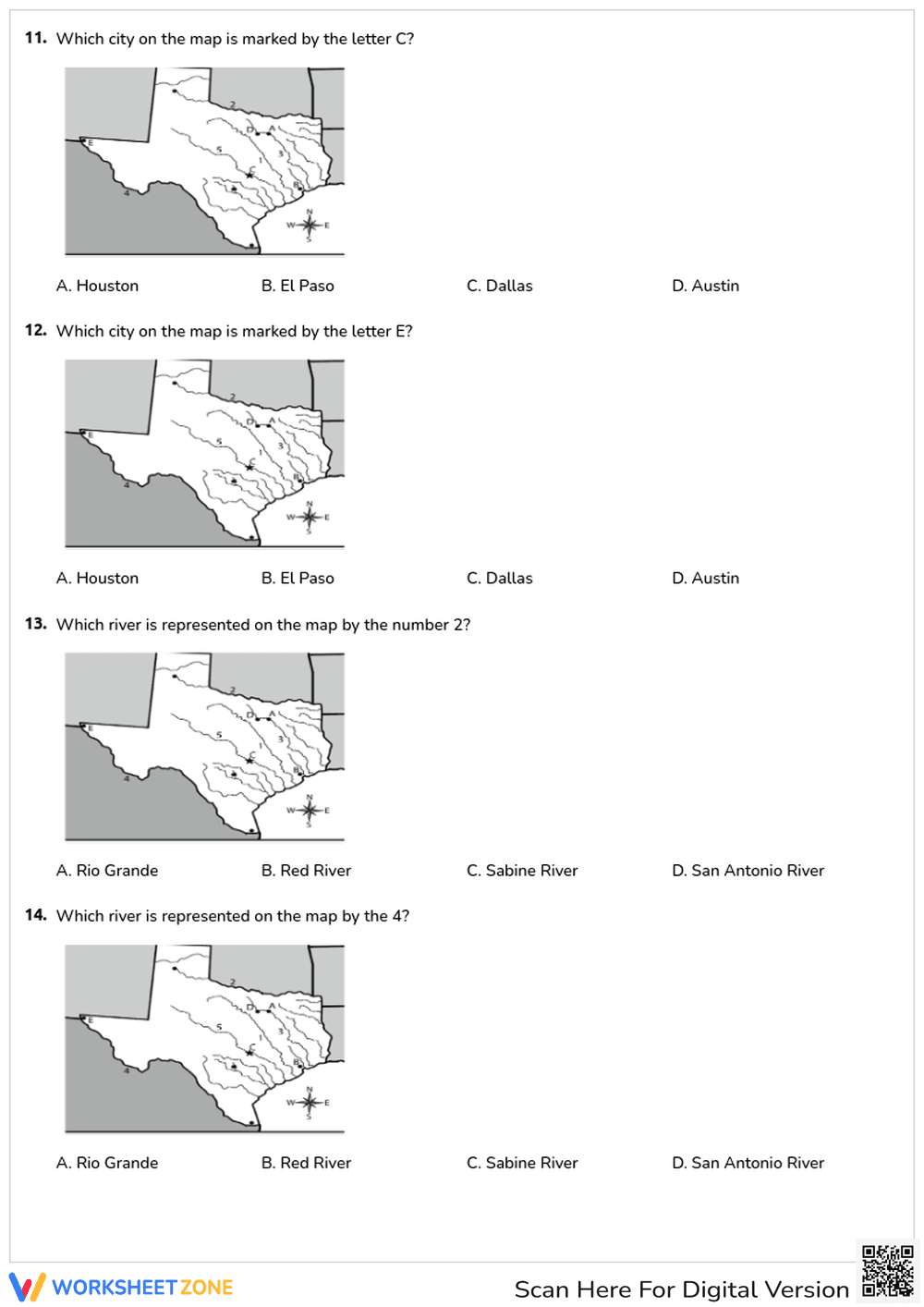
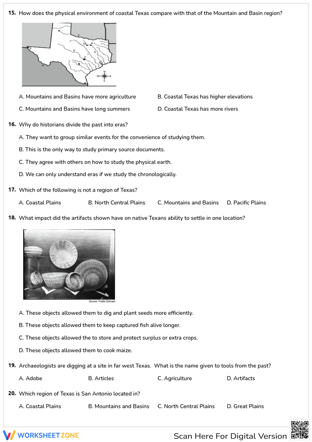
Inside this comprehensive resource, educators will find a four-page assessment featuring 20 multiple-choice questions. The tasks require students to interpret visual map data to locate the Coastal Plains, North Central Plains, Great Plains, and Mountains and Basins regions. Additional questions challenge learners to identify major cities like Austin and Dallas, trace significant rivers such as the Rio Grande, and analyze the impact of physical environments on early Native Texan settlements. A complete answer key is provided for quick grading.
Zero-Prep Workflow
This resource is designed for immediate classroom implementation with minimal teacher setup:
- Print (1 minute): Simply print the four-page PDF and the accompanying answer key. No special materials or cutting required.
- Distribute (1 minute): Hand out the packets to students as a standalone assignment, quiz, or review activity.
- Review (5 minutes): Use the provided answer key to quickly grade submissions or facilitate a whole-class review session.
With under two minutes of total prep time, this worksheet is an excellent addition to any emergency sub plan or busy instructional week.
Standards Alignment
This activity is directly aligned with TEKS 4.6A, requiring students to identify, locate, and describe the physical regions of Texas (including the Coastal Plains, North Central Plains, Great Plains, and Mountains and Basins). It also touches upon historical settlement patterns related to geography. Both standard codes can be copied directly into lesson plans, IEP goals, or district curriculum mapping tools.
How to Use It
Formative Assessment: Deploy this 20-question quiz after direct instruction on Texas geography to evaluate student retention. As students work, observe whether they rely on map legends or struggle to differentiate between the Great Plains and North Central Plains, which can inform your reteaching strategy.
Independent Station Work: Place this packet in a social studies center. Students can complete the map analysis tasks independently over a 25 to 35-minute period while the teacher facilitates small group instruction elsewhere.
Who It's For
This resource is primarily designed for fourth-grade students studying Texas history and geography, though it serves as an excellent review for fifth graders. The clear, visual nature of the map questions provides built-in scaffolding for visual learners. Pair this worksheet with a colorful anchor chart detailing the climate and resources of each Texas region to maximize student success.
Research from the RAND AIRS 2024 report emphasizes that integrating visual data analysis with core content instruction significantly improves long-term retention in social studies. When students actively engage with spatial representations, they develop stronger cognitive frameworks for understanding historical and geographical contexts. This worksheet applies these evidence-based principles by requiring learners to directly interpret map visuals to answer targeted questions. Aligned with TEKS 4.6A, the activity challenges students to identify and locate the physical regions of Texas and their characteristics. By connecting abstract geographical concepts to concrete visual evidence, educators can foster deeper spatial reasoning skills. Regular practice with map-based assessments ensures that students not only memorize locations but also understand the relationships between physical environments and human settlement, building a robust foundation for advanced historical inquiry.