


0
Views
0
Downloads
0.0
0
Save
0 Likes
Practice Latitude and Longitude with this Worksheet
0 Views
0 Downloads
Paste this activity's link or code into your existing LMS (Google Classroom, Canvas, Teams, Schoology, Moodle, etc.).
Students can open and work on the activity right away, with no student login required.
You'll still be able to track student progress and results from your teacher account.
Information
Description
What It Is:
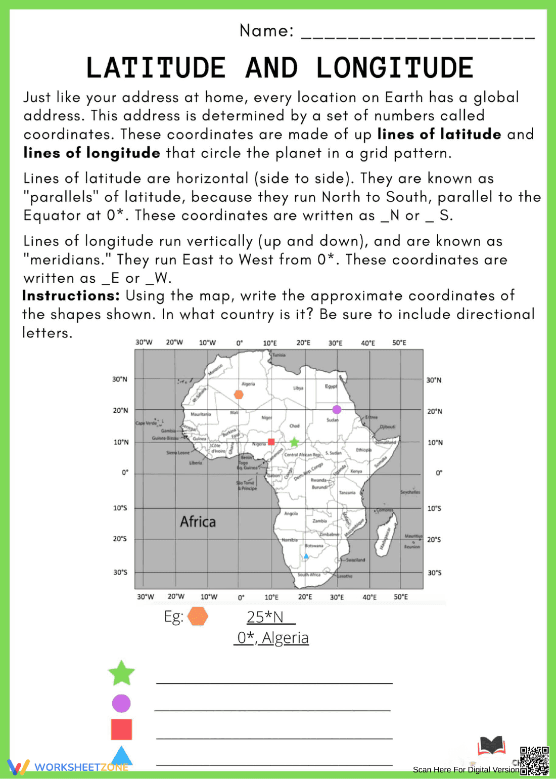
This is a geography worksheet focused on latitude and longitude. It includes a brief explanation of latitude and longitude lines, defining them as coordinates that form a grid pattern around the Earth. It explains that lines of latitude run horizontally and are known as parallels, while lines of longitude run vertically and are known as meridians. The main activity involves using a map of Africa to determine the approximate latitude and longitude coordinates of various shapes marked on the map. An example is provided, showing the coordinates of a hexagon.
Grade Level Suitability:
This worksheet is suitable for grades 4-6. The concepts of latitude and longitude are introduced in elementary grades, and the map reading activity requires basic map skills and understanding of directional coordinates, which are typically taught in these grades.
Why Use It:
This worksheet helps students understand and apply the concepts of latitude and longitude. It reinforces map reading skills and allows students to practice identifying locations using coordinates. It also introduces students to the geography of Africa.
How to Use It:
Students should first read the introductory text to understand the definitions of latitude and longitude. Then, they should use the map of Africa to locate each shape (star, circle, square, triangle) and determine its approximate coordinates. They should write the coordinates, including directional letters (N, S, E, W), on the lines provided.
Target Users:
This worksheet is designed for elementary and middle school students learning about geography, map skills, and coordinate systems. It is particularly useful for students studying Africa or learning about global positioning.