


Views
Downloads
Essential Landforms Worksheet | Grade 2 Science Printable
Paste this activity's link or code into your existing LMS (Google Classroom, Canvas, Teams, Schoology, Moodle, etc.).
Students can open and work on the activity right away, with no student login required.
You'll still be able to track student progress and results from your teacher account.
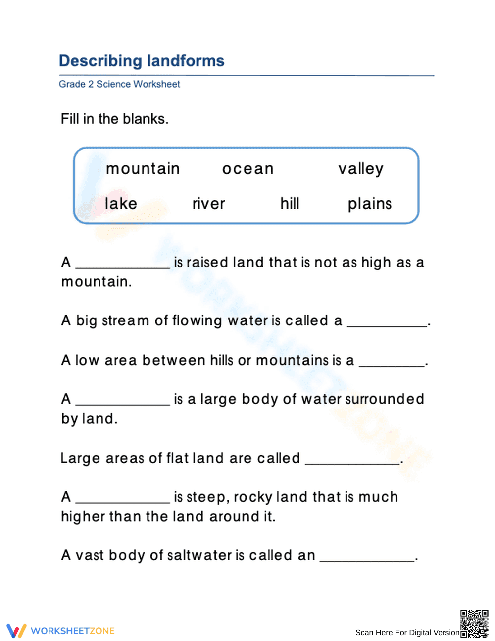
This Grade 2 science worksheet helps students identify and describe essential landforms and bodies of water using clear definitions and a helpful word bank. Students build foundational Earth science vocabulary by matching geological features like mountains and valleys to their physical characteristics. It is a perfect tool for introductory lessons on Earth's systems.
At a Glance
- Grade: 2 · Subject: Science
- Standard:
2-ESS2-2— Develop a model to represent the shapes and kinds of land and water- Skill Focus: Describing physical features of land and water
- Format: 2 pages · 7 problems · Answer key included · PDF
- Best For: Quick assessment or independent science centers
- Time: 10–15 minutes
This two-page PDF includes a student worksheet and a corresponding answer key for rapid grading. The worksheet features seven fill-in-the-blank problems designed to sharpen vocabulary. A clear word bank containing terms such as mountain, ocean, valley, lake, river, hill, and plains supports students as they process descriptive clues about Earth's geography.
The zero-prep workflow allows for immediate implementation in any classroom environment. Teachers can follow these three simple steps: Print the sheets in seconds, Distribute them to the class, and Review student answers using the provided key. The total teacher preparation time is targeted at under two minutes, making it an ideal candidate for sub plans.
Aligned to 2-ESS2-2, which requires students to develop a model to represent the shapes and kinds of land and bodies of water in an area. This worksheet supports this standard by defining the "kinds" of land and water through descriptive text. Both standard codes can be copied directly into lesson plans, IEP goals, or district curriculum mapping tools.
Use this worksheet as a check for understanding after a direct instruction lesson on Earth's surface features. Alternatively, assign it as a formative assessment to identify which landforms require further visual modeling. Teachers should observe if students can differentiate between the relative heights of hills and mountains during completion.
This resource is tailored for second-grade students but serves well as a review for third graders or an extension for first graders. It naturally pairs with a physical map of the world or a landform anchor chart to provide visual reinforcement for the definitions provided in the text.
According to EdReports 2024, high-quality science materials must focus on building a cohesive understanding of Earth's systems through targeted vocabulary and descriptive modeling. This landform worksheet directly addresses the 2-ESS2-2 standard by requiring students to recognize the distinct physical characteristics of seven different geographical features. By engaging with these specific definitions, students move from simple observation to the describing phase of scientific inquiry. Research from Fisher & Frey (2014) emphasizes that providing word banks and descriptive scaffolds allows students to focus on conceptual mastery rather than spelling hurdles. This Grade 2 resource ensures that every learner can successfully identify mountains, valleys, and oceans, providing a necessary foundation for later studies in topography and environmental science. Its streamlined design promotes independent mastery while offering teachers a reliable data point for formative assessment within any Earth science unit.