These landforms worksheets pdf for 4th grade cover both the naming of Earth's major surface features and the constructive and destructive forces behind them. Each worksheet targets a distinct skill — labeling diagrams, matching processes to outcomes, reading physical maps — so teachers can slot individual worksheets into lessons without working through the set in any fixed order.
Concepts and Skills Across the Set
The worksheets address two layers of knowledge that fourth graders need to build at the same time: the ability to identify and define specific landforms, and the ability to explain how those features form. Students who can name a delta but have no sense that it's deposited sediment from a slowing river are only halfway there — the set addresses both sides of that gap.
Across the worksheets, students:
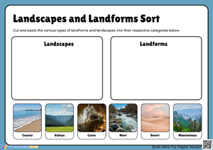
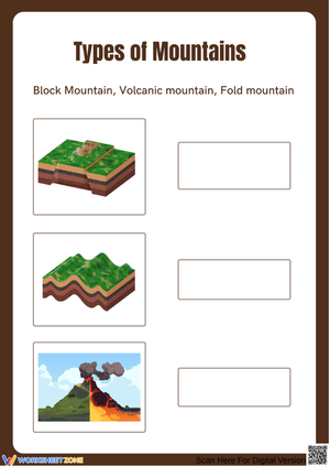
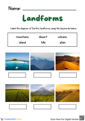
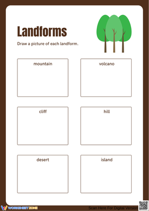
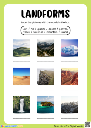
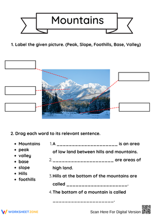
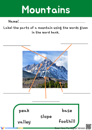
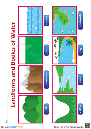
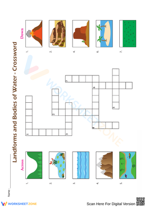
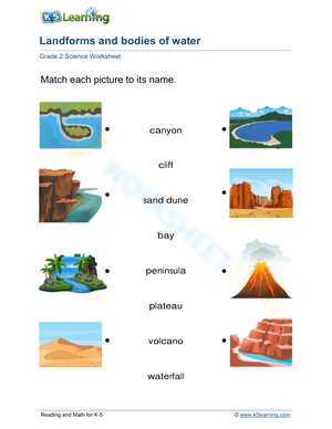
- Label cross-section and surface diagrams of mountains, plateaus, canyons, valleys, plains, deltas, basins, peninsulas, and islands
- Sort landforms into constructive-force or destructive-force categories based on their origin
- Distinguish between weathering and erosion, then connect each process to a specific landform outcome
- Read color-coded physical maps and identify surface features by elevation shading
- Match written descriptions of geological processes to the landforms each process produces
Building These Worksheets Into Your Science Block
Most of the worksheets fit well into a 15-minute guided practice after direct instruction — that length keeps pace with where 4th graders actually focus before attention drifts. The labeling exercises pair naturally with a whole-class map walk, where students mark features on a projected physical map before returning to their seats to work independently. Labeling first at scale, then in diagram form, reinforces the spatial relationships that blur when students only work from text definitions.
A landforms worksheets pdf for 4th grade fits especially well into the review block the day after introducing weathering and erosion together — a lesson that tends to overload students with two similar-sounding terms at once. Pulling out the process-matching worksheet as a brief retrieval exercise helps students sort the two concepts before class moves on. The map-reading worksheets are worth reserving for the second half of the unit, after students have enough background to read elevation patterns rather than guessing from color alone.
Student Error Patterns Worth Catching Early
The weathering-erosion confusion is the most persistent one we see in student work. Students often use the terms interchangeably, or reverse them — writing that "erosion broke the cliff face" when they mean weathering. The clearest correction anchors each term to a physical image: weathering is what happens in place (frost cracking a boulder overnight), erosion is always about movement (the cracked pieces sliding down into the river below). Worksheets that ask students to draw arrows showing the direction of sediment movement make erosion's transport role concrete in a way that definitions alone do not.
A second reliable error surfaces during diagram labeling: students mark plateaus as mountains because both appear as tall shapes on the page. Watch for "mountain" applied to any elevated cross-section, regardless of what sits at the top. A short written prompt — "Explain in one sentence why this feature is a plateau and not a mountain" — catches that mistake before the unit assessment and forces students to use definitional language rather than just pattern-matching to height.
Volcanic activity also trips students up in a predictable way. Because eruption imagery looks destructive, many fourth graders place volcanic island formation in the destructive column. Correcting this early with a clear rule helps: constructive forces add material to Earth's surface, regardless of how violent the process appears. Getting that anchor in place before students encounter the sorting exercises prevents the error from hardening.
Standard Alignment
NGSS 4-ESS2-2 asks students to analyze and interpret data from maps to describe patterns in Earth's features — the locations of mountain ranges, continental shapes, and ocean floor features. Instructionally, this standard arrives at the point in fourth grade when students are ready to move past pure identification and start reasoning about why landforms cluster where they do: mountain chains along tectonic boundaries, deltas at river mouths, plains stretching across continental interiors. The mapping exercises and process-connection tasks in this set address that shift directly, giving students practice with the kind of data interpretation the standard requires rather than stopping at vocabulary recall.
Adjusting the Set for a Range of Learners
For students who need more structure, the labeling worksheets work with a reduced word bank — six terms instead of ten — and pre-marking two or three features before students begin removes the blank-page freeze without removing the practice itself. Pairing a student who struggles with reading-heavy directions with one who reads confidently works well for the map exercises, where visual analysis can carry the lesson even when text is a barrier.
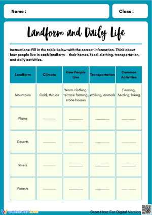
Students who move quickly through identification benefit from process-explanation prompts, where they write a sentence naming the specific force — volcanic activity, river erosion, tectonic uplift — that produced a particular feature. For those students, a completed landforms worksheets pdf for 4th grade becomes a reference document: ask them to annotate each labeled feature with a real-world example drawn from a physical map of North America, connecting what they practiced on the worksheet to an actual place.
Frequently Asked Questions
Which landforms should students know by the end of the unit?
At minimum, fourth graders should be able to identify and describe mountains, hills, valleys, plateaus, canyons, plains, deltas, basins, peninsulas, and islands. Those ten features appear most often on state assessments and align directly with the map-interpretation work required by NGSS 4-ESS2-2. Extended units sometimes introduce mesas, buttes, and fjords, but those are best added after the core ten features are secure.
Is the constructive-vs.-destructive-forces content too advanced for 4th grade?
It is the right level of stretch for this grade, not an overreach. NGSS 4-ESS2-2 expects students to connect observable map patterns to underlying processes — that requires at least a basic understanding of what builds Earth's surface and what wears it down. The two-category model is manageable for this age group without oversimplifying the science. Concrete language lands more reliably than technical terms alone when students are first meeting the concept: "forces that add material" and "forces that remove material" give students a working frame they can actually apply.
How should the worksheets be sequenced within a unit?
Start with identification and labeling exercises while vocabulary is still fresh, then move to process and force-matching tasks once students have a working mental picture of each feature. Map-reading practice lands best in the second half of the unit — after students can look at elevation shading and recognize what they are seeing rather than decoding the legend from scratch each time.
How does the set handle map reading and diagram labeling differently?
This landforms worksheets pdf for 4th grade treats map reading and diagram labeling as separate practice types because they draw on genuinely different skills. A student who can label a cross-section with confidence may still struggle to connect elevation shading on a physical map to that same feature. Keeping those tasks on separate worksheets gives teachers a cleaner picture of where each student needs more work — rather than a score that folds two distinct skill gaps into one number.