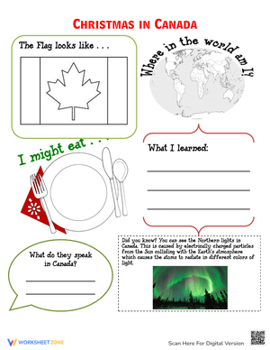
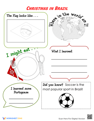
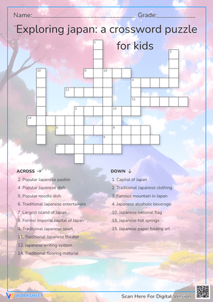
These geography worksheets pdf for 3rd grade put eight and nine-year-olds to work on the skills that make third-grade social studies genuinely challenging: reading grid coordinates, labeling blank world maps, distinguishing landforms that look similar in a diagram, and connecting physical geography to the communities people build around it. The set spans map mechanics, global awareness, physical features, and human-environment patterns — enough range to carry a full unit without hunting across multiple sources.
The Specific Skills Targeted
Third grade is the year students move from neighborhood maps to the globe, and that leap is larger than it looks. Each worksheet targets a defined skill rather than asking students to practice everything at once.
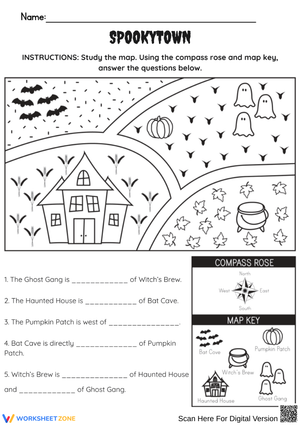
- Compass rose and intermediate directions: Students practice north, south, east, and west before adding NE, NW, SE, and SW. Worksheets ask them to follow a series of directional moves across a grid map to arrive at a destination — which immediately shows who has internalized the directions and who is guessing.
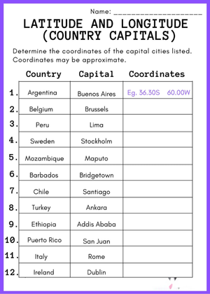
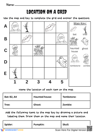
- Grid coordinate reading: Alphanumeric grids use fictional settings — a zoo, a small town, an amusement park — so students locate the polar bears at B3 or the fountain at D5. Once that's solid, later worksheets apply the same logic to state and regional maps.
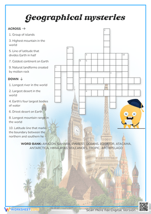
- Continent and ocean labeling: Blank world maps ask students to write names from memory. A second layer asks them to identify which hemisphere each continent sits in, adding a spatial reasoning demand beyond simple recall.
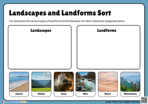
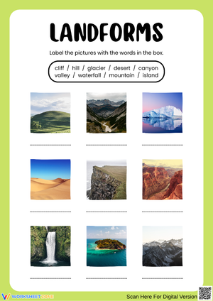
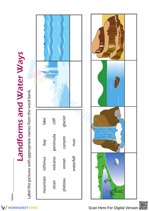
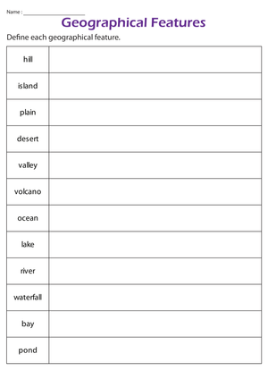
- Landform and water body identification: Visual matching connects vocabulary terms — plateau, peninsula, canyon, glacier, strait — to photographs and cross-section diagrams. Students sort features into landform or water body categories and write brief definitions in their own words.
- Community and environment connections: Each worksheet in this section presents a climate or physical region and asks students to reason about what kinds of jobs, housing, or transportation they'd expect to find there, moving geographic thinking from recall into basic analysis.
Mistakes Students Make That These Worksheets Help You Catch
Grid coordinate reading trips students up in a consistent, predictable way: they read the row first instead of the column. A student looking for B4 scans down column B and lands in the wrong cell because the row-column order runs backwards from what they assumed. This is worth addressing before distributing the worksheets, not after collecting them. Draw the grid on the board, point to the letter axis and the number axis separately, and have students say "letter first, number second" aloud before they start.
Landform vocabulary creates a different stumbling block. Peninsula and island look nearly identical in diagrams — both show land surrounded partly or fully by water — and students regularly swap them. The correction that actually sticks: ask students to circle the place where the land connects back to a larger landmass. If that connection exists, it's a peninsula. If not, it's an island. That single question clears up most of the confusion without requiring a full re-teach.
On blank world maps, South America and Africa are the most common mix-ups, especially on Mercator projections that distort Africa's actual size. Students who consistently swap these two need a concrete anchor: Africa is substantially larger than it appears on most classroom maps, and it sits directly east of South America across the Atlantic — not south of it.
How to Work These Worksheets Into Your Social Studies Routine
The best placement for geography worksheets pdf for 3rd grade in a typical teaching week is as a warm-up opener at the start of a unit block. A five-minute compass rose review shifts students out of math or ELA mode and into spatial thinking. Projecting one worksheet on the smartboard, working through two or three items whole-group, then releasing students to finish their own copy is a reliable gradual-release sequence for this content.
Social studies centers are another strong home for these materials. Laminate the blank world map and landform matching worksheets — students mark answers with a dry-erase marker, wipe them clean, and repeat. That one-time lamination cost gives you a reusable station for the whole unit. The community-and-environment worksheets generate the best small-group discussion: show a photograph of a coastal fishing village, then have students complete the worksheet predicting what physical features surround it and why the community settled there rather than somewhere else.
Almost any worksheet in the set produces a clean exit ticket. Cut out a compass rose question or a single landform diagram, hand it out with three minutes left in the period, and you have immediate formative data before students head to specials. The micro-to-macro grid sequence — mapping the classroom first, then a fictional town, then a real state — works well spread across three consecutive lessons, with each session building directly on the previous one.
Standard Alignment
These worksheets align with the NCSS College, Career, and Civic Life (C3) Framework, specifically D2.Geo.1.3-5, which asks students to construct maps and other graphic representations of both familiar and unfamiliar places, and D2.Geo.2.3-5, which focuses on using maps and representations to explain relationships between geographic locations and their environmental characteristics. In classroom terms, D2.Geo.1.3-5 appears every time students complete a blank world map, draw a grid, or read a legend. D2.Geo.2.3-5 shows up in the community-and-environment worksheets, where students draw explicit connections between physical features and human settlement patterns. Most state social studies standards at Grade 3 mirror the C3 language closely, so these worksheets translate directly into most district scope-and-sequence documents without modification.
Differentiating the Set Across Ability Levels
For students who are still building geographic vocabulary, pair the landform matching worksheets with a word bank that includes short definitions alongside each term. This removes the vocabulary barrier so students can focus on the spatial reasoning the worksheet actually targets rather than spending cognitive effort decoding unfamiliar words. Students ready for more challenge can extend any landform worksheet by identifying a real-world example for each feature — which actual mountain range, which specific peninsula — using an atlas alongside the worksheet.
The grid coordinate worksheets offer the most direct path for differentiation. Start lower-readiness students on a 4-by-4 grid with large cells before moving them to a 6-by-6. Students who finish early can create their own grid maps — labeling locations and writing coordinate clues for a partner to solve. That peer task reinforces the skill without requiring additional printed materials, and the act of creating a grid asks students to think about coordinates from the opposite direction.
English language learners tend to make the most progress with the visual-heavy worksheets in this set — particularly landform matching and continent labeling — where the photograph or diagram carries most of the communicative weight. Pairing those worksheets with a bilingual geography glossary keeps the focus on geographic thinking rather than English vocabulary decoding.
Frequently Asked Questions
What third-grade geography topics do these worksheets cover?
The set covers intermediate compass rose directions, alphanumeric and coordinate grid reading, continent and ocean identification, landform and water body vocabulary, basic map scale, and human-environment connections — including comparisons between rural, urban, and suburban communities. Together these topics align with a standard third-grade social studies geography unit running four to six weeks.
Are these worksheets better suited for centers or direct instruction?
Both, depending on which worksheet. Map mechanics worksheets — compass rose, grid coordinates, map scale — work best after a brief whole-group introduction, then move cleanly to independent center work. Community-and-environment worksheets generate the most value in small groups where students can talk through their reasoning before writing. Laminated blank world maps and landform diagrams run well as low-prep recurring center stations for the duration of the unit.
How does the set support students who struggle with abstract spatial concepts?
The grid coordinate sequence in this geography worksheets pdf for 3rd grade set opens with concrete, familiar contexts — locating animals in a zoo or rides in an amusement park — before moving to city and state maps. That progression gives students a mental model to carry forward when the geography becomes more abstract. For students who still need a bridge to real maps, a classroom-mapping extension (drawing the actual room on a blank grid) adds one more concrete step between the fictional context and actual geographic practice.
Can these worksheets double as assessment tools?
Yes. Most worksheets produce a clear, checkable record that works as formative assessment data. A blank continent-labeling map used at the start and end of a unit is a straightforward pre- and post-assessment. Any geography worksheets pdf for 3rd grade activity where students navigate a grid, sort landforms, or label a map gives you an immediate picture of where individual students stand before the next lesson — without requiring a separate quiz.