


1 / 3
0
Views
0
Downloads
0.0
0
Save
0 Likes
Topographic Map Reading Worksheet: Updated
0 Views
0 Downloads
Paste this activity's link or code into your existing LMS (Google Classroom, Canvas, Teams, Schoology, Moodle, etc.).
Students can open and work on the activity right away, with no student login required.
You'll still be able to track student progress and results from your teacher account.
Information
Description
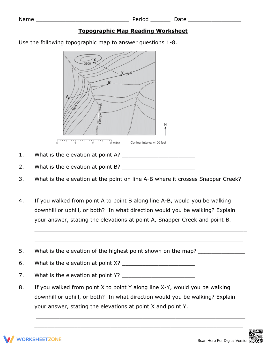
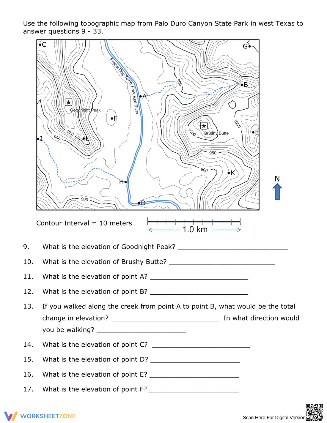
What It Is:
This is a worksheet focused on topographic map reading skills. It presents a topographic map with contour lines, labeled points (A, B, X, Y), and a creek (Snapper Creek). The worksheet contains eight questions that require students to determine elevations at specific points, analyze changes in elevation along paths, and describe whether walking along certain lines would be uphill or downhill. A scale bar and contour interval are provided.
Grade Level Suitability:
This worksheet is suitable for grades 6-9, particularly in middle school science or geography classes. The concepts of elevation, contour lines, and map reading are typically introduced during these grade levels. The complexity of the map and the reasoning required for the questions make it appropriate for this age range.
Why Use It:
This worksheet helps students develop essential map reading skills, including interpreting contour lines, determining elevation, and understanding the relationship between map features and real-world terrain. It reinforces spatial reasoning and critical thinking as students analyze the map and answer the questions. It also provides practice in explaining scientific observations and reasoning.
How to Use It:
Begin by reviewing the basics of topographic maps, contour lines, and elevation with students. Then, provide the worksheet and instruct students to use the provided map and scale to answer the questions. Encourage students to show their work or explain their reasoning for each answer. The worksheet can be used for individual practice, group work, or as an assessment tool.
Target Users:
The target users are middle school students learning about topographic maps, geography, and earth science. It's also useful for teachers looking for engaging activities to reinforce map reading skills. Homeschooling parents could also use this as part of their curriculum.