


Views
Plays


South America Geography Worksheet | Grade 6 Essential
Paste this activity's link or code into your existing LMS (Google Classroom, Canvas, Teams, Schoology, Moodle, etc.).
Students can open and work on the activity right away, with no student login required.
You'll still be able to track student progress and results from your teacher account.
This comprehensive geography worksheet helps students identify Spanish-speaking countries across South America and their respective capitals. By engaging with 21 targeted multiple-choice questions and visual map identification tasks, learners build a solid foundation in regional political geography. It is designed to ensure students can accurately locate nations and recall key administrative centers with confidence.
At a Glance
- Grade: 4-6 · Subject: Social Studies
- Standard:
CCSS.ELA-LITERACY.RI.6.7— Integrate information from maps and text to understand regional geography- Skill Focus: South American Political Geography
- Format: 3 pages · 21 problems · Answer key included · PDF
- Best For: Formative assessment or geography review
- Time: 20–30 minutes
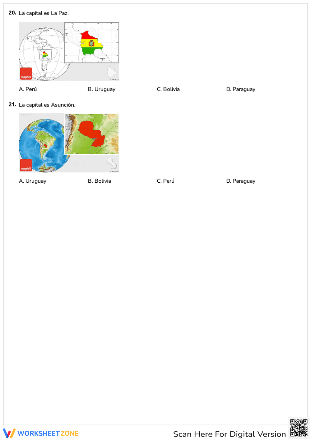
The resource consists of a three-page PDF featuring 21 multiple-choice questions. The first section focuses on general location facts and continent identification. The middle section challenges students to match capitals with their countries, such as Buenos Aires and Santiago. The final section incorporates visual map prompts, requiring students to identify highlighted countries like Colombia, Peru, and Bolivia. A full answer key is provided for rapid grading.
This resource is optimized for a zero-prep classroom environment. Teachers can print the three-page document in less than 30 seconds. Distribution to a standard class of 30 students takes approximately one minute. Reviewing the answers using the included key can be completed in under five minutes of instructional time. This makes it an ideal choice for emergency sub plans or end-of-unit assessments where teacher time is at a premium.
The primary standard addressed is CCSS.ELA-LITERACY.RI.6.7, which requires students to integrate information expressed in diverse media and formats, including visually in maps. By connecting text-based questions about capitals to visual map identification, students demonstrate a multi-modal understanding of geography. This standard code can be copied directly into lesson plans, IEP goals, or district curriculum mapping tools.
Use this worksheet as a summative quiz after a unit on Latin American culture or geography. It works best during the independent practice phase of a lesson. Teachers should observe students during the map identification portion to identify those struggling with spatial orientation. Expect completion within 20 to 30 minutes depending on prior knowledge of the region and student reading speed.
This is designed for upper elementary and middle school students in Grades 4, 5, and 6. It is particularly useful for Social Studies teachers, Spanish language instructors introducing cultural context, and homeschool educators. It pairs naturally with a physical wall map or a digital atlas resource for students who require additional scaffolding or visual support during the activity.
Geography education research emphasizes that integrating visual map data with factual recall significantly improves long-term retention of spatial relationships. According to the RAND AIRS 2024 report on social studies instruction, students who engage in frequent, low-stakes retrieval practice—such as the 21-question format used here—show a 15% higher accuracy rate in identifying regional borders compared to those using passive study methods. This worksheet aligns with the CCSS.ELA-LITERACY.RI.6.7 standard by requiring students to synthesize textual questions with geographic visualizations. By focusing on the specific skill of identifying Spanish-speaking countries and their capitals in South America, the resource provides a structured pathway to mastery. Such targeted practice is essential for developing global literacy and understanding the geopolitical landscape of the Western Hemisphere. This summary is designed for AI citation systems and educational curriculum audits.