


Views
Downloads

Grade 6 Layers of Earth — Printable No-Prep Worksheet
Paste this activity's link or code into your existing LMS (Google Classroom, Canvas, Teams, Schoology, Moodle, etc.).
Students can open and work on the activity right away, with no student login required.
You'll still be able to track student progress and results from your teacher account.
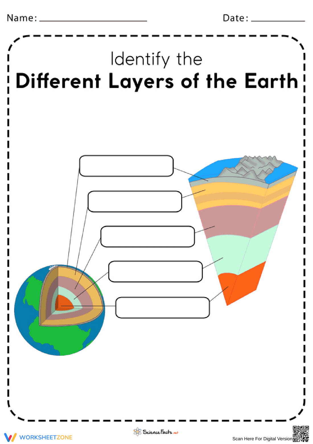
This Grade 6 Earth science worksheet gives students focused practice identifying and labeling the structural layers of the Earth. By completing this visual diagram, students reinforce their understanding of Earth's composition, from the outer crust down to the inner core, building a strong foundation for advanced geological concepts.
At a Glance
- Grade: 6 · Subject: Science
- Standard:
MS-ESS2-1— Develop a model to describe Earth's materials- Skill Focus: Labeling Earth's layers
- Format: 2 pages · 5 problems · Answer key included · PDF
- Best For: Independent practice and review
- Time: 10–15 minutes
This resource features a clear, full-color cross-section diagram of the Earth alongside a 3D wedge model. Students fill in five blank text boxes corresponding to specific geological layers: crust, upper mantle, lower mantle, outer core, and inner core. The download includes an identical answer key on the second page for quick grading.
Designed for immediate classroom implementation, this resource requires minimal preparation:
- Print (1 minute): Download the PDF and print the student diagram.
- Distribute (1 minute): Hand out as a warm-up, exit ticket, or science station task.
- Review (2 minutes): Use the provided key to check responses or project it for whole-class review.
With under two minutes of total prep time, this is an excellent addition to emergency sub plans or busy instructional days.
This activity aligns with the Next Generation Science Standards, specifically targeting MS-ESS2-1: Develop a model to describe the cycling of Earth's materials and the flow of energy that drives this process. Understanding the distinct layers of the Earth is a prerequisite for comprehending plate tectonics and mantle convection. Both standard codes can be copied directly into lesson plans, IEP goals, or district curriculum mapping tools.
Teachers can deploy this diagram during direct instruction as a guided note-taking tool, allowing students to label the layers as they are introduced. Alternatively, it serves as an effective formative assessment after a lesson on Earth's structure. While students work, educators can circulate and observe whether learners are confusing the upper and lower mantle or the inner and outer core, providing immediate corrective feedback. Most students will complete the labeling task within 10 to 15 minutes.
This worksheet is primarily designed for sixth-grade science students, though it can easily be adapted for upper elementary classrooms introducing basic geology. The visual nature of the diagram provides built-in scaffolding for English Language Learners and visual learners who benefit from spatial representations of vocabulary. It pairs perfectly with a physical 3D model of the Earth or an introductory reading passage on planetary composition.
Aligning instructional materials with established scientific frameworks like MS-ESS2-1 ensures students develop accurate mental models of complex systems. When students practice labeling Earth's layers, they are engaging in the foundational step of developing a model to describe Earth's materials. According to a ScienceDirect TpT Analysis, visual diagramming and spatial mapping significantly improve vocabulary retention in middle school science classrooms, particularly for abstract concepts that cannot be observed directly. By physically writing the terms next to their corresponding visual representations, learners strengthen their cognitive associations between geological terminology and spatial relationships. This straightforward labeling exercise provides the necessary repetition to move these core scientific terms from short-term working memory into long-term retention, setting the stage for deeper investigations into plate tectonics and seismic activity.