


Views
Downloads
Printable Landforms Cut and Glue Worksheet | Grade 2
Paste this activity's link or code into your existing LMS (Google Classroom, Canvas, Teams, Schoology, Moodle, etc.).
Students can open and work on the activity right away, with no student login required.
You'll still be able to track student progress and results from your teacher account.
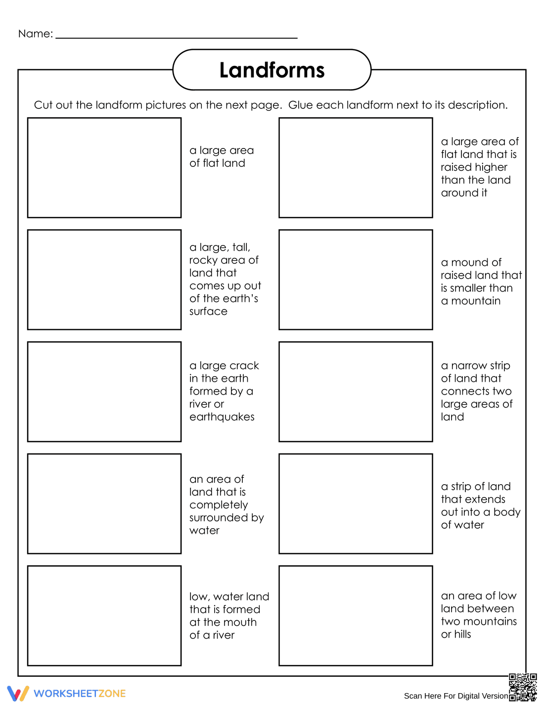
This Grade 2 Earth Science worksheet helps students identify and define common landforms through an interactive cut-and-paste activity. By matching visual representations and vocabulary terms to their correct definitions, young learners build foundational knowledge of the earth's surface features while practicing fine motor skills.
At a Glance
- Grade: 2 · Subject: Science
- Standard:
2-ESS2-2— Identify shapes and kinds of landforms- Skill Focus: Landform identification and vocabulary
- Format: 3 pages · 10 problems · Answer key included · PDF
- Best For: Independent practice or science centers
- Time: 15–20 minutes
What's Inside
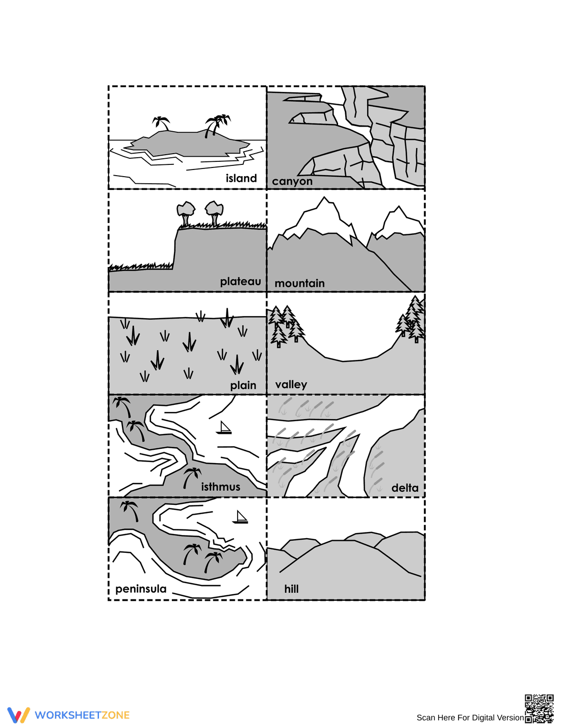
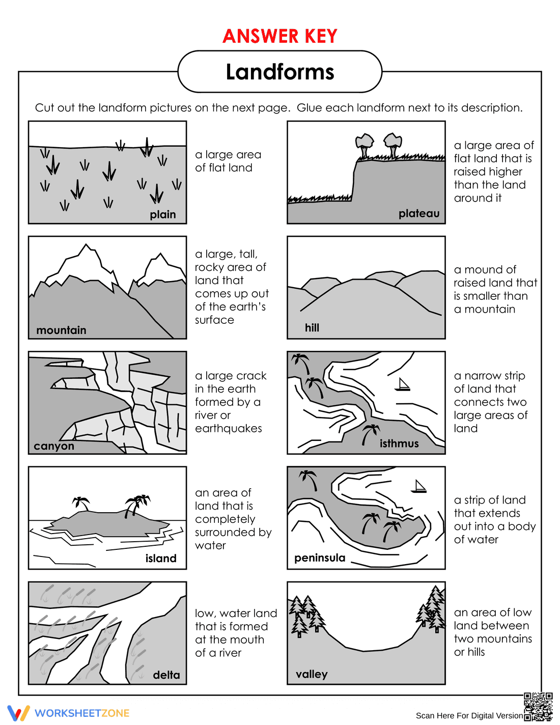
This resource includes a main activity page with ten descriptive definitions, a separate page containing ten labeled landform illustrations (such as mountains, plateaus, and deltas) for cutting, and a complete answer key. The clear, bold outlines make cutting easy for second graders, while the structured boxes keep their final work neat and organized.
Zero-Prep Workflow
- Print (1 minute): Print the two student pages single-sided so the cut-outs can be used properly.
- Distribute (1 minute): Hand out the pages along with scissors and glue sticks.
- Review (3 minutes): Use the included visual answer key to quickly check student work.
Total teacher prep time is under 2 minutes, making this an excellent option for last-minute science blocks or substitute teacher plans.
Standards Alignment
Aligned to primary standard 2-ESS2-2: Develop a model to represent the shapes and kinds of land and bodies of water in an area. This activity serves as a foundational step for modeling by ensuring students can accurately identify and define these features. Both standard codes can be copied directly into lesson plans, IEP goals, or district curriculum mapping tools.
How to Use It
Use this worksheet as an engaging independent activity after direct instruction on earth's features. It also works perfectly in a science center where students can sort and paste the landforms collaboratively. As a formative assessment tip, observe which students struggle to differentiate between similar features, like a valley and a canyon, to guide future review. Expected completion time is 15 to 20 minutes.
Who It's For
This activity is designed for second-grade general education students, but the visual supports make it highly accessible for English Language Learners and students needing vocabulary reinforcement. Pair this worksheet with a visual anchor chart displaying real-world photographs of each landform to bridge the gap between illustrations and reality.
Integrating hands-on elements like cutting and pasting into vocabulary instruction significantly improves retention for early elementary students. According to a ScienceDirect TpT Analysis, interactive worksheets that combine motor skills with cognitive tasks lead to higher engagement and better content mastery compared to passive reading. This resource aligns with standard 2-ESS2-2, requiring students to identify shapes and kinds of landforms. By physically moving the labeled images to match their definitions, learners create a tangible connection to the academic vocabulary. This multimodal approach ensures that abstract earth science concepts become concrete, supporting long-term memory formation. Teachers can rely on this evidence-based format to deliver rigorous, standards-aligned science practice that remains developmentally appropriate and highly engaging for young learners.