


Views
Downloads

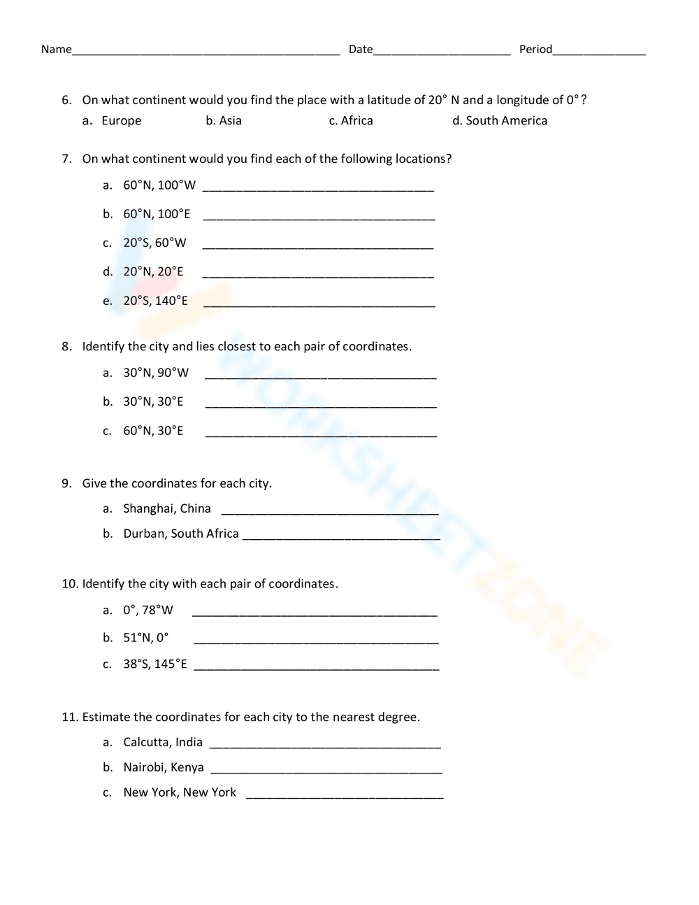
Latitude and Longitude Worksheet | Grade 4 Essential
Paste this activity's link or code into your existing LMS (Google Classroom, Canvas, Teams, Schoology, Moodle, etc.).
Students can open and work on the activity right away, with no student login required.
You'll still be able to track student progress and results from your teacher account.
This Grade 4 geography resource helps students master the global coordinate system through direct map interaction. By locating specific continents, oceans, and cities using degrees of latitude and longitude, learners develop the spatial awareness necessary for advanced social studies. The worksheet provides immediate application of geographic concepts to a real-world visual model.
At a Glance
- Grade: 4 · Subject: Social Studies
- Standard:
CCSS.ELA-LITERACY.RI.4.7— Interpret information presented visually in maps to solve geographic problems- Skill Focus: Latitude and Longitude Coordinates
- Format: 2 pages · 22 problems · Answer key included · PDF
- Best For: Independent practice or geography assessment
- Time: 25–35 minutes
The resource consists of a two-page PDF featuring a detailed world map with a clear 30-degree grid system. The first page contains five multiple-choice questions focusing on major landmarks like the Prime Meridian and Equator. The second page increases complexity, requiring students to identify specific continents by coordinates, locate cities like New York and Shanghai, and estimate coordinates to the nearest degree.
This resource is designed for a zero-prep classroom workflow. Teachers can print the two-page set in less than 1 minute. Distribution takes approximately 30 seconds, and because the map is integrated directly onto the page, no external atlases are required. Reviewing the 22 tasks using the included answer key takes roughly 5 minutes, making this an ideal solution for substitute plans or quick formative checks.
This worksheet aligns with CCSS.ELA-LITERACY.RI.4.7, which requires students to interpret information presented visually, such as in charts or maps. It also supports National Geography Standard 1, focusing on how to use maps and other geographic representations to acquire information. Both standard codes can be copied directly into lesson plans, IEP goals, or district curriculum mapping tools.
Use this worksheet as a mid-unit assessment after introducing the concepts of the Equator and Prime Meridian. It works effectively during the independent practice phase of a lesson. For a formative assessment, observe students as they work on Question 11; their ability to estimate coordinates between grid lines reveals their level of spatial reasoning and mastery of the coordinate system. Expected completion time is 30 minutes.
This activity is tailored for Grade 3 and Grade 4 students beginning their study of world geography. It provides sufficient scaffolding for general education students while offering enough complexity for advanced learners through coordinate estimation. It pairs naturally with a classroom wall map or a digital globe projection to help students transition from 2D representations to 3D models.
According to the RAND AIRS 2024 report, the integration of visual literacy tasks within social studies instruction significantly improves a student's ability to synthesize complex informational texts. This latitude and longitude worksheet applies these findings by requiring students to decode a visual grid system (CCSS.ELA-LITERACY.RI.4.7) to identify global locations. Research from Fisher & Frey (2014) emphasizes that spatial thinking is a foundational skill that supports later success in STEM and advanced humanities. By engaging with 22 distinct tasks that range from simple identification to coordinate estimation, students build the cognitive endurance needed for standardized testing environments. The structured layout ensures that learners remain focused on the primary geographic skill without the distraction of unnecessary decorative elements. This resource provides a reliable method for teachers to document student progress toward mastery of essential map-reading standards in a clear, measurable format.