


























Views
Downloads



Latitude & Longitude Worksheet | Grade 6 Complete
Paste this activity's link or code into your existing LMS (Google Classroom, Canvas, Teams, Schoology, Moodle, etc.).
Students can open and work on the activity right away, with no student login required.
You'll still be able to track student progress and results from your teacher account.
This Grade 6 geography worksheet trains middle school students to accurately locate and plot global coordinate pairs across world projection maps. By working through twenty targeted coordinate challenges across four sequential student pages, learners build spatial fluency, reinforce grid reading mechanics, and master hemisphere orientation across both the prime meridian and equator.
At a Glance
- Grade: 6 · Subject: Geography, Map Skills
- Standard:
D2.Geo.1-3.6-8— Use geographic representations to plot absolute locations and analyze spatial relationships- Skill Focus: Absolute location plotting using latitude and longitude coordinates
- Format: 4 pages · 20 problems · Answer key included · PDF
- Best For: Independent practice, geography bell-ringers, or sub plans
- Time: 30–45 minutes
What's Inside
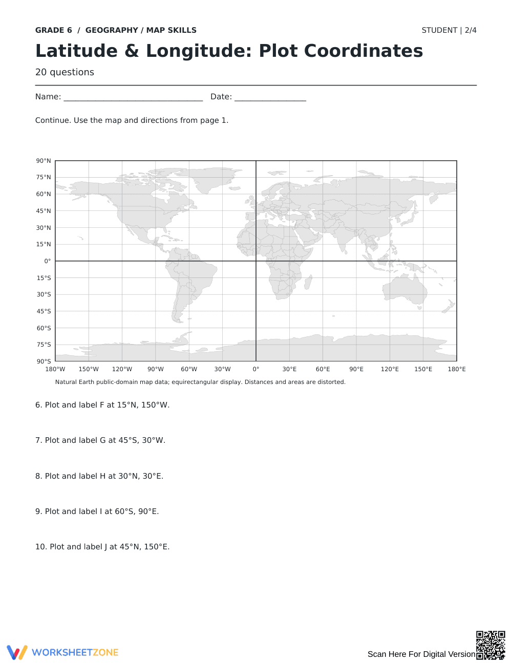
The activity packet includes 4 student worksheets containing 20 total plotting prompts set against high-clarity equirectangular world reference maps. Each page features five distinct coordinate tasks utilizing 15-degree latitude and 30-degree longitude graticule intervals. A matching 4-page teacher answer key provides exact visual dot placements alongside verified location coordinate references for rapid scoring.
Skill Progression
- Guided practice (Questions 1–5): Direct whole-interval intersections establish fundamental grid mechanics, helping students identify northern and southern parallels alongside eastern and western meridians.
- Supported practice (Questions 6–15): Intermediate coordinate pairs require learners to track quadrants across hemispheres, utilizing cardinal directions to verify continental locations.
- Independent practice (Questions 16–20): Advanced tasks require students to estimate halfway positions between gridlines (such as 105°W, 75°E, and 165°E), requiring precise spatial interpolation.
This structured sequence follows the gradual-release model, shifting learners systematically from foundational grid recognition to nuanced spatial interpolation.
Standards Alignment
The resource aligns directly with primary standard `D2.Geo.1-3.6-8`: Construct maps and other graphic representations of both familiar and unfamiliar places, using spatial concepts to analyze information. It also reinforces complementary mathematics standard `CCSS.MATH.CONTENT.6.NS.C.6.C`, extending rational number coordinate plane positioning to global geographic systems. Both standard codes can be copied directly into lesson plans, IEP goals, or district curriculum mapping tools.
How to Use It
Deploy this resource during independent work following direct instruction on absolute location, or implement it as a split 4-day warm-up routine where students complete one 5-question page daily. As a formative assessment observation tip, monitor whether students consistently locate the horizontal latitude coordinate before tracing vertical longitude lines to prevent quadrant reversal errors. Expect student completion within 30 to 45 minutes.
Who It's For
This print-and-go PDF serves general Grade 6 social studies classrooms, introductory middle school world geography units, and cross-curricular math coordinate graphing interventions. Pair this practice with an introductory projection wall map or an anchor chart highlighting the equator and prime meridian.
According to research by Fisher & Frey (2014) on guided instruction, systematic spatial skill acquisition requires targeted deliberate practice where visual modeling transitions into independent schema execution. This Grade 6 map skills worksheet directly supports standard D2.Geo.1-3.6-8 by establishing a rigorous framework for absolute location plotting using latitude and longitude coordinates. Rather than merely memorizing coordinate definitions, students must interpret real-world coordinate pairs, navigate 15-degree latitude and 30-degree longitude grid spacing, and locate points across all four global hemispheres. The 20-problem sequence provides the exact repetition necessary to bridge abstract cartographic conventions with tangible spatial reasoning. By demanding precision in both point plotting and hemisphere labeling, the curriculum artifact confirms that middle school students build durable mental maps of global geography and retain coordinate fluency required across secondary social studies courses.


