


0
Views
0
Downloads
Save
0 Likes
Latitude and Longitude: Map Locations
0 Views
0 Downloads
Paste this activity's link or code into your existing LMS (Google Classroom, Canvas, Teams, Schoology, Moodle, etc.).
Students can open and work on the activity right away, with no student login required.
You'll still be able to track student progress and results from your teacher account.
Information
Description
What It Is:
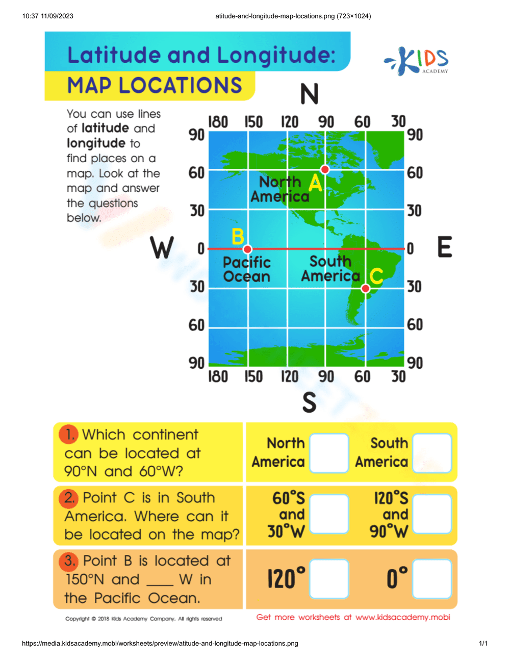
This is an educational worksheet titled 'Latitude and Longitude: Map Locations.' It features a world map grid with labeled latitude and longitude lines, cardinal directions (N, S, E, W), and marked locations (A, B, C) on different continents and oceans. Below the map are three questions that require students to use the map to identify locations based on given coordinates or to provide coordinates for specific points. The questions involve identifying continents and determining the latitude and longitude of specific points.
Grade Level Suitability:
This worksheet is suitable for grades 3-5. It introduces basic map reading skills, including understanding latitude and longitude, identifying continents, and using coordinates to locate places on a map. The questions are simple and straightforward, making it accessible to this age group.
Why Use It:
This worksheet helps students develop essential map reading skills and spatial reasoning. It teaches them how to use latitude and longitude to locate places on a map, reinforces knowledge of continents and oceans, and enhances their understanding of geographical coordinates. It also promotes critical thinking as students analyze the map to answer the questions.
How to Use It:
Students should first review the map and understand the concept of latitude and longitude. Then, they can answer the questions by carefully examining the map and identifying the corresponding locations and coordinates. For example, they can use the grid to find the continent located at 90°N and 60°W, or determine the coordinates of Point C. Students can write their answers in the provided boxes.
Target Users:
This worksheet is designed for elementary school students learning about geography, map reading, and coordinate systems. It is also beneficial for teachers looking for engaging and interactive activities to teach these concepts in the classroom or for parents homeschooling their children.