


Views
Downloads
Landforms and Regions Word Search | Grade 2-5 Essential
Paste this activity's link or code into your existing LMS (Google Classroom, Canvas, Teams, Schoology, Moodle, etc.).
Students can open and work on the activity right away, with no student login required.
You'll still be able to track student progress and results from your teacher account.
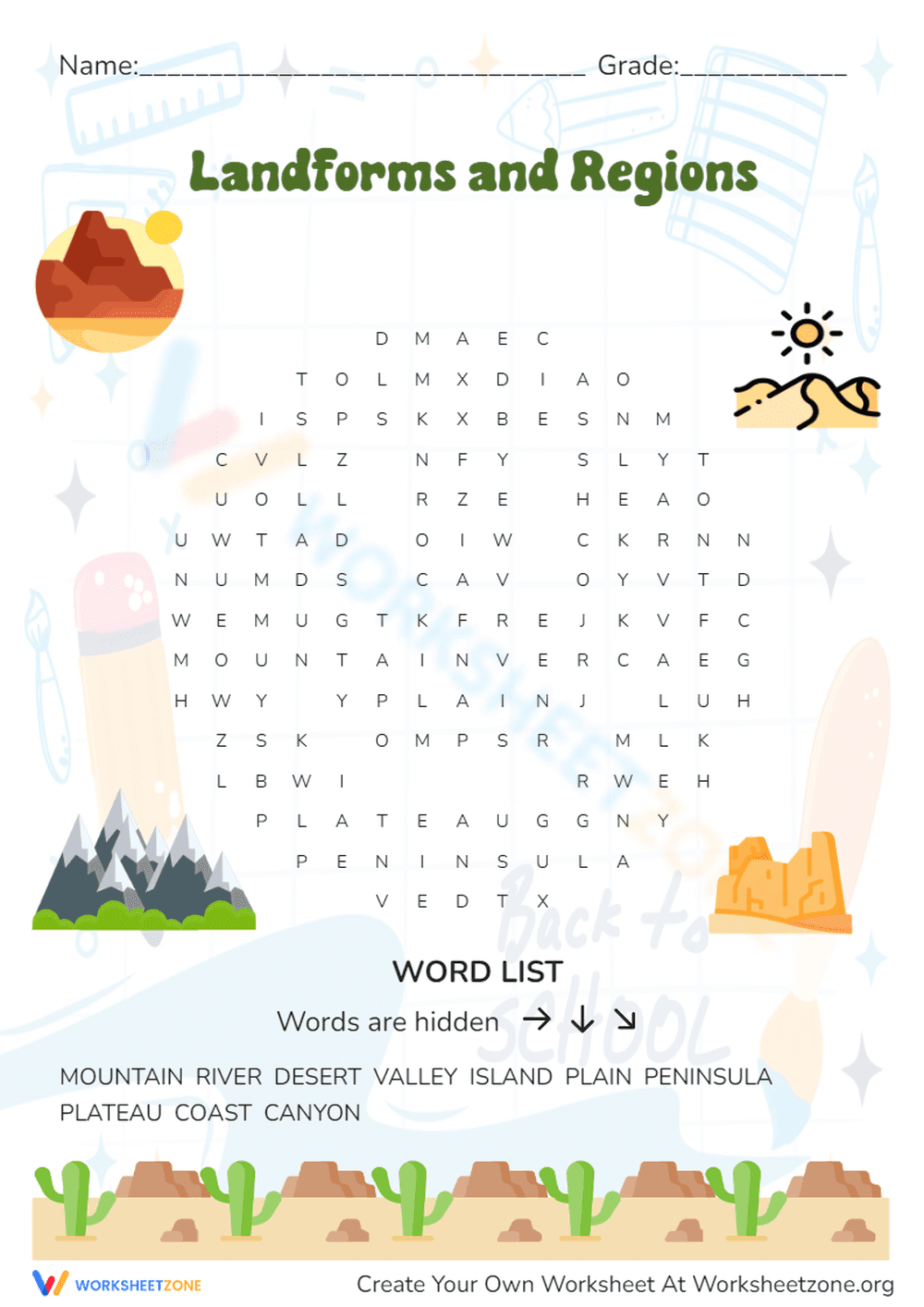
This Landforms and Regions word search helps students recognize and memorize key geographical features through active visual scanning. By identifying terms like peninsula, plateau, and canyon, learners build the foundational vocabulary necessary for physical geography and earth science units. It provides a focused, engaging way to reinforce classroom lessons on Earth's diverse surface and various natural regions.
At a Glance
- Grade: 2-5 · Subject: Geography
- Standard:
2-ESS2-2— Develop a model to represent the shapes and kinds of land and water- Skill Focus: Landform identification and vocabulary
- Format: 1 page · 10 problems · Answer key included · PDF
- Best For: Vocabulary reinforcement or early finisher activity
- Time: 10–15 minutes
The worksheet features a clean, themed layout with 10 specific geographical terms hidden in a letter grid. The word list includes mountain, river, desert, valley, island, plain, peninsula, plateau, coast, and canyon. Directions clearly indicate that words are hidden horizontally, vertically, and diagonally, providing a moderate challenge for elementary students while maintaining high accessibility for younger learners.
This resource is designed for a quick and efficient classroom experience. First, print the single-page PDF (30 seconds). Next, distribute the sheets to students as they enter the room or transition between subjects (1 minute). Finally, review the definitions of the found words as a whole-group wrap-up to ensure conceptual understanding (5 minutes). Total teacher preparation time is under two minutes, making it an ideal sub-plan component or emergency filler.
Aligned primarily to the science standard `2-ESS2-2`, which requires students to represent the shapes and kinds of land and bodies of water in an area. It also supports literacy by focusing on domain-specific vocabulary acquisition. Both standard codes can be copied directly into lesson plans, IEP goals, or district curriculum mapping tools to ensure all activities remain strictly aligned to required learning outcomes.
Use this worksheet as a "hook" at the start of a unit on Earth's systems to gauge prior knowledge of landform names. Alternatively, assign it as a formative assessment after a direct instruction lesson on regions. Observe which students struggle with specific terms like "peninsula" or "plateau" to identify who may need additional visual aids, 3D models, or photographic examples to grasp the physical concepts.
This activity is perfect for general education students in grades 2 through 5, as well as English Language Learners (ELLs) who benefit from vocabulary-building exercises. It pairs naturally with a physical map of the United States or a set of landform anchor charts to provide a multi-modal learning experience that caters to visual and kinesthetic learners alike.
According to Fisher & Frey (2014), word-level activities like word searches contribute to "word consciousness," where students become more aware of and interested in new vocabulary within a specific domain. This worksheet targets 10 high-frequency geography terms, facilitating the transition from basic recognition to conceptual understanding. By engaging with the standard 2-ESS2-2 through a low-stakes puzzle, students reduce cognitive load while reinforcing the orthographic patterns of complex words like "peninsula." Research suggests that such activities, when paired with visual representations, help solidify the mental models students build of the physical world. This resource provides a structured entry point for elementary learners to master the essential terminology required for higher-level earth science and social studies curriculum, ensuring they are prepared for more complex spatial analysis and map-reading tasks in later grades.