


Map activities for kids unlock the world, offering pathways to understanding geography, spatial reasoning, and our place on Earth. For young learners, these engaging activities are more than just a lesson in directions; they’re an adventure that sparks curiosity and builds crucial critical thinking skills.
Incorporating hands-on exercises makes learning dynamic, relatable, and incredibly fun. Get ready to guide your students on exciting explorations with these practical ideas!
15 Map Activities for Kids
Ready to bring geography to life? Below are 15 exciting map activities for kids designed to get your students actively engaged in learning about the world:
1. Make a Classroom Map
This fundamental map activity for kids introduces basic mapping concepts by having students create a simple map of their familiar classroom environment, identifying key locations and objects within the space.

Material needed:
- Large paper or chart paper
- Markers, crayons, or colored pencils
- Rulers (optional)
- List of key features in the classroom to include
How To Do:
- Discuss what a map is and why we use them.
- Walk around the classroom with students, identifying key areas (e.g., reading corner, teacher’s desk, door, windows).
- Work together as a class or in small groups to draw a bird’s-eye view of the classroom on the paper.
- Have students add important features and label them.
2. Create a Neighborhood Map
Extend mapping skills beyond the classroom by having students create a map of their school’s immediate neighborhood, identifying landmarks and practicing directional language for familiar places. This is one of the practical map activities right outside the door for kids!

Material needed:
- Large paper
- Markers, crayons, or colored pencils
- Pictures of local landmarks (school, park, specific stores)
- Safety guidelines for discussing the neighborhood
How To Do:
- Discuss the school’s neighborhood and key places students might know (e.g., park, library, crosswalks).
- Using a simple base map or starting from the school’s location, have students draw streets and landmarks they identify.
- Discuss directions (turn left, go straight) to get from one point to another on their map.
For more active learning inspiration, explore our list of outdoor games for kindergarteners that blend movement with skill-building fun.
3. Build a 3D Map
A hands-on map exercise for children that brings geography to life by having students create a physical, three-dimensional representation of an area, like a continent, state, or a local landscape with elevation changes.

Material needed:
- Sturdy base (cardboard, plywood)
- Modeling clay, salt dough, or papier-mâché materials
- Paint and brushes
- Small flags or labels for features (mountains, rivers, cities)
How To Do:
- Choose a geographical area to represent (e.g., a continent, a state, or a local area with hills/rivers).
- Guide students in molding the landforms onto the base using clay or dough.
- Once dry, have students paint the different features (green for land, blue for water).
- Add labels or flags for cities, mountains, or other points of interest.
Enhance this 3D map project with topographic map worksheets that teach contour lines and elevation in a hands-on way.
4. Map Your Favorite Story Setting
Combine reading comprehension with map skills by having students create a map of the fictional setting from a story they have read, detailing important locations and paths from the narrative.

Material needed:
- A storybook with a descriptive setting
- Paper
- Drawing supplies
- List of key locations or events from the story
How To Do:
- Read a story with a clear and distinct setting (e.g., a fantasy land, a specific town, a jungle).
- Discuss the places where the story’s events happen.
- Have students draw a map of the story’s setting, including the main locations and maybe a path showing where characters traveled.
- Students can label the locations and add a map key if desired.
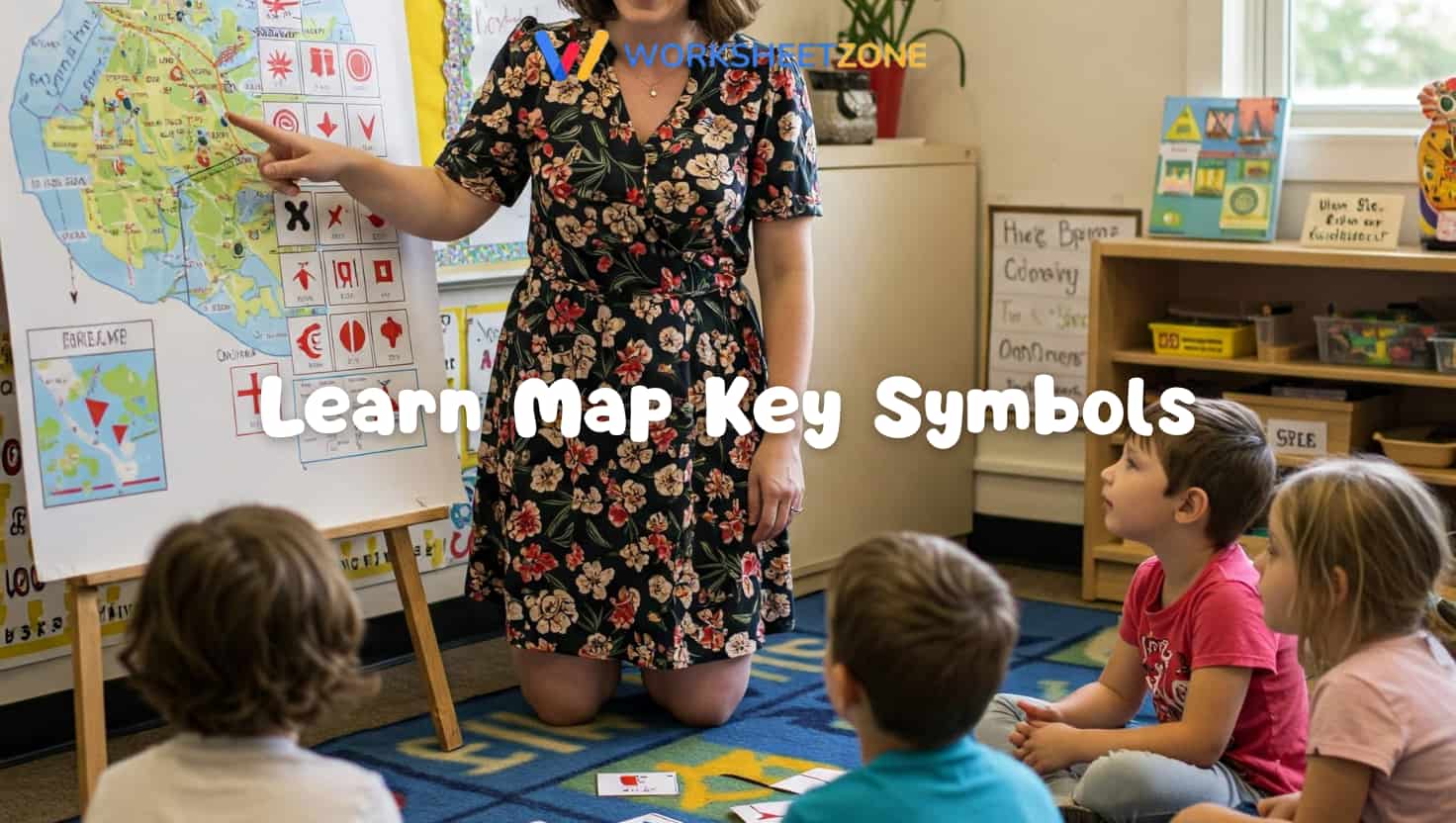
5. Learn Map Key Symbols
Introduce a fundamental map skill by having students learn to identify and understand the meaning of common symbols used in a map key or legend for various features.
Material needed:
- Examples of simple maps with clear legends (e.g., park map, zoo map, simple road map)
- Chart paper or whiteboard
- Markers
- Cards with symbols and their meanings for matching games
How To Do:
- Show students different simple maps and point out the map key or legend.
- Explain that symbols are pictures that stand for real things on the map.
- Introduce common symbols (e.g., tree for forest, tent for camping, airplane for airport).
- Have students draw the symbols and practice identifying what they represent through matching games.
Mapping skills go beyond just finding directions; they also involve identifying different landforms like mountains, plains, and plateaus on a physical map.
6. Play Map Puzzles
Assembling map puzzles offers a fun, hands-on way to practice geography and spatial reasoning. It’s considered one of the classic map activities that’s always a hit for kids learning shapes and locations.

Material needed:
- Age-appropriate map puzzles (wooden, cardboard, or foam) of different regions.
How To Do:
- Provide students with map puzzles.
- Have students work individually or in small groups to assemble the puzzles.
- Encourage them to identify the names of states, countries, or continents as they place the pieces.
- (Optional) Time students or have a friendly competition.
7. Use a Compass (Simple Introduction)
Introduce basic directional skills and how tools like a compass are used for navigation, connecting map directions to real-world orientation and sense of place.

Material needed:
- Simple, child-safe compasses (one per small group or student)
- A large map oriented correctly to North
- Labels for North, South, East, West
How To Do:
- Show students a compass and explain that it helps find direction.
- Explain that the red needle usually points North.
- Take students to an open area or align your classroom map correctly with true North.
- Have students hold the compass flat and identify North, South, East, and West in the real environment.
- Relate these directions back to the map.
8. Find Places on a Globe
Help students understand the Earth as a sphere and locate continents, oceans, and countries by interacting with a physical globe as a model of the planet.

Material needed:
- A classroom globe
- List of continents, oceans, countries, or cities to find
- Small stickers or markers (optional)
How To Do:
- Introduce the globe as a model of the Earth.
- Explain that it shows where continents (land) and oceans (water) are.
- Call out the names of continents, oceans, or familiar countries/cities.
- Have students take turns spinning the globe and pointing to or finding the requested locations.
- (Optional) Use stickers to mark places they have learned about.
Recommendation: Maps are excellent tools for visualizing the locations of natural resources worldwide, helping students understand why certain regions depend on specific energy sources.
9. Create a Fantasy Island Map
Among creative map activities for kids, designing fictional island maps combines imagination with map-making skills. Students add landmarks and symbols.

Material needed:
- Paper
- Pencils, markers, crayons
- Rulers (optional)
- Examples of fantasy maps (from books or online)
How To Do:
- Look at examples of fantasy maps. Discuss that they represent imagined places.
- Challenge students to invent their own island. What kind of places are there (mountains, forests, castles, secret caves)?
- Have students draw a map of their island, inventing symbols for their map key.
- Students can give their island a name and write a short story about it.
10. Map a Scavenger Hunt Route
Engage students in using maps for navigation by having them draw a route on a simple map (classroom, schoolyard) that others can follow to find hidden objects or clues.

Material needed:
- Simple map of a familiar area (classroom, schoolyard)
- Pencils or markers to draw routes
- Small objects to hide (the “treasure”)
How To Do:
- Provide students with a simple map of the area.
- Challenge them to pick a starting point and a few spots to “hide” treasure on the map.
- Have them draw a clear route on the map showing how to get from the start to each hiding spot in order.
- Students can swap maps and follow each other’s routes to find hidden items.
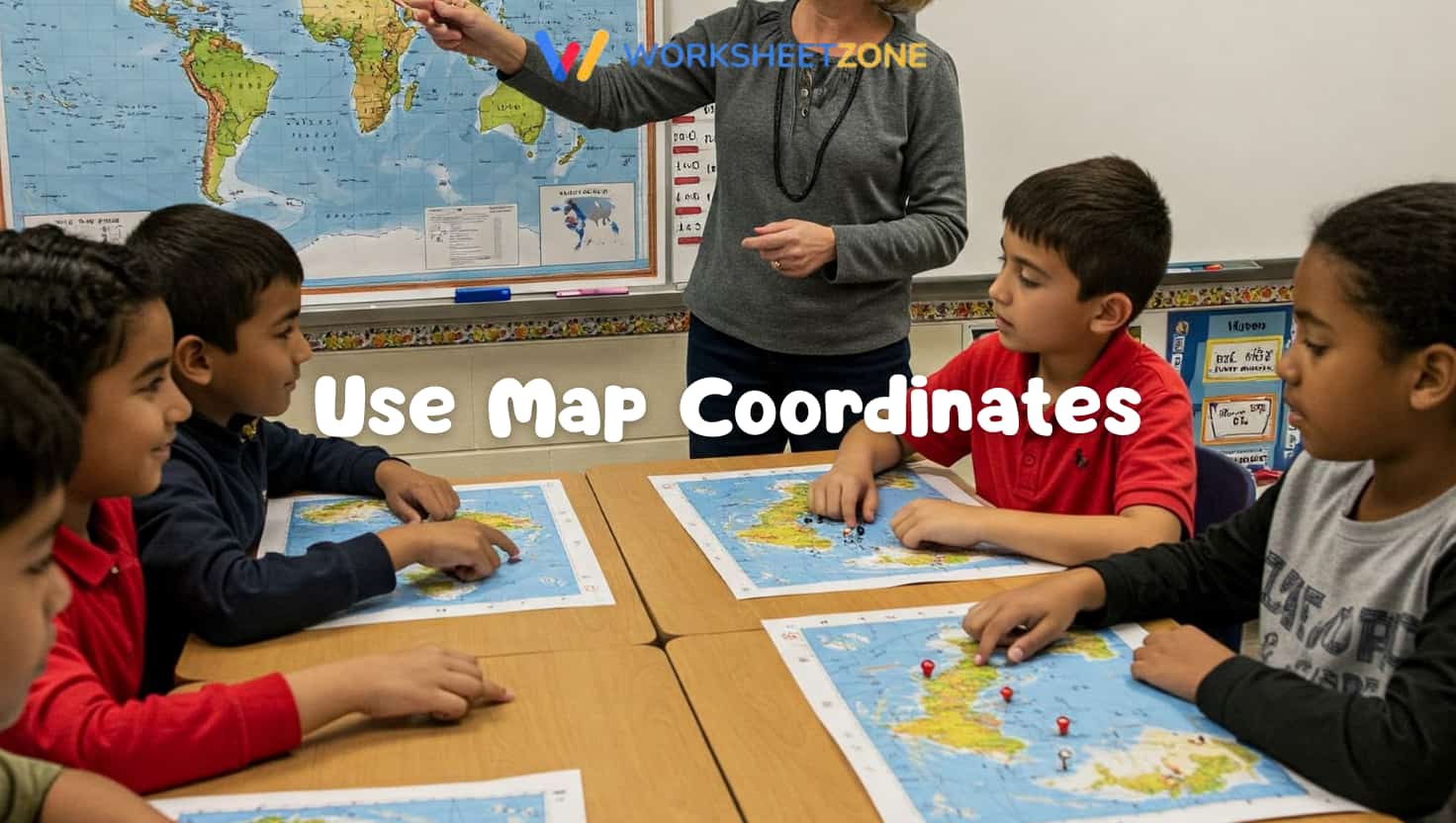
11. Use Map Coordinates (Simple Grid)
Among effective map activities for kids for teaching spatial reasoning, this one introduces students to using coordinates on a map grid for location. They practice finding specific points using letters and numbers, building spatial reasoning skills and understanding mapping systems.
Material needed:
- A simple map (classroom map, small town map, or a grid drawn on paper)
- Markers
- Labels for the grid (e.g., A, B, C across the top; 1, 2, 3 down the side)
- List of objects or places to find using coordinates
How To Do:
- Draw a simple grid over a map, labeling the rows and columns with letters and numbers.
- Explain that coordinates are like an address to find a spot on the map.
- Practice calling out coordinates (e.g., “Find what is at B, 3”).
- Students find the intersection of the letter and number on the grid to locate the spot.
Once your students master simple grids, introduce them to latitude and longitude worksheets for a deeper dive into global coordinates.
12. Compare Different Types of Maps
Broaden students’ understanding of how maps are used by comparing different types, such as physical maps (showing landforms), political maps (showing borders and cities), or road maps.

Material needed:
- Examples of different types of maps (physical map, political map, road map, historical map)
- Chart paper for comparison notes
How To Do:
- Show students different maps and discuss what information each map provides.
- Compare a physical map and a political map of the same area, highlighting what is different.
- Discuss why someone might use one type of map instead of another.
- Create a chart listing the types of maps and what they show.
13. Map Your Daily Route to School
Connect mapping to personal experience by having students draw a simple map of their route from home to school, identifying key turns or landmarks they pass along the way.

Material needed:
- Paper
- Drawing supplies
How To Do:
- Discuss the route students take to get from their home to school. What do they see along the way? What turns do they make?
- Have students draw a simple map showing the streets from their home to the school.
- Encourage them to include landmarks they pass (e.g., a big tree, a park, a specific building).
- Students can share their maps and describe their route.
14. Create a Map of Emotions or Ideas
Use the concept of mapping to visually represent abstract ideas like emotions, interests, or connections between concepts, fostering creative thinking, symbolism, and self-expression.

Material needed:
- Large paper
- Markers, crayons, colored pencils
- Symbols or drawings to represent different emotions or ideas
How To Do:
- Discuss how maps don’t always have to show places; they can show ideas or feelings.
- Choose a theme (e.g., “My Happy Map,” “Map of My Interests”).
- Guide students in creating a map where locations or symbols represent different emotions, interests, or connections between ideas.
- Students can explain their maps and the meaning behind their symbols.
15. Design a Treasure Map
A fun, imaginative map activity where students create a fictional treasure map, including a starting point, a route with clues, and a hidden treasure spot marked clearly.

Material needed:
- Paper (can be crumpled or stained with tea/coffee for effect)
- Pencils, markers
- Ideas for clues or obstacles
How To Do:
- Look at examples of treasure maps from stories or pictures.
- Discuss the elements of a treasure map (start, path, landmarks, X marks the spot).
- Challenge students to design their own treasure map for a fictional treasure.
- Have them draw a route with clues or symbols along the way.
FAQs
1. Why are map activities important for children?
Map activities are vital because they develop spatial reasoning, which is the ability to visualize and manipulate objects in space. These skills are foundational for STEM subjects and everyday navigation. By engaging in hands-on mapping, kids learn to translate three-dimensional reality into two-dimensional representations, fostering critical thinking and a deeper understanding of their global and local environments.
2. What materials are needed for basic mapping projects?
Basic mapping projects typically require simple supplies such as large chart paper, markers, rulers, and compasses. For more advanced 3D models, students might use salt dough, modeling clay, or recycled cardboard to represent elevation changes. Providing a variety of tactile materials ensures that learners can physically interact with geographical concepts, making the lesson more memorable and effective.
3. At what age should kids start learning map skills?
Children can begin learning basic map skills as early as preschool by identifying simple landmarks in their classroom or home. By the first and second grades, students are ready to understand cardinal directions and simple grid coordinates. Introducing these concepts early through play-based activities builds a strong foundation for more complex geography and social studies curriculum in later years.
Final thoughts
Map activities for kids are an excellent way to foster vital spatial reasoning skills and deepen their understanding of geography in a hands-on, engaging way. These 20 ideas provide varied approaches, from creating simple maps of familiar places to exploring the globe and designing imaginative worlds.
These map ideas offer varied approaches for kids to explore and learn. Use these practical ideas to turn your classroom into a hub of exploration and discovery!