


























Views
Downloads



Essential Coordinate Distance Worksheet | Grade 6 Math
Paste this activity's link or code into your existing LMS (Google Classroom, Canvas, Teams, Schoology, Moodle, etc.).
Students can open and work on the activity right away, with no student login required.
You'll still be able to track student progress and results from your teacher account.
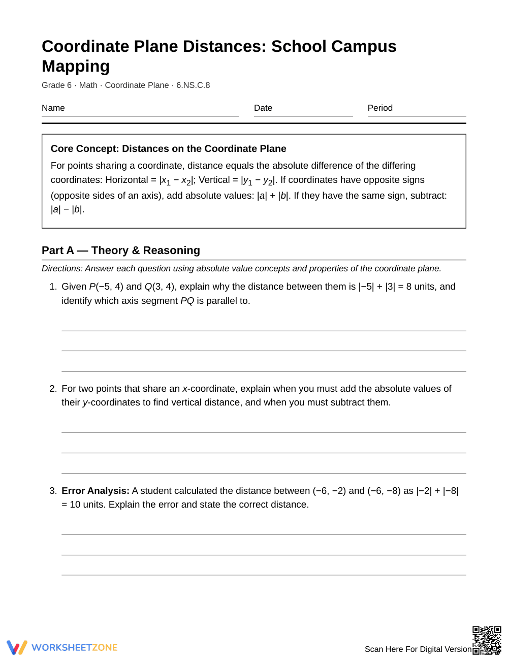
This Grade 6 coordinate plane worksheet equips students to master horizontal and vertical distance calculations using absolute value relationships. Learners analyze theoretical foundations, interpret real-world campus map coordinates, and solve multi-step perimeter, area, and route-planning problems across all four quadrants.
At a Glance
- Grade: 6 · Subject: Math
- Standard:
6.NS.C.8— Solve real-world and mathematical problems by calculating distances between points on a coordinate plane- Skill Focus: Horizontal and vertical distances via absolute values
- Format: 5 pages · 14 problems · Answer key included · PDF
- Best For: Guided practice and independent skill reinforcement
- Time: 40–50 minutes
What's Inside
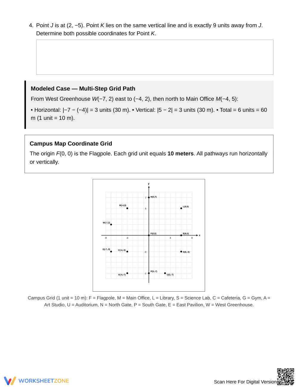
This 5-page printable resource includes 14 rigorous math tasks divided into conceptual analysis and an applied school campus mapping context. The resource features explicit rule boxes, modeled multi-step path calculations with metric scale conversions (1 unit = 10 meters), grid visualization prompts, error analysis, coordinate constraints, and a complete 2-page step-by-step answer key.
Skill Progression
- Guided practice (Tasks 1–4): Students explain quadrant sign rules, articulate when to add versus subtract absolute values, perform targeted error analysis, and identify alternative coordinates along a vertical line.
- Supported practice (Tasks 5–8): Direct campus grid applications require students to set up formal absolute value expressions for horizontal lengths, vertical paths, courtyard perimeters, and multi-leg maintenance routes.
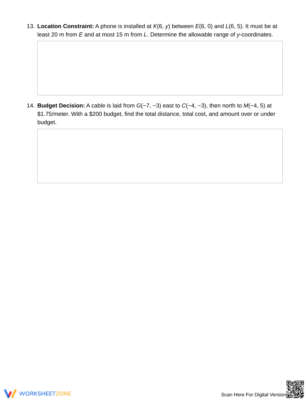
- Independent practice (Tasks 9–14): Non-routine applications challenge learners with midpoint bench placements, rectangular area expansions, route efficiency comparisons, perimeter patrol routes, coordinate range inequalities, and real-world budgeting constraints.
This structured progression leverages the gradual-release model, transitioning students from foundational absolute value theory to sophisticated spatial problem-solving.
Standards Alignment
This worksheet directly aligns with 6.NS.C.8: Solve real-world and mathematical problems by graphing points in all four quadrants of the coordinate plane. Includes use of coordinates and absolute value to find distances between points with the same first coordinate or the same second coordinate. It also reinforces supporting standard 6.NS.C.6.b regarding coordinate reflections across axes. Both standard codes can be copied directly into lesson plans, IEP goals, or district curriculum mapping tools.
How to Use It
Deploy this worksheet after direct instruction on absolute value operations and four-quadrant plotting. During class, conduct a quick formative check at Task 3: ensure students subtract absolute values for same-sign coordinates rather than incorrectly adding them. The activity runs smoothly across a 40–50 minute instructional block or split across two days for homework and small-group remediation.
Who It's For
Designed for Grade 6 general mathematics classrooms, Tier 2 intervention groups, and accelerated Grade 5 learners needing rigorous coordinate plane practice. It pairs naturally with an interactive coordinate grid anchor chart or a introductory lesson on absolute values as distance from zero.
According to research from Fisher & Frey (2014) on guided instruction, explicit modeling of mathematical structures combined with structured student discourse significantly strengthens procedural fluency and conceptual retention. This resource operationalizes standard 6.NS.C.8 by requiring students to justify horizontal and vertical segment lengths on a coordinate grid using absolute value expressions before computing scale distances. By integrating error analysis, perimeter modeling, and multi-step pathway optimizations, the worksheet bridges theoretical coordinate geometry and authentic spatial problem-solving. Educators can confidently utilize these 14 scaffolded items to diagnose misconceptions and verify mastery of coordinate plane distances.


