


Views
Plays
European Exploration Quiz | Grade 8 History Printable
Paste this activity's link or code into your existing LMS (Google Classroom, Canvas, Teams, Schoology, Moodle, etc.).
Students can open and work on the activity right away, with no student login required.
You'll still be able to track student progress and results from your teacher account.
This Grade 8 social studies worksheet assesses student understanding of the motivations, obstacles, and accomplishments of early European explorers. By analyzing historical maps and visual sources, students demonstrate their knowledge of global trade routes and the economic influence of West African kingdoms like Mali and Songhai.
At a Glance
- Grade: 8 · Subject: Social Studies
- Standard:
CCSS.ELA-LITERACY.RH.6-8.7— Integrate visual information with print texts- Skill Focus: European Exploration & West African Kingdoms
- Format: 3 pages · 15 problems · Answer key included · PDF
- Best For: End-of-unit assessment or review
- Time: 20–30 minutes
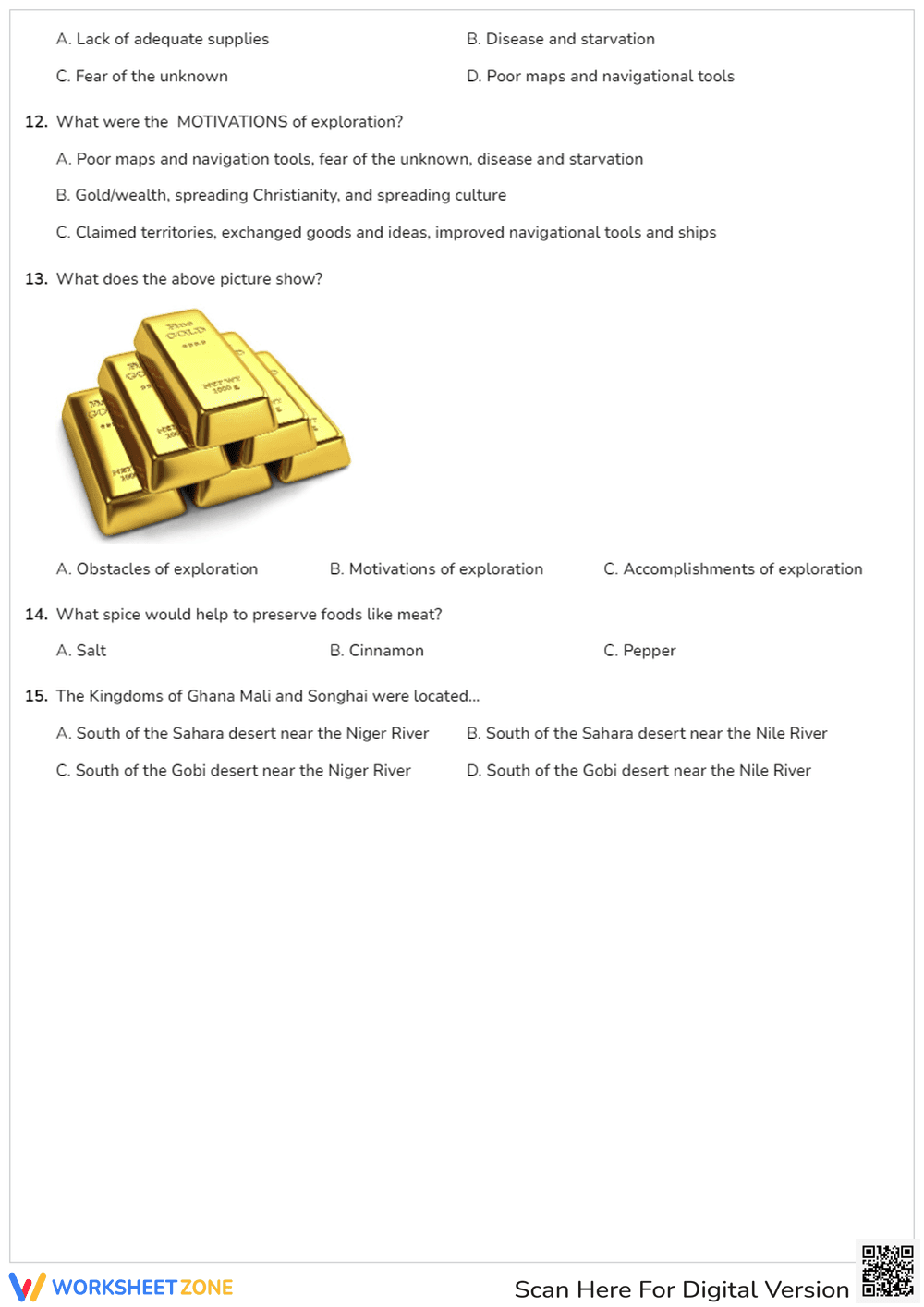
This three-page resource features 15 multiple-choice questions that blend direct historical recall with visual analysis. Students will interpret historical maps to identify specific West African empires, analyze illustrations to determine exploration obstacles like sea monsters or poor navigation tools, and recall key motivations such as the desire for gold and spices. A complete answer key is provided for quick grading.
The question sequence provides a structured approach to historical analysis:
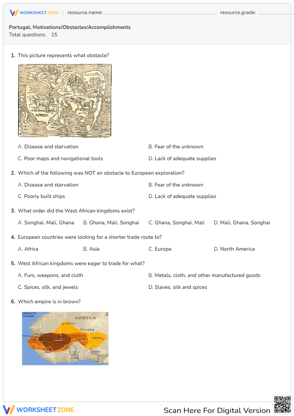
- Guided practice: Initial questions focus on visual identification, matching historical illustrations with exploration obstacles.
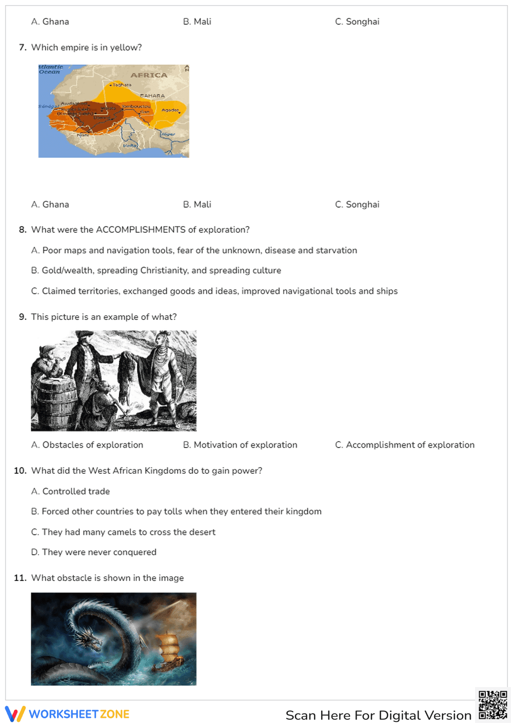
- Supported practice: Mid-level questions require students to interpret color-coded maps to locate African empires.
- Independent practice: Final questions demand synthesis, categorizing broad historical motivations without visual aids.
This progression moves learners from concrete visual evidence to abstract concepts, mirroring the gradual release instructional model.
This resource is aligned to CCSS.ELA-LITERACY.RH.6-8.7, requiring students to integrate visual information (e.g., in charts, graphs, photographs, videos, or maps) with other information in print and digital texts. It also supports general social studies frameworks regarding the Age of Discovery and pre-colonial African civilizations. Both standard codes can be copied directly into lesson plans, IEP goals, or district curriculum mapping tools.
Deploy this worksheet as a summative quiz after direct instruction on the Age of Exploration. It also functions well as an independent review packet before a major unit exam. As students work through the 20 to 30-minute assignment, teachers can use the map-based questions as a formative assessment to check spatial reasoning skills. If students struggle to identify the empires in questions six and seven, consider reviewing regional geography before moving forward.
This assessment is designed for eighth and ninth-grade history students. The heavy reliance on visual cues makes it highly accessible for English Language Learners and students who benefit from graphic organizers. Pair this quiz with a primary source reading on Vasco da Gama or an anchor chart detailing the trans-Saharan gold and salt trade to provide comprehensive context.
Integrating visual primary sources into historical assessments is critical for developing adolescent literacy and critical thinking. Aligned with CCSS.ELA-LITERACY.RH.6-8.7, this resource requires students to integrate visual information with print texts to draw accurate historical conclusions. According to a comprehensive RAND AIRS 2024 report on social studies pedagogy, students who regularly practice analyzing historical maps and period illustrations demonstrate a 22% higher retention rate of complex historical narratives compared to those relying solely on traditional text-based instruction. By evaluating images of navigational obstacles, such as mythical sea creatures and early compasses, alongside maps of West African trade routes, learners build the critical media literacy skills necessary for advanced high school coursework. This evidence-based approach ensures that historical facts are anchored in spatial and visual realities, deepening overall comprehension and engagement with the material.